December 22, 2016

A statue where Tupac Shakur first lived on the edge


Now that Tupac Shakur is being inducted into immortality at the Rock and Roll Hall of Fame, Baltimore needs to recognize its place in his musical geography. Baltimore needs a statue to Tupac.


Through the label of "West Coast Hip-Hop", Tupac melded music and geography. Baltimore was the last place he lived in middle and high school before moving to the west coast.

His family lived in the kind of rowhouse Baltimore is known for, in what ought to be an attractive setting on Greenmount Avenue. It sits right on the edge of the working class Penn Lucy neighborhood, where it abuts the affluent Guilford neighborhood.

Chez Shakur is the second house from the left in these two groups of three - 3955 Greenmount Avenue -
as seen from the green Guilford courtyard across the street that masks the busy traffic barrier.
Greenmount Avenue is thus known as an economic and racial barrier. Unfair, overgeneralized and overplayed or not, it's regarded as "poor and black" to the east and "rich and white" to the west. Conflicts and contrasts are always simmering, just as they were in 2Pac's time between East Coast and West Coast hip-hop cultures. Ultimately this framed the narrative of his drive-by assassination in Las Vegas twenty years ago at age 25.

Labels like east versus west applied to hip-hop or Greenmount Avenue are very easy convenient concepts to hang onto, which accounts for their power. We address conflicts though geography as varied as sports where we root for the home team to politics where we choose our President through our state representations in the Electoral College. Economic aid is given to distressed neighborhoods or cities beyond what we give to distressed people.

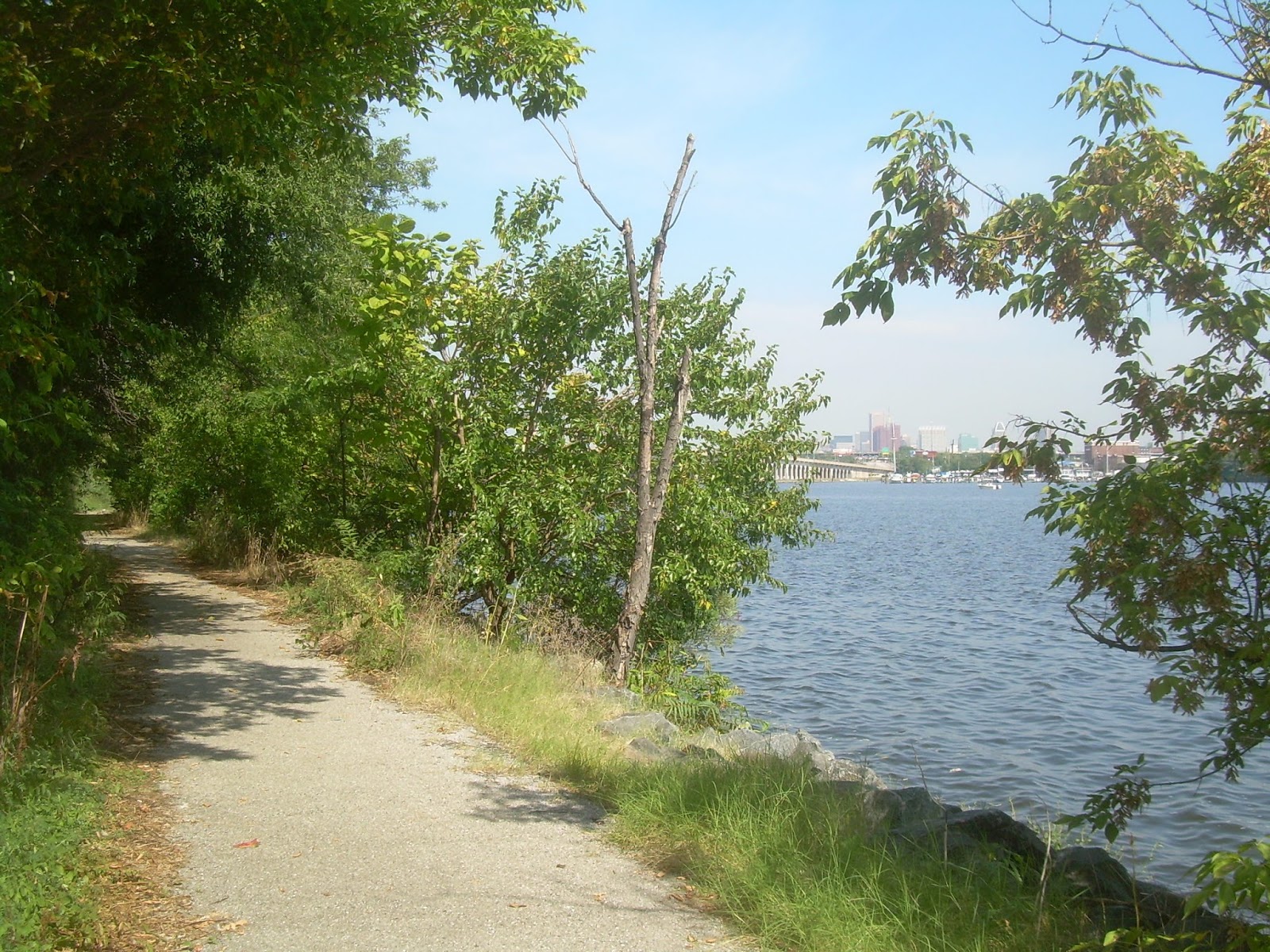
Greenmount Avenue is a very long straight street which becomes York Road just to the north of Tupac's house and then extends northward all the way into Pennsylvania. As a pre-automotive city, streets with  that much continuity are rare in Baltimore. On the south end, Greenmount gets enticingly close to downtown Baltimore, but then gently pivots in front of the city's prison complex and then ends in Old Town, which has never recovered from the 1968 riots brought on by the assassination of Martin Luther King.

There are many very attractive houses and streets, and many dedicated residents on both sides of Greenmount Avenue, but that doesn't change the narrative.

Greenmount Avenue gets its power from its linearity. It's like a passive line in the sand which becomes a provocation. But Baltimore needs to use it to negotiate for good instead of bad, so we don't end up like Tupac did in Las Vegas.

Death as a career move


It is often said that in show-biz, from Elvis to Michael Jackson, death is a good career move. Baltimore has two other inductees in the Rock and Roll Hall of Fame, and they're dead too - Frank Zappa and Mama Cass Elliott. Of course, all three had to leave Baltimore to acquire fame and fortune. Frank Zappa's musical influence as a writer and performer transcended genres perhaps more than anyone in American history except Duke Ellington or George Gershwin, who were much more apparently rooted in American geography.

Mention should also be given to David Byrne of the "New Wave" Talking Heads who grew up in the Baltimore suburb of Arbutus and went to New York to become recognized, and is still very much alive.

Mama Cass came to fame by way of the Mamas and Papas folk-rock group, where John Phillips was the leader and songwriter, although Cass was their most distinctive, beloved and "weighty" singer. She was just starting to shed the "mama" moniker, which she didn't like, when she died. Even in death, people mischaracterized her, saying she choked on a ham sandwich, which was untrue even though it stuck.

Frank Zappa has gotten a statue in front of the Highlandtown library, which is very nice but has very little significance beyond its face value. He grew up on the other side of town.

Image result for frank zappa baltimore statue
Zappa statue in Highlandtown with Baltimore Mayor
Stephanie Rawlings-Blake (in blue), Zappa Family and others.
http://thechronopages.com )
Frank Zappa's statue does, however, serve as a precedent and prototype for what should be done for Tupac Shakur. The most striking thing about it is its verticality, which creates an appropriately "larger than life" aura. But it does not command attention from passers-by, whether walking or driving. It's easy to ignore, unlike Zappa himself. Maybe that was intentional, conveying that Zappa didn't quite fit into Highlandtown's commercial branding strategy.

The stakes are higher for the legacy of Tupac Shakur. Statues are an element of geography, and geography played a major role in his life and musical career. In turn, race itself plays a prominent role in geography, especially in Baltimore and especially on Greenmount Avenue.

Meanwhile, the city is still engaged in a great municipal reappraisal of our historic Civil War monuments. Who among the statues are capable of withstanding 150 years of scrutiny? A who among them will now be declared unworthy and dismantled? The Mayor ducked the verdicts of her task force before she left office last week, leaving the statues in limbo.

The kind of controversy Baltimore appears to be capable of resolving is whether last year's Freddie Gray "Black Lives Matter" rioters should be called "thugs". After much debate, the answer is apparently "no". But of course, 2Pac had no qualms about using words like "thug", as well as a lot stronger words, including that one that begins with an "N".

Ah, but he's an artiste. His zeal for freedom of expression against "political correctness" was something he had in common with Frank Zappa, who once testified as such to Congress.

Statues to both Frank Zappa and Tupac Shakur will thus have to withstand another 150 years of scrutiny and reappraisal against constantly changing political standards.

The Best of 2Pac - Pt. 1: Thug
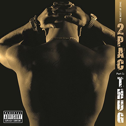
"The Best of 2Pac: Thug" album cover

Where to put the Tupak Shakur Statue?


Baltimore is a big city with lots of nooks and crannies in which to install statues. But Tupac needs to be noticed and reckoned with. He should also have geographic context. Context, however, is a multiple edge sword. Explanatory context was supposed to resolve the Civil War monument controversies - add some explanatory text saying that of course don't believe in slavery anymore and have evolved into far superior human beings. Of course.

The most obvious candidate location is the wide median on 33rd Street in the middle of the Waverly business district just a few blocks south on Greenmount from the Shakur House. But can Waverly withstand the Tupac brand as well as Highlandtown dealt with Zappa?

I'd say the answer is a resounding "No". Waverly's biggest retail plum over the past 50 years since James Rouse built the Waverly Towers shopping center at 29th Street was to get a Giant Supermarket, but the design turned its back to the entire rest of the business district. Most recently, Charles Village, the ivory tower Johns Hopkins University neighborhood just to the west decided it needed to expand its own retail district - which has turned out to be at the expense of its students shopping in Waverly.

Waverly probably can't withstand sharing its iconography with 2Pac.

If not Waverly, then where? Upton is the place where a nascent African-American Historic District has been gestating for many decades (while its history continues to crumble or be demolished). But that's a long way from Greenmount Avenue. In a city that's two-thirds black, do we still put everything that's really black all in one place?

Then there's "historically black" Morgan State University which is not too far east. That would probably work politically in an antiseptic ivory tower kind of way. Would Tupac approve?

It was previously proposed by one of my dear blog commenters that the city put it in a park which I had proposed at North Avenue and Charles Street, which is now undergoing a funky organic "arts district" kind of gentrification, near three colleges - Johns Hopkins, Maryland Institute and University of Baltimore. It's culturally and racially neutral territory. and is at the very geographic center of the entire city. This would work!

But the best site for a Tupak Shakur Shrine is...


... just two blocks north of Tupak's house near where Greenmount Avenue becomes York Road at Northway.

At this point, York Road becomes about ten feet wider than Greenmount, so the city installed a grass median strip a few years ago in an attempt at "beautification". It also becomes a commercial rather than a residential area, with the kind of nondescript businesses that have no cultural identity whatsoever. In other words, it's racially neutral territory.

The downside is that with no residents and no cultural identity, there is no constituency for maintaining any beautification, so the new median has become a mere nondescript grassy patch.

York Road looking south from Northway. Tupak's Greenmount Avenue neighborhood begins
 up ahead where the road narrows, the median ends and the trees get more plentiful.

So this median strip is the perfect place for a tall Tupac shrine that everyone must see but no one will have to confront.

But the piece de resistance is directly at the intersection of York Road and Northway - a magnificent stone wall that separates the exclusive Guilford neighborhood to the west from York Road to the east.

The wall is entirely symbolic. It is totally open for the free movement of pedestrians and vehicles (one-way outbound away from the neighborhood). The wall exists only as a beautiful icon. It's the kind of beauty Donald Trump sees when he when waxes poetic about his proposed wall at the Mexican border and which Hillary Clinton describes as Un-American and The Pope describes as sinful (as if The Vatican doesn't have a wall.)

Another alternative is a block closer to Chez Shakur at the intersection of Underwood Road, but it is in a more natural vegetative state and is more residential, with no iconic wall and less room for the shrine.

The Northway wall looking west into the affluent Guilford neighborhood from York Road

At Northway, there is plenty of room for the adjacent York Road sidewalk to be upgraded as a viewing area for the statue with explanatory verbiage. An endowment fund can be established by affluent liberals to pay for maintenance and to manage any artifacts of "self-expression" left by tourists and fans.

This is the wall that young Tupak Shakur grew up with before he joined the war between East Coast and West Coast hip-hop.

December 8, 2016

The new Lexington Market needs a grand staircase

The most important part of the new Lexington Market plan is the creation of its new outdoor space. That alone is sufficient reason to knock down the existing market and replace it with a new one with a glassy expanse that overlooks it.

The proposed new Lexington Market has some grand shoes to fill. It is essentially the last vestige of the transformational grandeur that was supposed to happen with the massive failed "Superblock" project. Before that, Baltimore's two rail transit lines, which almost but don't quite come together nearby, were supposed to trigger the transformation. But now there's not really a whole lot here to build upon - not even any of the great architecture that exists in abundance nearby but not here.

What the latest Lexington Market plan needs is a grand staircase - something sculptural, something iconic, something that adds the decisive vertical dimension. Something you can hang out on, something you can run up and down, not just in short choppy steps, but triumphantly like Rocky,

Designer's first draft: A stairway that's just a stairway - too steep, too plain,
and surrounded by plants where it should be surrounded by people.

The goal must still be for the new Lexington Market to establish a prominent place for itself in the center of the city, and reverse decades of de-emphasis of this area in Baltimore's overall geography. Now that downtown as a whole has also been de-emphasized as the center of the region, in favor of being just a neighborhood, this repositioning is more important than ever.

Basically, the new Lexington Market is being called upon to perform the same feat of urban development that the "Superblock" mega-project was called upon and failed to accomplish over the past two decades, and a series of other grandiose proposals also failed to do going all the way back to the 1970s. The city just needs to plan smarter.

The latest concept for the market is basically a good one. The new market needs to be glassy and extroverted, in contrast to the existing market which looks in on itself. That's about all that can be asked of the building's architects. What's critical is that the new market must look out upon something that warrants our attention, and that's where the adjacent proposed park and stairway must do their job.

Here's an example of a big iconic public stairway that successfully defines an urban space,
and could be a model for the Lexington Market Park. The central bulls-eye could also serve as a performance stage.

The new stairway should be a place to look out at and to look at from, a place to eat and to listen to musical performances and to watch the whole urban theater that unfolds around it. It should encompass the entire park, from Paca Street where it embraces the expanding University of Maryland campus, all the way to Eutaw Street and the expanding Lexington Market Metro Transit Hub.

A recent geographical history of Lexington Street


The current Lexington Market was expanded to engulf the adjacent block of Lexington Street from Paca to Eutaw in the early 1980s, the final step in the systematic elimination of six blocks of Lexington all the way from Charles Street to the east, which began in the 1960s, thus cutting off this area from the rest of downtown.

Into the 1950s, Lexington was one of Baltimore's main east-west streets, its retail district extending all the way eastward to Charles Street. First, the block between Liberty and Charles was eliminated in the 1960s with the creation of the Charles Center plan. It then remained as a construction zone well into the 1980s, the last portion of Charles Center that was completed. It was not just cut off to cars, but to everyone, until a large stairway was built just east of where Lexington once connected to Charles Street.

Another drab steep stairway that doesn't work well - where Lexington Street once existed into the 1960s
 and is now inside Charles Center. Charles Street is at the top of the photo. The Center Plaza park is in the foreground below.

This was essentially an afterthought to the rest of the Charles Center plan, although it was sold as a resolution of the conflicts of cars versus people. In the 1970s, Lexington Street was also closed to cars to the west between Liberty and Howard Street and turned into a pedestrian mall. Howard Street was then made into a "bus mall" as well, and later added light rail. Finally, after the retail business had dropped precipitously and there were no longer enough pedestrians to justify it, Lexington Street was rebuilt again and de-malled to accommodate cars.

Howard Street was also reopened to cars, although its orientation to transit made the average speed too slow to attract many cars. This garnered many complaints. People complain when traffic is too fast, but also when it's too slow. You just can't win when the conflict is expressed as cars versus people, when the real conflict is simply between streets that work and those that don't.

Amid all this, the Howard/Lexington retail district, once the flagship for the entire region, descended into irrelevance. Then more recently amid the rise of the Inner Harbor and its further drift to the southeast, downtown as a whole had to be rebranded as a neighborhood. So now we're back to square one, with the Lexington Market area searching for a new identity.

The new Lexington Market plan calls for a new somewhat smaller building on the vacant lot just to the south, with a bright glassy airy look that reminds everyone that they're in the middle of the city. This would allow adjacent Lexington Street to be reopened to pedestrians, but not to traffic, and incorporated into a park just to the north.

But parks have previously been promoted as the area's salvation. Fairly recently when the city was still trying to save the grandiose "Superblock" plan, the Baltimore Arena site several blocks away was proposed as a much larger park, to be financed by alleged tax revenue growth in a "TIF Bond District" throughout the west side of downtown. The Center Plaza park in Charles Center (see photo above) was also totally rebuilt about a decade ago, but it still suffers from the same basic problem of being an "inner block park" which violates the laws of urban geography that parks must be integrated with the street network for proper surveillance and exposure.

So the design of the new Lexington Market Park is critical in order to avoid the pitfalls of these other park attempts. It must feel like part of the market and also a natural extension of the surrounding streets, with space that is conducive to gathering. Hopefully, the much smaller and more purposeful Lexington Market Park will succeed and help purge all the previous park planning attempts at grandiosity.

Stairway to heaven


The proposed park's dominant physical element is a 15 foot elevation drop between Paca and Eutaw Street. This is a golden opportunity to build something grand - an iconic staircase designed around people - and not just any staircase. It should be designed like a big grandstand where people oversee other people. At the bottom should be a stage for performers, not just artists paid by the city or the market but any impromptu street performers who just happen to show up.

Grand mansions are built around grand staircases, and grand cities should be too. This should be the place where Baltimore's version of Rocky (Charles "Roc" Dutton? Rocky Carroll?) runs to the top and then congratulates himself for being himself. Large public stairways have an obligation to be designed to rise to the occasion to justify themselves.

If a 15 foot elevation differential is good, a much larger change would be even better. So if possible, the Lexington Market Park should be incorporated into the adjacent Metro Station down underneath Eutaw Street. This is destined to be and to remain the central transit hub for the entire regional transit system, since it's where the heavy and light rail lines come together, so it needs all the prominence it can get.

But unlike the smaller but similar subway entrance on the other side of Lexington and Eutaw which was designed around escalators, this one can give more priority to being artful rather than only a way to get from A to B, bringing more light and air into the otherwise dank expanses of the subway station . Perhaps this is where the performance stage should be, so sounds can waft into the subway, with maximum audience room above it toward the market.

Ultimately, the new Lexington Market needs to achieve the same transformative vision with this relatively modest project that the much more grandiose "superblock" was supposed to do.

Bunker Hill steps in Los Angeles - This perhaps shows an inkling of the kind of design that is needed
 in front of Lexington Market. (landscapevoice.com/bunker-hill-steps)

December 2, 2016

New Amtrak tunnel can help freight and local agendas

The latest $4.52 billion cost estimate for the replacement Amtrak tunnel under West Baltimore demonstrates the high stakes in infrastructure investment. But if all that money can enable the project to be done right, then that's how it should be done. (Who's money? That's still to be addressed.)

This project essentially creates a starting point from which all agendas can be served: Not just for the Amtrak Northeast Corridor, but also the freight rail system, the MARC Commuter rail system, and the local communities such as around the West Baltimore MARC Station. Everyone can win.

One of the gaps in the existing 1873 Amtrak tunnel which shows just how close to the surface it is.
The proposed tunnel would be much deeper.

What's not included: Speed


But first for the record, this expensive new tunnel doesn't have anything to do with vaunted "high speed rail" ambitions for the Northeast Corridor between Washington and New York. The proposed 1.4 mile tunnel would only allow train speeds to increase from "creaky" to "slow". The whole issue of true high speed rail is not being addressed - whether from Magnetic Levitation or even conventional European/Japanese technology (which is rooted in the 20th rather than 21st century).

Speed is addictive, however, which is why Amtrak got pushed to the back burner in the first place, in favor of faster airplanes (remember the supersonic Concorde?) and even Interstate highways (think General Motors' Futurama).

So the proposed West Baltimore Amtrak tunnel merely allows us to catch up with the present, or maybe not even that far. The current tunnel is an 1873 model. Think of this project like an upgrade to a serviceable used car that just whets your appetite for that future Ferrari.

But a functioning 1973 Chevy Chevelle would still be very useful in getting us from Point "A" to Point "B". It will just allow Baltimore and the Northeast Corridor to "move forward, not backward", as our new Mayor Pugh would put it.

Amtrak's agenda: Averting disaster and promoting Penn Station development


Point One: The existing ancient tunnel is a disaster waiting to happen. Anything bad that happens down there could paralyze the Northeast Corridor for days, months or even years.

The existing tunnel cannot even be properly maintained. At the very least, a new tunnel is needed so that the existing tunnel can be closed to await long-needed renovations for whatever purpose it ends up with in the future. The new tunnel would have four tracks to serve both Amtrak and MARC.

Secondly, Amtrak has an important side-business in promoting development around its stations. Amtrak stresses its "downtown-to-downtown" service, but downtown is not what it used to be. Most of its stations are on the edge of things, and need to be pulled into the center. The epicenter of the Amtrak universe at New York's Penn Station is next to Hell's Kitchen, which is now being transformed by a multi-billion dollar development above the train yard. Similarly, Philadelphia's station is on the "wrong side" of the Susquehanna River, which Amtrak and others have been busy developing into the "right side".

Amtrak land around Baltimore's Penn Station has been contemplated for similar ambitious development for decades. After many false premature starts, it is now being led by Michael Beatty, the developer behind Harbor Point.

The proposed new tunnel immediately to the west is Amtrak's way of ensuring that this development can be marketed to people along the entire Northeast Corridor, and not be merely an alternative to Harbor Point (or Port Covington), which are being planned for relative isolation from the rail corridor. Amtrak feels a need to get part of the action.


MARC's commuter rail agenda: The West Baltimore Station


The southwest end of the Amtrak tunnel project will be the West Baltimore MARC Station, which is at the west end of the US 40 Franklin-Mulberry corridor. This station is totally substandard for handling passengers and needs to be relocated. It is on a curve, it cannot be upgraded for the disabled, and boarding occurs on the center tracks, which now requires crossing the outer tracks to get there.  

A new station needs to be built in concert with the new tunnel, the portal of which will be on the revised alignment just to the north. This new alignment will cause much disruption to the surrounding communities, which should be made into an opportunity to promote revitalization of these communities, as well as the adjacent "Highway to Nowhere" which has been a scar for West Baltimore for many decades.

The new West Baltimore MARC Station would also be on a brand new bridge over Franklin and Mulberry Streets, so there is no need to cram all the street traffic, pedestrians and the rail station patrons into the narrow scary underpasses adjacent to the two streets. If and when the Red Line is built, it would also not have to be crammed into these underpasses as well.

Beyond that, the relationship between regional Amtrak service and more localized MARC service needs to be redefined. The needs of the various rider markets need to be more focused. Right now, MARC serves very few riders with Baltimore as their destination, but in the future, there will be a need for service which has more of the the flexibility and efficiency of a conventional random on/off rapid transit line.

This not only applies to the Baltimore-Washington corridor, but up to Philadelphia as well. Right now, MARC comes within only a few miles of the comparable SEPTA commuter rail service around the Delaware border. This gap not only needs to be closed, but this arbitrary seam needs be eliminated. Why end MARC service at Perryville or Wilmington? If the MARC trains go that far, they should go all the way to Philadelphia. And if that happens, the distinction between the roles of commuter rail and Amtrak will need to be redefined.

The West Baltimore MARC Station, along with others such as Halethorpe and Odenton, will thus function more like Amtrak stations, which will strengthen the entire system and the communities they serve.

The freight agenda: The Howard Street CSX tunnel


The new Amtrak tunnel will also be more attractive for freight trains, which on face value is a good thing. But that's mainly just because the existing CSX freight line and tunnel under Howard Street is so bad, in terms of safety, disruption and lack of capacity.

All of the adjacent communities around the new and old Amtrak tunnels, as well as along the CSX freight lines, are concerned about this. But failing to improve the rail lines is no solution. Trains are not going to disappear.

Fortunately, a viable plan to enlarge and upgrade the Howard Street freight tunnel is now available after many years of hand-wringing. This is where the freight trains ought to be. The current situation where a few freight trains use the Amtrak line in the middle of the night is clearly a stopgap at best.

Groups such as in Reservoir Hill who have been fighting the new Amtrak tunnel would be better served by pushing for the Howard Street freight tunnel upgrade to be built as a prerequisite for the Amtrak project. This would allow the Amtrak tunnel to be strictly passengers-only while the CSX tunnel would be freight-only. That's a win-win for everybody.

In sum, Amtrak riders may be the smallest beneficiaries of the new tunnel. They will save a couple minutes at most traversing the current 1.4 mile distance. What's most important is to ensure that other agendas are best served as well: Building better communities around Penn Station and the West Baltimore MARC Station, upgrading and redefining the MARC system, and providing safe and efficient movement for both freight and passengers on the CSX and Amtrak lines.

October 25, 2016

Trenchant unity for Highlandtown and Greektown

Back in the 1980s, City Councilman Dominic "Mimi" DiPietro didn't like the name Greektown, fearing folks would think the neighborhood was just for Greeks. Instead, he wanted it to be called East Highlandtown.

The legendary Councilman who was also referred to as "Mayor of Highlandtown" had a good point. Unity among neighborhoods should be an overriding goal. The quaint old notion of Baltimore being a city of separate autonomous neighborhoods has often been misused as an excuse to deflect issues of segregation and disparity and to reinforce "border vacuums", as Jane Jacobs called the intervening dead zones.

There is indeed such a border vacuum between Highlandtown and Greektown, in the walled trench that carries Eastern Avenue under a series of railroad tracks. It's a particularly depressing experience for pedestrians to be confined to a narrow sidewalk inside the trench between massive retaining walls and speeding traffic.

Eastern Avenue is a dense local street through the Highlandtown and Greektown business districts,
 but in between it suddenly opens up as an expressway inside a trench under a series of railroad overpasses,
 isolated from distinctive but crumbling old industrial buildings and dwarfing the lone pedestrians.

As the old industrial uses which occupied this dead zone have deteriorated and been abandoned, the border vacuum has become worse. The communities has long recognized this, and have steadfastly worked to create new development plans for a mixed-use "Loft District" that would turn this industrial area into a vibrant people place.

It has now become increasingly clear that the key to fulfilling this promise is to transform the Eastern Avenue trench which currently prevents the unification of Highlandtown and Greektown.

The Neighborhood Name Game


Mimi DiPietro lost his name game and Greektown still retains its distinct identity. For most people, the Greek in Greektown applies first and foremost to the restaurants. Marketing is really what neighborhood names are mainly all about.

Perhaps the ideal slogan would be "In unity there is strength", but for the purposes of marketing, it could just as easily be "It's all Greek to me." Since the DiPietro days, Highlandtown has actually been trying to catch up with Greektown and fill the major void left by the loss of its most famous restaurant, Haussner's.

Highlandtown has also been losing its border battle with Canton to the south. Now just about anything more than a block south of the Eastern Avenue business district in Highlandtown is referred to as Canton, if not Brewers Hill (a name that didn't even exist yet in the 1980s).

But what benefits Canton or Greektown or Highlandtown should benefit all of them. This also goes for the expanding Latino population as well. While the central Latino business district has become Broadway in Upper Fells Point, their population has shifted mostly toward north Highlandtown around Fayette Street. Baltimore is big enough for everyone.

The Highlandtown-Greektown Highway Trench


The Eastern Avenue trench was originally built for the "Red Rocket" streetcar line to the Sparrows Point steel mill. The Red Rocket was as close to modern light rail as Baltimore's old streetcar system ever got, with multi-car trains and high speed gate-controlled operation in its outer reaches.

This trench was later enlarged to accommodate automotive traffic. Then throughout the 1950s, the streetcar line was dismantled piece by piece, first in the inner city where the streets could not easily accommodate such heavy duty vehicles. By the end of the 1950s, there was nothing left.

Without the streetcar line, the entire trench was converted to what was essentially a four-lane expressway - a sort of mini-prototype of West Baltimore's later notorious "Highway to Nowhere". This never made any sense. since it connected at both ends to slow-moving local commercial streets which served the respective Highlandtown and Greektown business districts.

The Eastern Avenue trench looking west toward the Highlandtown business district on the distant horizon at the end. 

Eastern Avenue continued in that configuration to this day. This is particularly harmful on the Greektown end, since it is accompanied by peak period parking restrictions which greatly hamper the local businesses and restaurants, and make an uncomfortable sidewalk environment with no parking to buffer traffic.

Over the years, the Neighborhood Design Center (NDC) has served as a consultant to community organizations for both Highlandtown and Greektown. (I was a volunteer traffic consultant in some of those efforts.) The studies found that traffic was actually heavier on the Highlandtown end of Eastern Avenue where it was confined to one lane in each direction than it was at the Greektown end where it had two lanes during peak periods.

The City implemented some of NDC's recommendations, including installing turn-lanes at Haven Street in Highlandtown and constructing a channelization island at the trench entrance in Greektown, but they refused to remove the parking restrictions in the Greektown business district. The City has also retained lane designations at the two intersections of Eastern Avenue and Ponca Street which add congestion that nullifies most of the advantage for traffic from restricting parking in the first place.

As a result, the highway trench is still having a very bad influence on both Highlandtown and Greektown, as well as on the border vacuum in between.

Pre- and Post-Red Line Planning


The original 2002 Red Line plan called for two east light rail branches, one down Boston Street through Canton and the other along Eastern Avenue through Highlandtown to Bayview. That was always obvious overkill and various other options were subsequently proposed.

The Southeast Community Development Corporation came up with a promising concept for a rail transit corridor between Canton and Highlandtown as a way to organize new development in the deteriorating industrial area between Highlandtown and Greektown.

An early infeasible plan for the industrial area by the Southeast Community Development Corporation,
 showing a streetcar-style Red Line along a development street that would extend south to Brewers Hill and Canton.

As can be seen from this rendering commissioned by the Southeast CDC, the idea was a very locally-oriented streetcar-style Red Line in the middle of a development street, not like anything resembling a high-speed regional rail line.

Eventually however, the Red Line alignment was dictated by the need to maintain the freight railroad right-of-way which had previously been vacated by Norfolk Southern, but which they wanted to preserve for future use to serve the burgeoning port to the south. The Red Line thus had to be squeezed into the corridor rather than serving as a development spine. North of Eastern Avenue, this required a huge viaduct of up to 70 feet high to carry the Red Line over the freight tracks, the north fringe of Greektown and the Harbor Tunnel Thruway to bring it into Bayview.

The early plan for the industrial area would have created pedestrian plazas that extend across the railroad tracks,
 but would have kept the Eastern Avenue highway trench largely as-is. But future freight trains crowded this plan out.

The Red Line would have still occupied pretty much the same space on the existing Eastern Avenue overpass as the Southeast CDC rendering above had envisioned. But unlike the rendering, it would not have been flanked by a transit station and adjacent new development, but instead by freight tracks which would have necessarily been off-limits to pedestrians.

As shown in the rendering, this concept plan also did not really deal with the overdesigned Eastern Avenue highway trench either. The drawing instead shows pedestrian plazas leading up to the Red Line and the new development on either side of Eastern Avenue which attract people away from the trench. This concept would not have been feasible with the presence of active freight railroads.

With the Red Line now dead but with the freight railroad revival more alive than ever, a new revised development plan for this area is still needed. Opponents of this kind of community-oriented development have recently tried to prevent a zoning change to enable mixed use development, arguing that it is incompatible with the increasing freight rail traffic, but the zoning change is now on track to approval as part of the city's new comprehensive Trans Form zoning code.

The Trench is Key


So with the freight railroads being a permanent barrier, fixing the Eastern Avenue trench is now paramount. The trench stands as the only viable way to get from Highlandtown to Greektown and points in between.

The entire trench therefore needs to be converted from a high speed highway corridor to a "people place". There are actually three railroad lines which need to be avoided - one CSX line and two Norfolk Southern lines.

The area of the trench devoted to pedestrians can be greatly expanded by narrowing the roadway space from two to one lane in each direction, matching the single lanes in the Greektown and Highlandtown business districts to the east and west. Traffic would still be able to flow better inside than outside the trench by controlling access. Driveway intersections leading up to the development areas could be provided, along with a third lane for left turns as needed.

This view looking up at an industrial building surrounded by wild greenery
 from down in the trench is isolated but attractive. 

Creative designs can be introduced which would to bring new development down to the grade inside the trench, and to raise the grade of key portions of the trench to meet the development on the upper levels. Designers are often liberated by multi-level opportunities. For example, oppressive retaining walls abutting speeding traffic could be replaced by sidewalk cafes.

Eastern Avenue is already the organizing "spine" of both Highlandtown and Greektown. As such, the future of both of these neighborhoods depends on the health of Eastern Avenue. So it only stands to reason that their unification around the development of a new mixed use "Loft District" between them should also be predicated on a redesign of the Eastern Avenue trench.

September 23, 2016

The next Port Covington could be Patapsco Hill

Now that the Port Covington deal seems to be done, the post-game analysis has begun. The word most often used to describe the massive Under Armour/Sagamore development is "unprecedented". It clearly breaks the previous rules.

Most Baltimoreans want to know how the deal will affect the city's overall fiscal health and economic climate, while some are more concerned with specific job and housing opportunities for low income residents.

But to Corporate America, the question will be: Where can we find another deal like that?

While Port Covington is unique, there is another very large site nearby with the same critical geographic attributes, being in Baltimore but not of Baltimore. It's an isolated site of roughly 50 acres that could be called "Patapsco Hill".

Patapsco Hill development as it could be seen looking west from the Patapsco Avenue bridge over the Patapsco River.
 The tallest tower at left is shown at a height of about 400 feet - just because Google Earth can do it.

Patapsco Hill


The Patapsco Hill site is roughly bounded by Patapsco Avenue to the north, the Patapsco River to the east, Southwest Park in Baltimore County to the south and the Central Light Rail Line to the west.

The city of Baltimore is often said to be "on" the Patapsco River, but really only a very small portion is - mainly Reedbird Park between Cherry Hill and Brooklyn. The Inner Harbor, Middle Branch, Northwest Branch and Outer Harbor are actually an estuary of the Chesapeake Bay.

Patapsco Hill is the only large developable land mass in the city that can accurately be described as being on the Patapsco River.

The site is currently being used as a truck and junk storage yard and was formerly a landfill, which accounts for its lofty ridge above the riverfront parkland to the south. In this age of "brownfields" remediation and "smart growth", and with the Patapsco Avenue light rail station located conveniently along its border, this site of about 50 acres is crying out for a better and more environmentally responsible use.

The river has most recently been known for the tragic and destructive flooding upstream in historic Ellicott City. Cleaning up Patapsco Hill for efficient high density development would be a great alternative to more flood-inducing suburban sprawl near the sources of the river watershed.

Patapsco Hill is as similar to Port Covington as is likely to be possible. It has a waterfront with boat access along the wide and wild portion of the Patapsco River, so it's kayak-ready. The 230 acre Southwest Park right at its doorstep can also provide many other recreation opportunities, yet is vast enough to swallow up a large population of users while retaining its rustic character.

With the adjacent light rail station already in place, there is easy access to downtown and even easier access to BWI-Marshall Airport. It's also close to the Harbor Tunnel Thruway (Interstate 895), although like Port Covington, a developer would probably ask for new and improved ramps. The adjacent portion of six-lane Patapsco Avenue is also extremely underutilized.

Patapsco Hill location - about two miles south of Port Covington.

All the same hype as Port Covington about attracting the "millennial" generation could apply to Patapsco Hill, although they'd perhaps be a bit more suburban-oriented millennials. But even Port Covington's design combines urban and suburban trappings. We want it all: urban, suburban and back-to-nature.

The Patapsco Hill site is also extremely isolated, as demonstrated by the fact that no one ever seems to talk about it. While it is near the city neighborhoods of Cherry Hill and Brooklyn, the Baltimore County neighborhood of Baltimore Highlands and Anne Arundel County's Brooklyn Park, it has no access from any of them, being cut off by two railroad lines (one freight, one light rail) and the Patapsco River.

Patapsco Hill looking eastward along Patapsco Avenue, with its light rail station in the foreground.
 The Cherry Hill community is seen to the left behind the CSX freight railroad tracks.
 Brooklyn and Brooklyn Park communities are in the top background beyond the Patapsco River and I-895.

Twice in a Lifetime Opportunity?


The fact that another site exists with such similar attributes to Port Covington also demonstrates that the city should not bargain from the presumption of scarcity. Baltimore is a very large city with lots of opportunities all around. The only scarcity is that each of us has only "one life to live" - to evoke a defunct soap opera. That's fitting, because the dealmaking in this city often resembles a soap opera with a new episode every day. There will be a new "search for tomorrow" and if the city is not prepared, all we can say is "now what?"

As such, the Port Covington deal has not prepared Baltimore for the next one. The project evidently exhausts the city's borrowing limit for Tax Increment Financing. There is no funding source for the new expressway ramps. The city still has a school aid shortfall. The next developer will still face the same angry crowds demanding more community benefit funds. And the real negotiation took place in secret, so we don't really know how it proceeded and what the city actually agreed to. One of the few things we can infer is that the vaunted "but for" rule has been thrown on the scrapheap of history.

The word "unprecedented" is fitting because with no guidelines, the next deal will be unprecedented too.

This distant northward view of Patapsco Hill from the Patapsco River shows the vastness
of  the adjacent 230 acre Southwest Park, and the relationship to the downtown skyline,
 barely seen on the distant horizon. To the right is the split of the Harbor Tunnel Thruway
 into two legs, toward I-97 to Annapolis and I-95 to Washington, DC.

What the City needs even more than exciting new development opportunities is an economic climate which is conducive to such plans. Developers need to know what they will be facing, especially out-of-town developers who have no local political expertise but have access to a whole world of capital funding. Each new plan should demonstrate what is possible and thus pave the way for the next one.

The Patapsco Hill site is partially in Baltimore County and abuts Anne Arundel County, so it also calls for an even broader political consensus. The city should not act like we follow only our own rules without regard for the rest of the state or the increasingly global economic arena.

Or even worse, making up new rules as the game is played.

Patapsco Hill as seen looking northward from the Baltimore Highlands Light Rail Station through Southwest Park.

September 12, 2016

Big Port Covington needs an even bigger light rail line

For big Port Covington to achieve its over-the-top development ambitions, it's becoming increasingly clear that it will need more than just its own little light rail spur. What is needed is a whole new light rail line that links the rest of the city to the entire three miles of underdeveloped waterfront between Westport, Port Covington, Cherry Hill and Brooklyn.

Proposed 3-mile light rail spur, beginning at a new North Westport station along the existing Central Light Rail line,
 with two stations each for Port Covington, Cherry Hill and Brooklyn.

Both proponents and skeptics insist that the Port Covington project must elevate the entire city, even while admitting that it's isolated from the city and cannot solve the city's economic problems all by itself.

Attention has focused on human development - job training, education, et al - but physical development is what Port Covington is. It must physically fit in to the city even while it necessarily stands out, far more than even Harbor Point. For this, improved transit is the only answer.

Two early danger signals from the "all in" strategy


The city is now in an extremely odd position. It is fully in bed as a partner with the developer. Port Covington is now "too big to fail".

Splitting the project into manageable increments would be the ideal solution, but that doesn't suit the agendas of either side. Smaller developments would create smaller issues and problems. Instead, the ante has been raised to a dizzying level.

From the physical development standpoint (which has gotten scant attention), two major danger signs have already emerged from this "all in" strategy: (1) Federal rejection of funding for the new Interstate 95 ramps; and (2) Developer Kevin Plank's decision to leave his Westport waterfront land outside his multi-decade Port Covington program.

The new I-95 ramps were probably unworkable anyway, and they couldn't increase overall network capacity. Transit is the only way to do that.

Leaving Westport would out is also understandable from a business standpoint, since Port Covington is so huge already and they don't need the competition. But the Westport community has already suffered from many years of speculation and disinvestment due to previous failures. Some people say Westport must wait its turn, but that only feeds the fear that Port Covington will thrive while poor areas of the city rot.

Will Westport continue being the forlorn town across the river, like East St. Louis or Camden, New Jersey? Westport already has a nearby casino like East St. Louis, and Camden is being considered for one.

The proposed Port Covington light rail spur plan doesn't even include a Westport station. It would just whiz by.

Transit linking into the entire city


The proposed light rail spur must promote development goals for the entire city, not just Port Covington. Not only would the current plan bypass Westport, it also would not traverse Under Armour's corporate campus at the south end of Port Covington. Instead it would be pushed up against I-95 at the north edge of the site.

Instead, Port Covington's light rail stations should be major development nodes that are built around transit and walkable to the entire site.

The developer's solution is to serve the majority of the site with a "rail circulator" that requires a separate transfer from the light rail line. There has been no case made thus far for this concept and it is almost certainly unworkable and pointless - just one of the toys in the plan.

The plan also includes water taxis and buses, which are nice for some local trips, but not a serious infrastructure plan for a site that must accommodate many thousands of trips per day.

Port Covington needs to be walkable. The light rail stations should be hubs for walking to all the destinations throughout Port Covington, not dependant on transfers to another expensive circulator, especially a rail circulator which has no flexibility to change as needs and conditions change.

Large transit-oriented waterfront redevelopment areas in working-class Cherry Hill and Brooklyn,
 showing four proposed light rail stations

There are three more possible major waterfront development sites within a very short distance of Port Covington that can greatly benefit from the same kind of transit-oriented development - Westport, Cherry Hill and Brooklyn, The light rail line should serve all of them.

A Westport to Cherry Hill to Brooklyn Light Rail Line


A better solution is thus to build a much larger light rail spur that connects all the potential waterfront redevelopment areas in a three-mile corridor from Westport to Port Covington to Cherry Hill to Brooklyn. This line can be implemented in clear and do-able steps:

1 - Build a "North Westport" station now - along the current Central Light Rail Line, near or just south of where the line goes underneath I-95. This will be a link to a first phase for the Westport waterfront redevelopment, a connection to the casino area (including the abominable new Greyhound Bus Station) and a future transfer station for light rail trips to and from BWI Marshall Airport.

2 - Include light rail in the upcoming Hanover Street Bridge study. Incorporating light rail in the major Hanover Street Vietnam Veterans Memorial Bridge rebuilding plan would be much more efficient than considering light rail from scratch. Three alternatives for light rail could be: (1) part of a whole new replacement bridge, (2) a great way to reuse the current historic bridge for "people" uses like fishing, bikes and pedestrians, with the heavy traffic shifted to a new parallel bridge, or (3) operation of light rail in mixed traffic lanes incorporated into a renovation of the current bridge.

3 - Have light rail go through the entire Port Covington site, not just the north end - Light rail must be designed to be the source of the vast majority of the new access capacity for the entire development.

Grossly overdesigned one-way northbound Hanover Street in Cherry Hill could be downsized to a local light rail street.
To the right (east) only Harbor Hospital and vast seas of  surface parking stand between here and the waterfront.
To the left, various low-grade suburban-style parcels ripe for redevelopment sit between here and the Cherry Hill community.

4 - Redesign Hanover Street in Cherry Hill as major new light rail and local development spine - Through traffic would be shifted to a two-way Potee Street, instead of Potee's current role as the one-way southbound couplet for Hanover, for which both streets are grossly overdesigned. This concept was actually considered in the early '90s as part of the transition of South Baltimore General Hospital to Harbor Hospital, but it was too ambitious for its time. Both Under Armour and the development revolution around Hopkins Hospital have demonstrated that the time is now right for a major new development plan to link the waterfront, Harbor Hospital and Cherry Hill to the rest of the city.

Middle Branch trail adjacent to Harbor Hospital (unseen to the left) - Port Covington can be seen across the water
 at the north end of the Hanover Street bridge, with the downtown skyline behind it.

5 - Extend the light rail line southward to Brooklyn - along Hanover Street, to do the same thing. The Brooklyn waterfront is now mostly occupied by the city's largest and most grossly overdesigned intersection at the convergence of Hanover, Potee and Frankfurst. It can be reconfigured and tightened up to create an active new community-accessible waterfront and redevelopment, extending eastward along Frankfurst Avenue on a site now occupied by a concrete plant to the Masonville Cove nature preserve.

The graffiti and crenelation laden Castle Restaurant on Potee Street in Brooklyn
 would be adjacent to the end of the light rail line.

6 - Terminate the line on Potee Street in Brooklyn - just north of Ritchie Highway near the city border. This is a vacant site that had been proposed for a courthouse which ran into environmental problems. It can better be developed as a transit hub to intercept bus and automobile trips destined for Port Covington, downtown and the other activity areas. North of here, the light rail line would probably be best suited for an elevated structure to send it over Patapsco Avenue, the Harbor Tunnel Thruway and the CSX railroad tracks.

"One Baltimore" or Two?


There has been a lot of talk lately about whether the Port Covington project will help lead us to "One Baltimore" instead of two separate unequal cities that divide the rich and poor. Clearly, Port Covington's geography reinforces this division. A larger light rail project which encompasses both rich isolated Port Covington and the "Other Baltimore" of Westport, Cherry Hill and Brooklyn is the best means of unifying this divisiveness.

But equally important is attracting new development across the entire income spectrum of this "Other Baltimore". This plan would be in a good position to do so because it would serve areas that are not already being developed, but are in a strong position for development by virtue of their proximity to the waterfront.

But development of these other areas needs to happen in concert with Port Covington. It should not just be a slow march of invading yuppies or millennials, such as was started in Federal Hill in the 1970s, before spreading southward to overtake Locust Point and now Port Covington, before then proceeding at a glacial pace over many decades into Westport, etc.

A healthy city attracts geographically broad-based redevelopment. If it merely is seen as an economic tug-of-war between rich developers and a poor city, either the developers will win due to their ability to exploit the city's desperation, or they'll go elsewhere and everyone will lose.

Unfortunately, that's mostly how it continues to be seen. Bishop Douglas Miles of BUILD, one of the leading advocacy groups for the poor in the recent negotiations, proclaimed: "To any developers out there, when you come to the table now, come with your checkbook ready" (Sun, Sept 9).

That sounds like an odd threat toward the people we're trying to lure to invest Baltimore, particularly when it refers to a developer who is poised to be awarded $660 Million in city TIF bond money up front, with the benefits to the city to come later, if at all.

The entire city needs developers and development, and every tool must be seen according to its ability to get it.

August 25, 2016

Camden Yards / Convention Center / MLK Tram-Campus

The recently announced study by the Maryland Stadium Authority to determine how to improve the Baltimore Convention Center is a great idea. The Convention Center is practically right across the street from Oriole Park at Camden Yards, the Stadium Authority's home turf and its very first project in the early 1990s which began its streak of success.

The natural outcome of this would be to expand the Convention Center into Camden Yards. That would also provide a big push for the city's nascent Camden Yards entertainment district, which extends southward to the Horseshoe Casino. The fact that the Maryland Stadium Authority already manages most of this property for the state makes this a perfect marriage.

Camden Yards could be redeveloped into an attractive "Convention Campus" - including new convention space, outdoor exhibition space, entertainment-oriented venues and supporting development replacing surface parking lots. It would culminate in a new Baltimore Arena - on a far less difficult site than one created by knocking down most of the existing Convention Center or working around the existing arena site to the north.

Camden Yards main lingering issue, which can readily be overcome and turned into a plus, is that it's relatively isolated from the rest of the city by the confluence of Interstate 395, Russell Street, MLK Boulevard and Conway Street. That hasn't stopped Yankees and Red Sox fans from invading the Inner Harbor when they come to town, of course, but it needs to be further encouraged. Seeing conventioneers gallivanting along the Inner Harbor promenade, dressed perhaps in Otakon outfits, is one of the joys of the Convention Center. More of the city needs to share in this.

The old billion-dollar Hackerman all-in-one mega-Convention arena hotel retail plan would not have helped. Just as the huge Javits Convention Center in the Hell's Kitchen section of Manhattan didn't help much until the recent High Line and Hudson Yards developments came along. Big-box conventioneering is a dieing trend, just like big box retailing.

Trey Winstead's "Baltimore Gondola" aerial tram may be the missing link


Trey Winstead has been promoting his aerial tramway concept for the city's waterfront for over a decade, but it still appears to be a solution looking for a problem.

But "How to expand the Convention Center?" may now be just the problem to be solved.

Oriole Park at Camden Yards revolutionized baseball stadiums in the 1990s, but copycat ballparks in Pittsburgh, San Francisco and other places have now made it somewhat routine, if still very attractive in its own right. Winstead's proposed "Baltimore Gondola" looks just like the kind of innovation that can propel the Convention Center and Camden Yards into the 2020s, and extend their impact through far more of the city.

Winstead's plan has received virtually no criticism on its technical merits. It's basically an urban ski lift, but with flexibility to adapt to high-capacity urban situations. It just needs to find its place.

Ski lifts are for mountains - steep and rugged terrain. Baltimore's mountains are the metaphorical kind. We just need to find the kind of metaphorical mountain that the Baltimore Gondola can climb successfully where other transportation can't or won't. The closest comparable urban tram to Baltimore is the Roosevelt Island Tram across the East River from Manhattan, which has operated successfully since the 1970s.

Like a ski lift on a mountain, an urban tram needs to be integral to its environment, not superimposed on a place that's already working without it. If you've got a ski slope, you build a ski lift. Ski lifts don't serve just any mountain - only mountains with ski slopes. They're built together.

Similarly, the Baltimore Gondola aerial tramway would be designed and built together with a Convention Center expansion across the Conway Street, Howard Street, Interstate 95 intersection into Camden Yards. Like a ski slope or the East River, this intersection is a formidable barrier but can be navigated easily by an aerial tram.

Possible "Baltimore Gondola" route to the west, with seven stations: The Inner Harbor to Camden Yards segment
 along Conway Street is the same as the Winstead plan. Then it proceeds southward, then northwest along MLK Boulevard

The "Baltimore Gondola" aerial tram should go west, not east


Winstead's aerial tram plan already calls for a segment above Conway Street from Camden Yards to the Inner Harbor, but where his plan sees this as the west end, it ought to be the east end of a plan that heads west.

In any plan, this segment is crucial. This is not only the gateway to Oriole Park at Camden Yards, it is also both a light rail and a MARC commuter rail station. And it is near an enclosed overhead walkway to the Convention Center above Howard Street. What's needed is a design that truly integrates all this.

Beyond this segment, the tram should proceed through Camden Yards to the southwest. The next station should be located south of the MLK Boulevard, which would serve as the anchor for the new Camden Yards Convention Campus. The large adjacent parking lot between MLK Boulevard and Hamburg Street just north of M&T Bank (Ravens) Football Stadium would make an excellent site for a new arena (Carmelo Anthony Arena?) designed for convention-oriented uses.

This station site is also centrally located to serve the rest of the new "Entertainment District" southward to the Horseshoe Casino.

Beyond that, the tram could then be extended northwestward across busy Russell Street and above Martin Luther King Boulevard to the heart of West Baltimore, further extending the reach of downtown and the Inner Harbor for attractive new development opportunities.

The tram could be a perfect fit, but only if everything is planned to work together, in concert with new development.

Station locations


Here's where the stations could be located:

Inner Harbor - Between the Visitors Center and the Light Street Harborplace Pavilion, which is an ideal place. Tourists to the Visitors Center are perfect candidates for side-trips into the "real Baltimore", which is where the Gondola would go. Of course, some new West Baltimore development would be necessary to ensure that this reality is not too real.

Camden Yards - An ideal location where Oriole Park at Camden Yards, the light rail station, MARC commuter rail station and the convention center come together. There is significant additional development potential as well, including more intense and street-oriented use of the famous Oriole Park Warehouse, and "air rights" development over I-395 and Howard Street to provide even better linkages.

Camden Yards South - The parking lot between M&T Bank (Ravens) Stadium on Hamburg Street and I-395 would make a great site for the new replacement arena and the north anchor of the city's new "entertainment district". This could extend southward along a new Baltimore "Bourbon Street" to the casino. So far, this nascent entertainment district has been bottom-feeding, as exemplified by the recent announcement of a new Hammerjacks III music venue to be located in the obscure catacombs underneath Russell Street just south of Ostend Street and the football stadium. This is actually a very healthy sign, not to expend the best development sites on things that don't need them. (The exact opposite kind of development happened with the city's idiotic decision to put the new Greyhound Bus Station out on a waterfront peninsula near the casino, disconnected from all other transit.)

Pigtown and Pratt Street - The stations along MLK Boulevard would position this community as West Baltimore's mirror image of Federal Hill (yin to its yang). This stations should be accessible from the west side of MLK Boulevard, not isolated in the median. Further, the median and the highway as a whole should be narrowed as much as possible, to increase the land for the station sites, surrounding parkland, new development, and buffer space for the existing neighborhood.

Huge Martin Luther King Boulevard through the University of Maryland campus
 is a much more suitably scaled place for an aerial tramway than 19th century Fleet Street to the east. 

University of Maryland Campus and BioPark - This station should be designed and located to make MLK Boulevard a focal point of the campus instead of a barrier. Again, the roadway and median should be narrowed as much as possible, which should be do-able without appreciably increasing congestion  or reducing capacity.

Heritage Crossing - Let me be the first to suggest that the huge proposed redevelopment by Caves Valley Partners of the abandoned Metro West Social Security complex should be named "Heritage Crossing" - in homage to the gorgeous neo-Olmsted mixed-income neighborhood adjacently located just across the "Highway to Nowhere". This would be a call to finally get rid of the highway, expand the city's horizons and reunite all the adjacent neighborhoods. A sensible west-side light rail Red Line would also have a connection at this point (instead of the defunct tunnel under Fremont Avenue). Moreover, this would make particular sense if a busway was implemented in the west Red Line corridor on a temporary or even a permanent basis.

In sum, this kind of west side plan would enable the Baltimore Gondola to become integral to new development, the same way that ski lifts are integral to ski slopes.

Improving on the current east-side "Baltimore Gondola" plan


Under Armour's Port Covington plan is the ultimate example of the current trend of increased developer power and responsibility over the city's planning process. Under Armour has literally written a billion dollar ticket for new infrastructure, including $660 Million in city Tax Increment Financing (TIF).

The Port Covington plan is far too big to not be a precedent for the next wave of development, despite all the controversies.

It thus strongly points to Tax Increment Financing as a strong candidate to be the funding source for an aerial tram. In turn, it would demand that developers would have an extremely strong say in building the tram.

Current version of the official Winstead "Baltimore Gondola" plan 

That makes this year's iteration of Winstead's Baltimore Gondola aerial tram plan (shown above) extremely puzzling.

There's no problem with the Segment between Stations #1 and #2 on the west side of the Inner Harbor, which is identical to the easternmost segment of this west side plan. The Segment from Stations #2 to #3 would also work for either plan, as an intelligent (although perhaps not aesthetic) alternative to the big pedestrian drawbridge in the Inner Harbor 2.0 plan prepared by the city's powers-that-be. But obviously those powers don't want trams there.

The first big problem - probably fatal - is that there is no station in  the segment between Station #3 (Pier 6) and #4 (Broadway/Fells Point). That means no station directly serving Harbor East and Harbor Point, by far downtown's biggest recent development area. It can easily be imagined that the developers have already quietly conveyed their opposition to the entire tram plan, and at the very least would forbid any station near their areas. That's exactly what Harbor East developer John Paterakis told the city and state about their Red Line light rail plan, which followed the exact same route and hence became one of the nails in the Red Line's coffin.

Moreover, Harbor East and Harbor Point have already gotten all their infrastructure funded. Harbor Point's uses a generous allotment of TIF bonds, so they're certainly not going to be ready for even more TIF financing, if it's even possible.

Is historic Fleet Street in Fells Point a place where people could envision looking up at an aerial tramway?

Then there's the thorny problem of making an aerial tramway fit into the 19th century streetscape of Fleet Street in Fells Point (see photo above).

Finally, there's no potential for any more new infrastructure-fueled whole-cloth development along the Fells Point and Canton waterfront, near Stations #4, #5 or #6. From now on, everything there will be infill development, not amenable to a TIF tax district.

None of the other major new development sites in southeast would be decently served by any tram plan. These include Perkins Homes (which I recently discussed here), Canton Crossing, Brewers Hill and the Highlandtown Loft District. So it's back to the drawing board, folks...

A west side tram plan is more likely politically and financially feasible


In contrast, TIF financing should be eminently feasible for a west side plan for any land that ends up on the tax roll for development, most notably the massive former Metro West Social Security site recently purchased by Caves Valley Partners.

Much of the Camden Yards land owned by the State of Maryland Stadium Authority could be returned to the tax rolls for redevelopment. A new arena would be a demonstrable money-maker (unlike the city-owned TIF financed Hilton Hotel nearby). New parking garages for the development and events would be a lucrative cash cow as well. The area's premiere political player is Orioles owner Peter Angelos, who should be ripe for a deal now that he has seemingly won the war to stop the state's State Center plan. A new Camden Yards development plan would be an entirely different kind of deal.

The University of Maryland at Baltimore, of course, is also state-owned, but is surrounded by much developable land as part of the associated BioPark.

The city's west side really really needs more new development. The drift between the city's east and west sides has become increasingly glaring - focusing attention to the "Two Baltimores" disparity. The Caves Valley Metro West site is not only the gateway to Heritage Crossing, but also to gritty Harlem Park and Sandtown, which is where Freddy Grey died in police custody before last year's uprising and riots. The riots extended southward to the Rite Aid drug store just across MLK Boulevard from this site.

Unfortunately, Caves Valley's first move has been to market part of this huge property for a "pad site" - real estate parlance for a free-standing fast food joint or a Royal Farms-style gas/convenience store. This would be a disastrous precedent.

We must think big to STOP THE PAD - and set the stage to create the best possible socially-conscious development.

August 15, 2016

Proposed Pratt to Pigtown Parkway: Sooo-eee chic

Pigtown's development strategy is all about positioning. The community touches several of West Baltimore's healthiest neighborhoods, including Barre Circle, Camden Crossing and Ridgely's Delight, but so far all the pieces haven't quite come together.

Pigtown has made a great effort to be noticed. They've put their cool Pigtown logo banners all the way up on Pratt Street, well north of what is traditionally thought of as Pigtown, thus demonstrating the real estate adage that successful neighborhood brands expand to cover territory that was once outside.

Great logos are a rare and precious thing. The iconic pig is a great asset. It's hard to believe planners once wanted to change the neighborhood's name to the anonymous "Washington Village".

Pratt Street is also iconic - the east-west spine of the Inner Harbor. So this positioning is an effort to get Pigtown closer to Baltimore's front door and its big bucks economy.

Pigtown's plan also calls for gateways to its Washington Boulevard business district to lure people in from the outside. But Washington Boulevard's gateways lack a softer side, dominated by heavy traffic fed from its intersection with the giant Martin Luther King Boulevard, which is also a major barrier to downtown and the Inner Harbor.

So the key to making Pigtown's strategy work is to reposition this gateway in the most inviting possible way to the Baltimore mainstream.

Looking westward into the Washington Boulevard business district from what would be a Pigtown gateway.
Banners with the Pigtown logo are directly above the "2-Chic Boutique",
owned by Presumptive Mayor Catherine Pugh and Comptroller Joan Pratt. 

Pigtown Park


The solution is to locate Pigtown's gateway as close as possible to downtown and the Inner Harbor, and to make it as alluring as possible. This cannot be well done at the existing giant intersection of MLK and Washington Boulevard, with its brutally heavy traffic whizzing by.

Instead, the gateway should be in a new Pigtown Park, where Washington Boulevard can emerge out of an attractive meandering greenway directly from Pratt Street to the north.

Creating a prominent gateway from Pratt Street would enable the city and the world to see Pigtown as Baltimore's first major full-service neighborhood westward from the Inner Harbor, framed by greenery that draws people into its residential and commercial areas. This would both contrast and complement Otterbein and Ridgely's Delight nearby, which are merely small enclosed residential enclaves.

Proposed Pigtown Park served by Pigtown Parkway (shown in porcine pinkish mauve) from Pratt Street in the lower-right corner
to the Washington Boulevard business district in the upper-left.
The proposed relocated southbound lanes of Martin Luther King Boulevard are shown in yellow.
The adjacent neighborhoods are Barre Circle above (west of) MLK Boulevard and Ridgely's Delight below (to the east).

Most of this parkland can be created by narrowing MLK Boulevard, shrinking its median strip and pushing the remaining roadway up against the existing east curb. This is how it should have been designed in the first place.

When Martin Luther King Boulevard was originally plowed through the corridor in the early 1980s, it was made much wider than necessary simply because the land was there and the designers had a propensity for grandiosity. This also left a huge swath of small jagged parcels which were mostly converted into miscellaneous open spaces. But that land can be re-made into a long greenway that provides useful active open space which can relate to the adjacent communities. It's even already part of the city's various plans, for what it's worth.

But so far, this concept has gotten very little traction from the powers-that-be, who appear to be more interested in demolishing more and more houses, propping up highly subsidized mega-projects like La Cite and the Biotech Park, and solidifying rather than breaking down corridor barriers, notably the historic B&O Railroad "First Mile" and the Franklin-Mulberry "Highway to Nowhere".

The big bend in proposed Pigtown Parkway through Pigtown Park - from the Washington Boulevard Pigtown business district
in the upper left, toward the Pigtown Gateway at Pratt Street/MLK Boulevard in the upper right.

Pigtown Parkway


Having Washington Boulevard wind through parkland toward Pratt Street would change the way people see Pigtown. Here's how it could be done:

1. Narrow MLK Boulevard by eliminating most of its median strip and unneeded non-thru lanes, and pushing the whole road up against its existing east curb. Three northbound and two southbound lanes should be enough for this segment. The third southbound lane should be expendable south of Pratt because there would no longer be any turns into Washington Boulevard, and no longer a capacity loss due to traffic on the two legs of Washington Blvd. moving in separate green signal phases.

2. Eliminate some of the parking lot for the small shopping center which flanks Washington Boulevard. If need be, it can be replaced by new parking behind the stores in the recovered right-of-way of the narrowed MLK Boulevard. The smaller of the two retail buildings at the corner of MLK and Washington Blvd. (currently including a 7-11) should also be rebuilt so that it overlooks the park appropriately for such a visible location. The larger shopping center building (Dollar General Store) is also ugly, but it's set back far enough from these streets so that it doesn't matter too much.

3. Make parkland out of all this recovered land, northward to Pratt Street. Some existing parkland behind the brick wall in the Barre Circle neighborhood should be incorporated as well.

Looking northward toward Pratt Street from proposed Pigtown Park at what would be its North Gateway.
The park would incorporate practically all of  the adjacent southbound MLK Boulevard to the right
 (which would be narrowed to a single lane and realigned to become Pigtown Parkway) and some of the existing park behind the brick walls to the left.

4. Rebuild Washington Boulevard as a narrow parkway that winds through the park from the Pigtown business district northward to Pratt Street, instead of going straight into MLK Boulevard.

5. In the south/west-bound direction, the new Pigtown Parkway should originate as a single lane out of the intersection of Pratt Street and MLK Boulevard. This would essentially become the gateway to Pigtown, providing the maximum presence for the neighborhood and business district from downtown and the Inner Harbor to the east, as well as most of West Baltimore and the University of Maryland campus to the north.

6. In the north/east-bound direction, the roadway should diverge from that alignment to intersect MLK Boulevard somewhere south of Pratt Street. Such a new intersection would segregate its turning traffic from turns at the existing MLK intersections at Pratt and Washington Blvd., making traffic more manageable, reducing congestion and providing an additional safer location for pedestrians to cross.

7. Bikes, pedestrians and joggers should be accommodated on separate off-street paths as part of the city's larger system.

8. The Pratt Street/MLK Boulevard intersection should have be some kind of artful monument, sculpture or kiosk to announce this Pigtown gateway. With a pig perhaps? Tasteful, not too campy, maybe even chic - although a bit of controversy never hurts.

Proposed Pigtown Park plan view - Pratt Street Gateway in the upper left, Pigtown Parkway in stylish porcine pink,
relocated southbound MLK Boulevard in yellow, and the Pigtown Washington Boulevard business district in the lower right.

Six Mile Greenway Loop


All this would be part of a proposed six mile greenway loop to revitalize West Baltimore - northward along the MLK Boulevard right-of-way through the University of Maryland campus to the Caves Valley redevelopment of the empty Social Security complex, then westward to redevelop the "Highway to Nowhere" corridor, then southward to the Gwynns Falls Greenway, and then back east along the historic B&O Railroad "First Mile" corridor along the desolate "no man's land" north edge of Carroll Park.

So while this is part of a Pigtown plan, it would serve as an even greater template for the revitalization of West Baltimore as a whole. Neighborhoods like Pigtown are unique, but also need to be interconnected with the city.

Right now, the city is looking at what to do with its vast inventory of vacant lots and abandoned buildings, and the natural tendency for them is to consider new open space or parkland as a catch-all use. But parks need to be located where people are and where they want to be, not where people used to be.

Parks need to serve a greater purpose, to bring communities together, provide recreation, and to guide and stimulate revitalization. Parks which truly serve the people feed on themselves, because people want to be near other people. A new Pigtown Park along Martin Luther King Boulevard from Pratt Street to Washington Boulevard would serve such a purpose.