SOUTHWEST PARK: THE LOST CONTINENT

Baltimore has an outback that is so vast as to achieve mythical proportions. Most of it looks like it is in pristine natural condition, while another huge part has been taken over by uses that are so ugly, marginal and inconsequential as to be rendered almost as invisible as the natural magnificence that it hides.
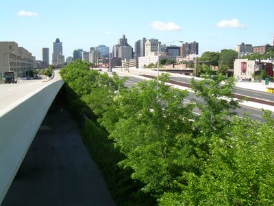
And all of the above is conveniently located near major highways and the light rail line.
This is the "Lost Continent" of Southwest Park, located just south of
Patapsco Avenue along the Baltimore City/County line. With a name like Southwest Park, the place must be so obscure as to have been off the radar screen of the name-makers who have stuck names of note to almost anything. Southwest Park sounds like a name that planners would stick on a land parcel in some obscure technical report that was long ago banished to a dusty shelf. Southwest Park also
hearkens back to the early days of suburbia when places off the previously beaten track were mostly named after their location relative to downtown, as if that was their only source of identity - e.g.
Northwood,
Westview,
Eastpoint,
Southdale.
The park is also sometimes referred to as Southwest "Area" Park, which reeks even more strongly of planner-
ese. Can you imagine anyone referring to Yellowstone Area Park or Yosemite Area Park?
The photograph above only hints at the magnificence of Southwest Park. A small branch of the
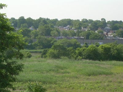
Patapsco River is shown toward the right, but the main river itself is hidden behind the trees to the left, and can only be seen up close. The photo below looks northward toward a huge parcel relegated to truck trailer storage, located on top of a huge land mass that is probably a former landfill.

Seen from the park valley floor, the vast metallic expanse of sun-glistened truck trailers in the distance looks like a mythical "shining city on the hill". Yes, indeed, this "trailer trash" is a placeholder land use for something in the future that could allow humans to take full advantage of this magnificent view and natural resource.

Here is the same mountain of trailers as seen from the north on
Patapsco Avenue. An even more varied assortment of industrial debris occupies this part of the site.
Below is another view of the trailer trash looking westward on
Patapsco Avenue. The light rail line is shown by the overpass on the upper right. The
Patapsco Avenue light rail station is just to the left of the overpass, behind the trees.
All of this would make a fantastic new transit-oriented community, with intimate access to the light rail
system for easy access to downtown and the airport and close-by access to I-95 and I-895, including the "Lost Highway" to I-97 (see previous article). The trailer trash could be replaced by the highest and most humanly intense uses that could be supported by the whatever geological constraints the trash mountain may impose.

Southwest Park is one of those places that a previous generation used for its own purposes, but left open for better use in the future. Off to the east is Brooklyn Park, an attractive community built before the sprawl era, but one which is not fully appreciated now. Brooklyn Park is cut off from Southwest Park by I-895 and by a huge sound wall, that prevents some wonderful views.
The
Patapsco River is also in front of the wall and the highway, and is even more hidden from the community - almost totally in fact. In the photo below, the only sign of I-895 is a sign, across the wide river from the park. The
Patapsco Avenue bridge is barely visible in the distance.
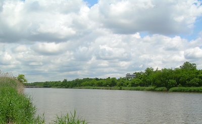

This is the broad
Patapsco River as it was known to Baltimore's original explorers, who could navigate as far upstream as
Ellicott City. Now almost all of the visible
Patapsco River can be seen only as a small stream. Southwest Park is one of the few places where the
Patapsco River can be seen as a real full-fledged river.
Southwest Park is like the lost continent of Atlantis, ready to be found and ready to be given a second chance. So now, the Baltimore Region should recognize Southwest Park for its opportunities to create the types of ideal relationships between nature and urban development that were squandered during the sprawl era of the last half of the 20
th century - with human and transit-oriented development overlooking a beautiful natural expanse. Who knows? Politicians may even want to rename Southwest Park after a real person.