December 23, 2019

MagLev station should cross street into Charles Center

The latest word for the 300 mph MagLev plan under Baltimore is for the downtown station to replace the Garmatz Federal Courthouse, just north across Pratt Street from the previous site at the Convention Center. That's progress, but it needs to be nudged north just one more block to the site of the Fallon Federal Building at the south end of Charles Center, whose demolition would be far more beneficial for the entire city.
Fallon Building, as seen across Lombard Street from Garmatz Building, built on top of an imposing impenetrable pedestal, cutting it off from the rest of the city and all of Charles Center behind it. This should be the location of the MagLev Station. (Baltimore Heritage, Eli Pousson)

To the MagLev planners and engineers, this is no doubt all about "constructability". They need a site where a giant hole in the ground could be dug in a place that allows access to the huge deep tunnel accommodating the high speed trains. The location originally chosen under the Convention Center must have been very problematic to have gotten them to move it northward to the other side of Pratt Street, where the functional and modern Garmatz Courthouse would have to be demolished.

But moving the MagLev station hole northward just one more block across Lombard Street would allow them to knock down the older and very dysfunctional Fallon building instead and create a great station location that would open up all of downtown. Ever since that building was constructed in the mid-1960s as the south anchor of the massive Charles Center project, it has been a curse on downtown, effectively creating a wall that forever cut a large portion of downtown off from all growth to the south, most notably the Inner Harbor.

What's more, there's already a large hole in the ground next to this site, due to the failure of the Mechanic Theater redevelopment project which has been largely a result of the massive wall that the Fallon building created when they were both built at about the same time. The Mechanic Theater hole in the ground can be combined with a Fallon Building hole and the vacuous plaza between them to create a truly formidable and encompassing MagLev Station site.

Here's the big hole in the ground already dug where the Mechanic Theater once stood, just north of the Fallon Federal Building and adjacent to the Charles Center Metro Station entrance, shown just to the right.

Making this area work is crucial to the future of downtown Baltimore. Without a fully functional Charles Center, downtown Baltimore really has no center. Ever since it was built in the 1960s, the huge mass of Charles Center has reduced the viability of the Howard/Lexington retail center to the west and even the Chinatown area to the north. The Charles Center access problem was originally supposed to be solved by aerial walkways which were built across virtually every major street in the area, including Lombard, Pratt, Charles and Light, as well as through the buildings, plazas and the McKeldin Fountain to the Inner Harbor. These walkways have gradually been dismantled over the years in the face of their failure to unify the areas.

Recommended Charles Center MagLev Station site in green, just north of the currently proposed Garmatz Building site and the previously proposed Convention Center site.

Creating a central rail transit hub is also essential


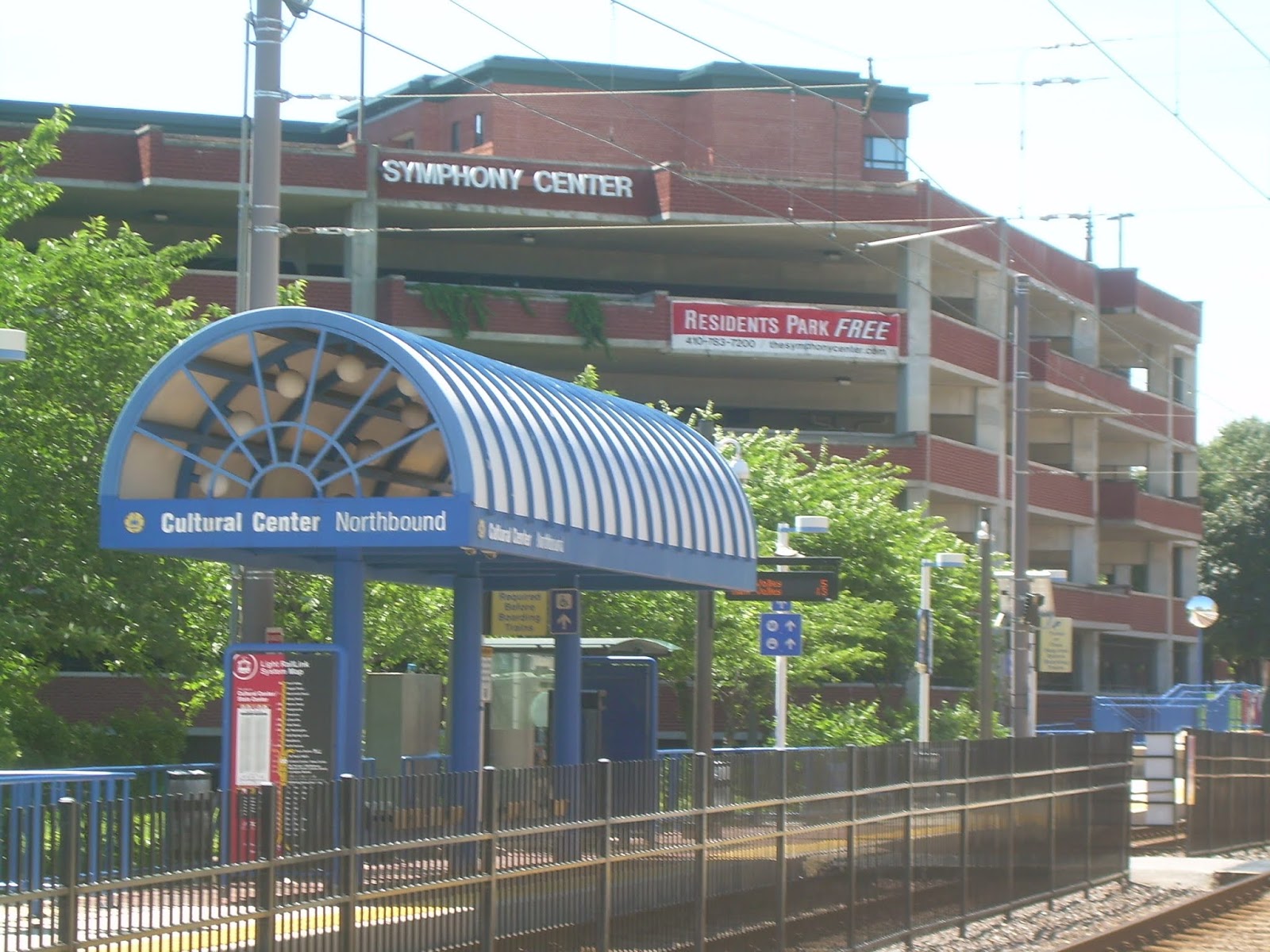
This failure is also inextricably linked to the failure of Baltimore's regional rail transit system to have a central unifying hub. The semi-permanent hole left by the demolition of the Mechanic Theater is contiguous with the Charles Center Metro subway station and also occupies much of the intervening gap westward to the Howard Street light rail line.

It is crucial to connect all of this as well as possible to the proposed MagLev station. The MagLev planners talk about the need for a parking garage to serve the station, but that's a very minor consideration. Sure, convenient parking is needed for certain VIP passengers, but there is no way that auto access can accommodate more than a very small share of them, and the efficiency of this access and the high speed MagLev time savings would inevitably be fully negated by street congestion anyway. MagLev should be capable of saving a half hour or more in getting to Washington, and eventually more toward New York, but it would lose all of this if it relied on driving on the local streets to get to the station.

This access can only be provided if it fully relies on the entire regional rail transit system. This can only be provided north of Lombard Street.

There is also a "default" station location proposed for Cherry Hill several miles to the south, but this is a non-starter in achieving this. It's too far from downtown, too close to BWI Airport (but not close enough to be useful) and basically near nowhere that most MagLev riders would want to go.

Ultimately, Baltimore needs the MagLev station to be downtown. It may very well be possible that the MagLev planners, designers and engineers can conceive of a solution that achieves the necessary downtown linkages without knocking down the Fallon Building, but this must not be an afterthought. It's disconcerting that they're already talking about details like parking, which makes it appear that they're putting the cart before the horse (there's a good metaphor in there somewhere!)

Many people have also questioned the level of importance that Baltimore is having in the whole MagLev planning equation, fearing that the city is being treated as a mere stepping stone in connecting Washington to New York. In the linked article, that includes Jim Shea, a very prominent citizen now dealing with MagLev in his role with the Central Maryland Regional Transit Plan Commission. Only locals can truly ensure that Baltimore's needs are being fulfilled in the MagLev planning process. And clearly, if the city's station is not well located, Baltimore will forever be doomed to be an unimportant "whistle stop".

To make the current downtown MagLev station plan work, the best possible linkage is needed with the Charles Center Metro Station, the Mechanic Theater demolition pit, the rest of Charles Center, and the central light rail line. Moreover, knocking down the Fallon Building will remove the wall that has prevented Charles Center from being integrated with the Inner Harbor and serving its historic and rightful role as the center of downtown.

If that can't be achieved, then it will be necessary to go back to the drawing board to consider other locations like the Shot Tower Post Office site a few blocks to the northeast.

The older and obsolete Fallon Federal Building, not the adjacent Garmatz Building, is what is standing in the way of a great linkage to all of these essential access points.

The Baltimore Magnetic Levitation planning process has now reportedly "paused", but it's really only just begun. Baltimore needs to use this pause to determine if MagLev is going in a direction that will actually serve the city.

October 29, 2019

"Station West" should strive to outdo Penn Station

While the planners at the Baltimore Metropolitan Council have declared failure in the effort to build any new rail transit in their 25 year plan, there's still a project that can keep the door open. The West Baltimore MARC Station must be totally replaced when the planned new Amtrak tunnel is built. For this new station, $90M has been programmed in the region's long range plan. This creates a great opportunity to use the Amtrak Northeast U.S. Corridor as the impetus for new transit in Baltimore, even while we've given up on expanding our own region's rail transit system. Building a great train station in West Baltimore at the end of the Franklin-Mulberry "Highway to Nowhere" is the key.
Welcome to Station West - This needs to become a real neighborhood, instead of just a bus loop and commuter parking lots as far eastward down the "Highway to Nowhere" as the eye can see. The temporary station platform is up the wood stairs to the left. The "Ice House" should be a future neighborhood development along Franklin Street, to the upper left.

The rationale goes like this. Starting with the 2002 regional rail plan, transit planners believed that a comprehensive rail system throughout the region was necessary to achieve a "critical mass". They rejected the concept of incrementalism as much as possible. They saw the failure of "transit oriented development" and the stagnant rail ridership throughout the system as explanations for why Baltimore needed a D.C. Metro kind of major comprehensive system. With the $3 billion Red Line, it was all or nothing, and even if all of it had been built, many more billions of dollars would still be needed to complete the system before success could be achieved. Even when Governor Hogan killed the $3 billion Red Line, they refused to even consider anything less.

But a different kind of "critical mass" has been emerging over the past several decades. The suburbs are now a sideshow. The traditional linkage between the city and suburbs is being gradually replaced by a new linkage between Baltimore and the other cities of the Northeast Corridor - Washington, Philadelphia, New York and in between. And instead of daily 9 to 5 job commuting, the new linkage emphasizes mostly independent employment, along with occasional face-to-face activity in the different cities. Much of this is fueled by widening disparities in the cost of living among these cities, so that long distance encounters make more economic as well as cultural sense.

This concept has long been recognized by planners for the Penn Station area. The surrounding "Station North" neighborhood has been marketed to people who make frequent, if not daily, trips from Baltimore to Washington, but the success has only been modest. Station North didn't really take off until its emphasis was shifted more recently to culture, arts and education, fueled by expansion of the nearby Maryland Institute College of Art and University of Baltimore.

This follows a long proven principal: Any successful urban neighborhood needs a diverse mix of activities and a strong quality of life, regardless of its other reasons for being. So fledgling "Station West" which includes the West Baltimore Station should strive to emulate "Station North" as a  neighborhood, which includes Penn Station. Of course, the neighborhoods have virtually nothing in common except train stations, but that makes them even more complimentary.

New West Balt Station should be iconic neighborhood anchor


So start with the train stations. The new West Baltimore Station should be designed to be an icon, just as Penn Station is. It won't have the historic beaux-arts architecture of over a century ago, but it will have the advantage of being a clean slate where contemporary style can be free to express itself. What must be avoided is building just a cheap train platform plus bare-bones facilities. The attractive new Camden Station which the MTA has just completed at Camden Yards has the right concept, but the West Baltimore Station should go further because it must play the role of a neighborhood anchor.

Here's an idea: A few years ago, the zeal to extend the iconography of Penn Station was perhaps overdone with the installation of the new Man-Woman sculpture in front of the station. Many people complained bitterly about how this contemporary sculpture was totally in conflict with the historic beaux-arts look of the station itself. This controversy demonstrated the power of art and iconography. So let's use this same power to promote the West Baltimore Station. When the new station is built, the Man-Woman sculpture should be moved to Station West to allow its iconic value to achieve better integration with its surroundings.

Critics decry the metallic Man/Woman Sculpture for how out of place it is in front of historic Penn Station in Station North. Its iconic value would be better served by moving it to the front of a new modern train station at Station West.

The sculpture would continue to be associated with train travel, but now it will be able to do so in a more harmonious way. And it would be "good riddance" for many advocates of Station North.

Beyond that, what the new Station West neighborhood needs is to create logic out of what is now the  illogic and destructive force of the obsolete "Highway to Nowhere". This should not necessarily be done by destroying the illogical or destructive past, but simply by making it work. History is not neat and tidy. That's why a "Walk of History" could be part of what replaces the highway, as discussed in a previous blog article. Various other art objects that didn't work in other parts of the city could be made to work here.

Most importantly, Station West must be made into a true neighborhood, with real residents and real life rather than just parking lots. But every train station area has its own strengths and weaknesses which must be dealt with. Station West is closer to Washington, DC than is Station North, so that may be a key advantage to some people. It provides abundant free parking, unlike Station North, but this may only be a small relative advantage, since the nearby Halethorpe or BWI Airport stations offer much better parking and auto access, especially in the long run.

Rail service will be expanded


The whole way that train service is marketed will change in the future. The distinctions between MARC and Amtrak - commuter and regional rail - will be blurred. The Baltimore Metropolitan Council long range plan considers the MARC rail service area to be expanded all the way from Northern Virginia to the south (where it would serve the new Amazon headquarters) to Philadelphia to the north.

Station West must find its role in all this, just as Station North has. There's also "Station East" to consider, even though that emerging neighborhood east of Hopkins Hospital doesn't even have a station now. Then there's a possible Magnetic Levitation train system, and - who knows - maybe even hyperloop. Transportation is always evolving and progressing.

And there's no reason why the Red Line plan couldn't be resurrected in some alternative guise to serve Station West, which in turn, could make Station West much more connected to downtown than Station North is. This need not be dependent on some multi-billion dollar comprehensive rail plan such as the 2002 plan.

Incrementalism will certainly play a role. It could start as simply a shuttle bus line that takes advantage of the lack of traffic conflicts inside the "Highway to Nowhere" ditch. One of the justifications for not knocking down both of the "Highway to Nowhere" bridges over MLK Boulevard would be to accommodate buses between the West MARC Station and downtown. This service would be far better than the Charm City Circulator from Penn Station to downtown, which is really just a redundant replication of MTA bus service. Beyond that, the west shuttle could be upgraded to a streetcar line, then part of a streetcar system, and then part of the light rail system, possibly connected to the existing central light rail line on Howard Street. It could even grow into a facsimile of the Red Line extending all the way to suburban Woodlawn and the CMS and Social Security complexes, and even to the east side as well.

In any case, the eventual long range rail transit system of the future won't necessarily be built as it was envisioned in 2002, but all possible options need to be considered.

It all begins by building a new West Baltimore train station that can truly serve as an anchor for a new Station West neighborhood. And while Station West should strive to outdo the initial premise behind Station North, all neighborhoods ultimately develop their own personalities based on their own residents. One could call it the "Creative Class" phenomenon invented by Richard Florida - except that people,  neighborhoods and cities have always worked to define each other.

July 9, 2019

Planners say: No new rail transit for next 25 years

The good news in the new draft 2045 regional transportation plan produced by the Baltimore Metropolitan Council is that the city is focusing on coordinating its major transportation projects into development areas, namely Port Covington and the "Highway to Nowhere" corridor. The bad news is that the plan is virtually all highway projects, with no new rail transit whatsoever. The always obsolete "Highway to Nowhere" will be retained, albeit in slightly truncated form. Is this the death knell for "transit oriented development"?
This is how the Red Line had been proposed to look at the Harlem Park Station. It would have done nothing to improve the environment of the surrounding "Highway to Nowhere". The new 2045 plan gets rid of all new rail transit plans, but keeps most of the highway, including this portion.

Governor Hogan is still getting lambasted by the city for killing the Red Line project four years ago which would allegedly had revitalized the "Highway to Nowhere" corridor. The city then quickly said it would propose new alternatives, but never did.

The Governor's reason for cancelling the Red Line project was very specific: the downtown tunnel was half the cost yet it didn't connect to the existing subway tunnel. At that time, he also made clear that he was not against all rail transit by approving the Purple Line for Montgomery and Prince Georges County.

After the Red Line's demise, the city even proposed another unrelated rail project - a spur from the existing central light rail line to Port Covington. But that project has also been left out of the new plan.

Here are the chapters of the 2045 plan that deals with projects and funding. Costs are a major issue, of course. Federal rules require that long range regional plans be fiscally constrained and must not be mere "wish lists". But there is a provision for the inclusion of "illustrative projects" which could be amended into the plan "should future funds become available". For example, the plan includes a proposed third span for the Chesapeake Bay Bridge, for which no specific concept or cost has yet to be developed.

Such off-budget projects are now a significant trend. These include projects funded predominately by public-private partnerships to be paid back by user revenue, loans, tax increment financing or other creative tools. The Purple and Red Lines were both to be financed by a mixture of these new and traditional methods. But no rail transit projects have now been included in that category as well.

This exclusion makes it appear that the Baltimore City, MTA and Baltimore Metropolitan Council regional planners have simply given up. Governor Hogan implicitly gave a simple directive for the Red Line: Propose a project that actually works, but without a new downtown tunnel two blocks away from the existing subway tunnel that would have cost well upward of a billion dollars.

Since then, Baltimore has had three mayors who have produced no plans.

The explanation might be that Baltimore is simply too dense to accommodate efficient surface rail transit (as opposed to major expensive tunnels), but not dense enough to support the kind of "transit oriented development" that rail transit has thrived upon in other cities. Transit oriented development in Baltimore has been a monumental failure along both the largely underground heavy rail Metro and along the all-surface central light rail line, and even in the two areas served by both, Lexington Market and State Center.

Some changes to the "Highway to Nowhere" and MLK Boulevard


An interesting aspect of the new 2045 regional plan is that an area which should have received major attention to "transit oriented development" in the Red Line plan is now, for the first time, proposed for major spending, but without the Red Line.

This so-called "Highway to Nowhere" corridor of West Baltimore, along with the adjacent Martin Luther King Boulevard, are vestiges of the city's failed interstate highway plans of the 1970s. This new inclusion of major investment, but without rail transit, would be similar to what has happened in other sections of the Red Line corridor. The Harbor East, Harbor Point, Canton Crossing and Bayview areas on the east side have been booming with major development in spite of no Red Line. The city is now betting the same for the "Highway to Nowhere" on the west side.

Throughout the fifteen year Red Line planning process, the city insisted that this "Highway to Nowhere" must be retained, so the potential for "transit oriented development" was limited to certain areas where limited adjustments to the highway were proposed. This seemed to be a major blown opportunity, since preparation for the Red Line entailed temporarily closing the entire highway anyway, which was accomplished with virtually no adverse effects. On the other hand, the Red Line plan itself had to be changed to eliminate the station closest to the highway's MLK intersections to accommodate a longer tunnel.

Those limited adjustments to the highway produced during the Red Line planning have now made it into the proposed 2045 plan. Specifically, this is a $118 million project to remove its two bridges over Martin Luther King Boulevard, replace them with surface roadways and reconnect Fremont Avenue with a large new intersection with the highway. Another $9 million will also be budgeted for "Re-Visioning" the 1.5 mile entirety of MLK Boulevard from Washington Boulevard (Pigtown) to Howard Street (State Center) as a separate project.

But the bulk of the "Highway to Nowhere" within the big notorious West Baltimore ditch between Schroeder and Payson Streets will remain as it has been since the 1970s.

This is a similar but larger version of what was done nearly a decade ago at the west end of the "Highway to Nowhere", where one block of the highway between Payson and Pulaski Streets was replaced with surface roadways and at-grade intersections. Pedestrians and local traffic will be able to walk or drive along Fremont Avenue the same way they can now traverse Payson Street - on, off or across the highway.

On Payson Street, this has not reduced the adverse impact of the "Highway to Nowhere" in any significant way. The highway remains a huge impediment to the communities. It is still much easier for local people to use the existing desolate but efficient bridges over the highway at Schroeder, Carey and other streets to get about.

At MLK Boulevard, replacing the existing highway overpasses with bigger surface intersections will also not make things any better for the communities. Yes, the heavy traffic volumes have proven that they can be accommodated, but the amount of backed-up traffic increases greatly without the overpasses, making it a very harsh environment for people, including bicyclists - to which the "complete streets" program is purportedly addressed.

What's more, the walls and buffers which were built along the highway right-of-way to seal off the adjacent Heritage Crossing community will need to be retained more than ever in order to fend off the traffic impacts. This will continue to keep Heritage Crossing as an isolated island, and prevent it from performing its originally intended function to be a catalyst for the revitalization of adjacent Upton, Lafayette Square, Harlem Park and the rest of northwest Baltimore.

MLK Boulevard under the "Highway to Nowhere". These two overpasses are proposed to be demolished, bringing all the highway traffic down to the surface intersections with it. The existing design is actually airy and attractive, but results in major dead spots and is isolated from the Heritage Crossing neighborhood (gazebo seen in background).  

Design is actually only a small part of the problem, and even serves well to mitigate the larger problem of too much traffic at the end of an interstate highway. The overpasses are light and airy (see photo above), in contrast with those on most highways. The larger problem is the highway itself. As long as some portion of the "Highway to Nowhere" is retained as a vestige of an interstate highway, motorists will behave as if it is an interstate highway, and people and the adjacent communities must react accordingly.

There can be no satisfactory "transit oriented development" in such an environment, with or without the rail transit. That is one reason why the communities have suffered and why the Red Line plan failed. The only potential beneficiary of such a plan could be the Metro West project to redevelop the vacant Social Security Administration complex. Since that complex has always been an isolated fortress, it may be be able to function while remaining as a fortress - with whatever pretty new trappings that $118 million can buy as a selling point.

The only satisfactory solution is to get rid of the entire "Highway to Nowhere", or at least narrow it down to a single roadway. Tearing down just one of the two bridges would eliminate the huge dead space which is now the highway median. A remaining bridge could even be converted to a bike bridge or a transit bridge or a bridge for quiet slow local traffic to avoid the congestion at the MLK intersections below.

The fact that the city wants to do pretty much the same things without rail transit that they were planning to do with rail transit, along the Red Line corridor, indicates why they are now willing to dispense with new rail transit altogether. This also shows how rail transit has always been oversold.

None of this means that rail transit can't be worth building, as many other cities have done. It simply means the city needs a good workable plan.

Huge highway changes for Port Covington


While Port Covington's proposed light rail spur has been excluded from the proposed 2045 plan, it does includes major highway spending. This is shown in a separate section of the report for funding by the MDTA (Maryland Transportation Authority - that "D" in the acronym makes little sense). That means that toll revenue from the Fort McHenry Tunnel and other toll roads would be used to finance the projects. Ironically and in contrast to the rest of the plan, no price tag is given for these projects, even though a single exact year is specified for all of them - 2029.

Here is the description given on Chapter 7, Page 36 of the draft report:

Improve I-95 ramps along approximately 7 miles of I-95 and sections of Hanover Street, McComas Street, and Key Highway. Improvements include:

1. I-95 Northbound Off-Ramps- (a) Exit 52, new ramp from Russell Street off-ramp; (b) Exit 53 interchange, new spur from I-395 southbound ramp; (c) Exit 54, remove ramp from I-95 northbound to Hanover Street southbound; and (d) Exit 55, reconstruct ramp from I-95 northbound to McComas Street 

2. I-95 Northbound On-Ramps – new ramp from McComas Street to I-95 Northbound 

3. I-95 Southbound Off-Ramps – new ramp from I-95 southbound to McComas Street westbound 

4. I-95 Southbound On-Ramps – realign ramp from McComas Street Westbound to I-95 southbound

5. Hanover Street – reconstruction from CSX Bridge to McComas Street westbound to I-95 southbound 

6. McComas Street and Key Highway – (a) realign McComas Street; and (b) widen Key Highway between McHenry Row and McComas Street 

7. Pedestrian and Bicycle Connections – (a) new sidewalks along Hanover Street and realigned McComas Street; (b) shared use path along Key Highway; and (c) shared use path linking South Baltimore to Port Covington peninsula.

All this would clearly cost a tremendous amount of money, at least on the order of hundreds of millions of dollars, and would be over and above the $660 Million Tax Increment Financing which the city has already allocated to pay for other infrastructure projects in Port Covington. Other federal funding was also requested in concert, and as an equal priority, with the proposed expansion of the Howard Street CSX freight rail tunnel, but that was previously rejected.

Having the tolls of Fort McHenry Tunnel users pay for improvements for a private development such as Port Covington will certainly be controversial, especially since there would be no enhancement of traffic flow for traffic using the tunnel itself, and would most likely make it worse.

And since the light rail project has been excluded, there will be little access or mobility benefit to the rest of the city.

A new kind of transportation planning


Whatever the outcome of all this, it does signal a new era in regional transportation planning - where traditional large scale simulation modeling of traffic flow on a comprehensive network is replaced by a focus on specific key development areas - in this case the MLK/"Highway to Nowhere" corridor of West Baltimore and the Port Covington area of South Baltimore.

This is actually a welcome new direction. Transportation should be used to shape our environment and to invest in needed economic development. The old method relying mostly on traffic volume number crunching mainly resulted in self-fulfilling traffic growth and rampant uncontrolled suburban sprawl.

But doing it with no proposed investment in new rail transit looks like a dead end. Only rail transit, not buses, have proven to be able to shape our urban environment enough to make a real difference. And buses are mostly a short term investment anyway. When buses get old or overcrowded, we simply buy more new ones.

Too much proposed new spending is also falling through the cracks in the plan. Governor Hogan's huge proposed multi-billion dollar "express lane" plan (which started with the O'Malley/Ehrlich I-95 widening from Baltimore to White Marsh) is largely ignored, as are the profound changes that could come about due to billions of proposed "off budget" upgrades to Amtrak and for a new Magnetic Levitation system. The prevalent attitude appears to be that we will build what we can, not what we should.

So this draft 2045 regional transportation plan has serious deficiencies. But looking at the bright side, these are not abstract metaphysical problems. The issues are focused on two very real and very important places: The "Highway to Nowhere" corridor and Port Covington. On the other hand, the cynically-inclined would notice that these two areas are each dominated by powerful well-connected developers - Sagamore/Under Armour at Port Covington and Caves Valley Partners at Metro West at MLK Blvd. in the "Highway to Nowhere" corridor. Politics is never far away.

In any event, the solutions can readily be both tangible and real. There are two steps.

1 - The plan needs to analyze the needs of the desolate divided "Highway to Nowhere" corridor in its entirety, coupled with the "ReVisioning" of the entire adjacent MLK Boulevard corridor which is already specified.

2 - The plan needs to analyze the needs of the entire Middle Branch corridor in its entirety. The City is already doing that as an urban design exercise, but it needs to be expanded to a full transportation and economic development study in determine the best investments. The Port Covington plan, a very small portion of the whole, should not simply be treated as a given, especially since development conditions for Under Armour and other prospective tenants are in a constant state of flux.

The results of these studies should show that the Baltimore region does indeed need to invest in additional rail transit over the next 25 years. This would probably not be the kind of pseudo-DC Metrorail type comprehensive system that was proposed in the 2002 plan and which included the failed Red Line project. Instead, it should be the type of development-oriented transit that can make a real difference for the region.

Selected links to a few of many related blog articles:

Greenway linkage including MLK Boulevard and "Highway to Nowhere"
https://baltimoreinnerspace.blogspot.com/2015/09/six-mile-greenway-loop-would-rebuild.html

An expanded light rail spur to Port Covington
https://baltimoreinnerspace.blogspot.com/2016/09/big-port-covington-needs-even-bigger.html

MLK Boulevard redesign for a Pigtown Gateway
https://baltimoreinnerspace.blogspot.com/2016/08/proposed-pratt-to-pigtown-parkway-sooo.html

Integrating Metro West with Heritage Crossing and "Highway to Nowhere"
https://baltimoreinnerspace.blogspot.com/2017/03/metro-west-should-become-heritage.html

Creating a hybrid streetcar/light rail Red Line
https://baltimoreinnerspace.blogspot.com/2013/09/integrating-light-rail-and-streetcars.html

June 10, 2019

Which community will inspire a real Middle Branch plan?

Baltimoreans know the drill: Whenever some big new hyped-up "game changer" development proposal comes along, like Port Covington, Horseshoe Casino, M&T Bank Stadium and even the dead Walmart, everything in the past gets swept away - both good plans and bad. So the latest of countless Middle Branch plans now being prepared is like a shot in the dark. Let's enjoy the pretty surrealistic renderings by "world class" architectural firms and then focus on the many (mostly) ignored possible developments that could really make this area take off. Here are six of them.
West8 came up with the wildest idea of all - a huge new superhighway on a bridge connecting Port Covington directly to Brooklyn. Cherry Hill would lose its long distance waterfront view and have it replaced with a view of a highway. Also note that Harbor Hospital gets to keep the entire waterfront for itself.

The proposed new plan is currently at the stage where the three urban design firms are being subject to a competition to determine whose ideas are most favored by the city and the public. The three competing entries are illogically presented in the form of YouTube videos so you get only look at one graphic at a time and must pause the video to give it more than a cursory glance. This may be due to the fact that the city government's computer network has recently been hacked and is out of service, so YouTube is a more reliable medium.

In any event, a competition is a very wrongheaded way of doing it. It is far more important to know which ideas are feasible, economically and environmentally, and most importantly, which ideas can best leverage private investment. This is what the city really needs.

So the real competition is not between design firms. It is between the various portions of the Middle Branch that could attract and leverage greatly needed investment:

1. Westport


Westport was the hottest major development site in town a decade ago, and is still the only one with great light rail access to both downtown and BWI Airport. It is currently out of favor mostly because it is now owned by the Port Covington consortium which wants no competition. It was probably the city's best shot at luring Amazon, but the official "shovel ready" site was touted as the Sunpaper's printing press property in Port Covington. Some other critics think Westport's fall from favor is due to the shallowness of the adjacent Middle Branch, and it is to the credit of the current urban design teams that they are showing how this might be used as an amenity, not a liability.

Westport waterfront becomes Westport wetlands in the West8 plan, which enables the construction of a boardwalk out into the Middle Branch to a helical lookout (lower left). One narrow channel is dredged to provide access for a water taxi.

Westport is the single most critical geographic link between the north and south portions of the Middle Branch corridor, but the city can't go around spending money without using it to maximize leverage for private investment. It would be extremely foolish for the city to put one penny into making the Westport site more valuable until it gets a real commitment for major private investment... period.

2. Port Covington


The part of Port Covington covered by the city's $660 Million TIF tax incentive package is mostly inland rather than directly on the Middle Branch shoreline. The shoreline itself is occupied predominately by a new whiskey distillery, the West Covington nature preserve which the developer has recently converted into a mega-bar after chopping down numerous trees, and by the future Under Armour corporate campus, the offices of which are temporarily housed in the defunct Sam's Club Big Box store on-site.

So while Port Covington is still the "big kahuna" of proposed Middle Branch developments now in active planning, the city has lost much of its leverage to further guide it. Nevertheless, the extent to which Port Covington development takes place will determine how much spins-off to the rest of the Middle Branch. That is now a big uncertainty so at this point, we can only hope.

There is also one major parcel in Port Covington not owned by the Under Armour/Sagamore consortium, the now vacant Locke Insulator site just east of the Hanover Street bridge. This could turn out to be a key property depending on what happens to the bridge, which needs expensive repairs or replacement.

Peter Tocco's photoshopped waterfront hotel veneer for the casino's giant ugly deadening parking garage is still the best solution anyone has shown for this portion of the Middle Branch.


3. Horseshoe Casino Gateway


The Horseshoe Casino made a mockery of previous Middle Branch plans when it plopped a 3500 car parking garage directly on the waterfront, while orienting the casino itself toward the strip of gas stations, convenience stores and self-storage warehouses on Russell Street. Then the city added insult to injury by building a new Greyhound Bus station on much of the remaining waterfront green space - a location that has absolutely no relationship to the rest of the city's transit network.

Since then, Horseshoe's economic impact has been spiraling downward with the opening of the state's leading casino at National Harbor and a new casino hotel at Arundel Mills. The next seemingly desperate act  was to convince Top Golf, a chain of slick suburban driving ranges, to open its first urban outlet on the Middle Branch, where the animal rescue shelter currently resides. It remains to be seen how well the Top Golf concept adapts to an urban waterfront setting.

Resuscitating Horseshoe Casino appears to be a task where the city and state governments urgently need to take an active role, because they already have so much of a stake in it as a source of revenue. But the Middle Branch plan is mute to this.

This is the state's only urban casino so it is more sensitive to its surroundings than the others. It needs to overcome bad images people may have of its location and the city as a whole. All the planning so far of the Middle Branch has only made this worse - a place for a stinky incongruous bus station and a huge parking garage that backs onto a highway interchange above a swamp. The pretty pictures in the new plans try to soften this sorry situation but really don't deal with it at all.

The best solution so far is Peter Tocco's image of a waterfront casino hotel (see above) that serves as a narrow veneer to the parking garage and activates the remaining parkland. It's difficult to find good solutions to this hole that the city and the casino have dug for themselves. There may be other ideas, but no one has presented them.

4. Cherry Hill


The Cherry Hill community is where the potential of the Middle Branch has already been most realized and where planning concepts can most easily be tested. If folks want to just spread out a blanket or jog along the shore, they can do that now on the large grassy area north of Waterview Avenue. But not that many do. The key is connecting the waterfront to development, and the only use that does that is Harbor Hospital - not exactly quintessential waterfront activity.

My crude Google Earth graphics of waterfront development interspersed with the Harbor Hospital in Cherry Hill has a lot more reality potential than most of the superior renderings of the Middle Branch Plan design teams.

The simplest and probably best solution is simply to encourage Harbor Hospital's ownership to sponsor a development plan for the parking lots and underutilized areas around the hospital that is sensitive to the shoreline. This would encourage more recreational and other people-activity such as just passively hanging out. The hospital has made development proposals in the past, but obviously never got enough encouragement to follow through.

Another view of possible waterfront development adjacent to Harbor Hospital in Cherry Hill. The Hanover Street bridge leading to Port Covington is shown on the right.

Cherry Hill is also the community which would benefit the most from a new light rail spur, such as an extension of the one in the Port Covington plan. This proposed spur was hyped up when the Port Covington plan was being sold to the public, but has been almost totally left out of the conversation and drawings since then. A longer spur extension to Cherry Hill along with transit oriented development would refocus the interest. The existing light rail station on the opposite side of Cherry Hill is well used, but is not very close or convenient to most the community.

5. Brooklyn and Masonville


It was gratifying to actually see the latest Middle Branch plans extended as far south as Brooklyn, but the urban design firms did not do much with it. The southern terminus of the waterfront is shown in the plans as the Masonville Cove nature preserve, which has already been meticulously restored as part of the Maryland Port Administration's development. However, this is blocked from the rest of the Middle Branch and the Brooklyn community by a concrete plant, and none of the plans show this as changing in the future. The concrete plant clearly needs to be redeveloped for an active waterfront use.

Potential Brooklyn waterfront development on the current site of a concrete plant,
 as seen from the Masonville Cove nature preserve.

Such a project could be very attractive to a developer seeking a site that is isolated from the usual urban hubub, but still linked in. The linkage to the rest of Brooklyn would be via the site just to the west which is now occupied by possibly the world's most wastefully sprawling urban intersection between Hanover and Potee Streets and Frankfurst Avenue. Efficiently tightening this intersection would free up much waterfront land and for the creation of linkages to Brooklyn, Masonville and northward to Cherry Hill, where traffic on the Hanover Street bridge over the Patapsco River could be greatly curtailed or even eliminated.

6. MagLev Train Station


Cherry Hill appears to be the current leading contender for a Baltimore Station on the proposed mega-billion dollar 300 mph Magnetic Levitation Line between Washington DC and eventually to New York. This is more of an accident of geography than a planning decision, but Baltimore must be prepared to respond with its own intelligent plans nonetheless.

This station site is wedged between the Cherry Hill Light Rail Station and the Baltimore-Washington Parkway, and was chosen by engineers because it could be built on an elevated alignment instead of an even more expensive tunnel. But north of this station, it would still need to enter a very large tunnel portal somewhere in the Middle Branch/Westport lowlands area, under the very severe constraints of maglev alignment geometry. The impact on the Middle Branch and Westport could be severe.

A Baltimore maglev station would be a major boost to the city economy, so serious provisions would be necessary for high density transit oriented development. The most likely site for this would be the existing commercial and industrial uses in this part of Cherry Hill, which is probably not the best from the city's point of view since until now no plan has ever proposed displacing the current uses and jobs.

The other station option studied by the maglev consultants was downtown, most likely Camden Yards, which is certainly better for the city but billions more expensive. Another alternative proposed here is Patapsco Hill adjacent to the Patapsco and Baltimore Highlands light rail stations, just south of Cherry Hill and west of Brooklyn. This would be the least expensive option, especially in the short and medium terms and if it eliminated the need for a very expensive station at BWI Airport.

A Patapsco Hill Maglev Station would be a major stimulus to the Middle Branch plan and all its surrounding communities, but without undue impacts and pressure on Westport and the northwestern portion of Cherry Hill.

The role of the current Middle Branch Plan


The design competition for the latest Middle Branch plan has provided some attractive future scenarios that illustrate what a wonderful resource it is, but there are practically no clues as to what the city should do next. The first lesson is the one taught by Dr. Hippocrates: "First Do No Harm". Because harm is exactly what the city has inflicted with its casino and bus station developments and by letting Westport get imprisoned by land speculation.

The future is largely in the hands of outsiders: The Under Armour/Sagamore development team in Port Covington, the Caesar/Horseshoe team running the casino, the MedStar team which owns Harbor Hospital, the Japanese/American consortium trying to build a Maglev line, the owners of the Locke Insulator property, the Vulcan Materials Concrete Company and probably some other firms flying under the radar.

The city does have some priorities in the area that cannot wait until outsiders decide what to do, but these are not intrinsic to the Middle Branch plan: The Horseshoe Casino must be fixed so that it is a viable revenue generating competitor with the Arundel Mills and National Harbor Casinos. The proposed light rail spur needs to be planned so that it provides maximum benefit to the city as a whole, not just for Port Covington's speculative plans. And planning and design for the new or improved Hanover Street Bridge must proceed for the maximum benefit to the entire area.

As for the Middle Branch plan, it must be used as leverage to get its best outcome from any and all of the potential investors, and not simply as an end in itself.

Hargreaves Jones interpretation of the ecological evolution of the Middle Branch. Global warming is said to be raising the sea level, but the Middle Branch is being submerged under wetlands.

May 27, 2019

Woodberry just got bigger - let's build on that

It's a tale of two Woodberries. In historic Woodberry, irreplaceable houses from the 1840s are being demolished. Meanwhile, new high density housing is being built in another Woodberry that nobody knew existed, where the "highest and best use" until now was the city's Stump Dump. Historic Woodberry is a highly livable transit-oriented community, while the New Woodberry is devoid of urban charm - but that's where major new development should be and is happening.
"The Woodberry" - a large standard-issue boxy efficient postmodern apartment
building of the type which is now popular and routine throughout the city.

Real estate developers and agents are the ultimate deciders of neighborhood names and boundaries, making successful neighborhoods grow and others recede. So it is significant that the major new 283 unit apartment building on Cold Spring Lane is being called "The Woodberry" even though it is well over a half-mile from anything else in Woodberry. And that's by trail. It's over a mile away via actual streets.

The city needs to build on this success and not dwell on any failure in historic Woodberry or anywhere else. But there's no sign that the city has learned this lesson.

This expansion of what it means to be in Woodberry is particularly significant because the city's most affluent and coveted neighborhood, Roland Park, is actually closer to this new complex than is old Woodberry. And so is Park Heights to the east on Cold Spring Lane, which is (shall we say) reputationally challenged.

Identity crisis - Cold Spring to Woodberry


The lack of identity over the years for this stretch of Cold Spring Lane just west of the Jones Falls Expressway has not due to a lack of interest, though almost all the investment has been by the public and quasi-public sectors. Way back in the 1970s, there was a grandiose plan for an entirely "new town in town" called Cold Spring. Much of it was built, but the only part built near Cold Spring Lane was an expensive entrance road which required switchbacks to get northward to the main part of the development up a steep hill southwest of Cylburn Park.

"The Woodberry" is the first new residential growth since that time. When the architectural rendering shown above was drawn, the large vertical sign on the building was going to say "Cold Spring". But perhaps the developer reconsidered upon realization that Cold Spring Lane is often mentioned in crime reports from Park Heights and other neighborhoods. Hence the latest rendering on the developer's website has the sign changed to "The Woodberry".

The biggest investment in this area since the new town was the construction of the Central Light Rail line, which runs directly adjacent to the new apartment house, but with the Cold Spring station way down in a gully between the Jones Falls stream and its namesake expressway. It is not conveniently located to the new apartment house, but making it more so would have been difficult. Many proposed plans were drawn up over the years to make this a true "transit oriented" site, but they were apparently too difficult to pull off.

Construction of "The Woodberry" as seen across the Jones Falls and up the hill from the Cold Spring Light Rail Station. The project's large parking garage is now in view, but will be wrapped by the housing units.

Of course, there will be confusion when people try to explain that "The Woodberry" apartment complex is near the Cold Spring Lane light rail station, instead of near the Woodberry light rail station.

Considering the record of virtually total failure for "transit oriented development" everywhere else in Baltimore over the years, this failure is simply a recognition that unless everything is done almost perfectly, it won't work. There's very little room for error, so there's not much point in even trying.

So The Woodberry is essentially going to be a large, isolated, fortress-like building wrapped around a large parking garage to get people into their cars and quickly onto the Jones Falls Expressway to go wherever they want to go.

On its own terms, this project looks like a big winner: Great highway access, pretty good transit access, good security, and right next to the beautiful Jones Falls Trail. With those positives, The Woodberry's confusing name and lack of urban charm seem like mere quibbles. The politics even went smoothly by Baltimore's contentious standards. No project is perfect, so why did this one take so long to build?

Meanwhile, back in the REAL Woodberry...


A mile south in the real actual Woodberry neighborhood, genuine urban charm seems to have recently become a real liability. Two irreplaceable stone houses from the 1840s were surreptitiously demolished by their developer, even while negotiating with the community for their preservation.

Woodberry site where two historic stone houses were recently demolished. Also shown are three similar surviving houses, two in the background across the street and one recently renovated to the left. The light rail tracks are in the foreground.

The owner of that property must have concluded that the Woodberry "brand" was more of a state of mind than actually living in the kinds of historic buildings that had actually defined the neighborhood. This greatly upset the neighbors.

The developer wanted to build high density "hipster flats" on this site, where the density is achieved not just by increasing the size of the building, but by making each unit smaller and not providing much off-street parking. This also upset many people.

This illustrates a problem with "transit oriented development". It calls for a higher density of development than the existing historic buildings can often contain. Near the downtown light rail station at Howard and Lexington Streets, the city developed a plan called the "Superblock" which jeopardized many historic structures. After much controversy and delay, that plan was killed and most of the old buildings have stood vacant and rotting ever since.

The city must be extremely careful about "transit oriented development" in historic neighborhoods, or it will lead to sudden unwanted demolition such as has recently happened here. The developer will still be able to build high density "hipster flats", but they will be even more out of character with the historic neighborhood, which need development controls regardless of density.

"The Woodberry" is part of the solution for Woodberry


"The Woodberry" apartment project on Cold Spring Lane is exactly the kind of site where high density development can work. But it took almost four decades after Cold Spring New Town and three decades after the light rail line was built for the city to do it.

Unfortunately, it looks like the city has still not learned its lesson, by allowing historic buildings to be demolished while neglecting prime sites that are ideal for high density development.

Directly across Cold Spring Lane from "The Woodberry" is a property which the city has been using as a "Stump Dump" ever since the new town project was planned. This is an even better site than that of "The Woodberry". It was precisely where the Cold Spring light rail station was originally supposed to be and could easily be relocated, and a bridge could provide safe direct access to the affluent Cross Keys and Roland Park communities and Poly-Western high school.

But the City government loves its stump dump, where it can dump the stumps of all the large mature trees it chops down throughout the city to accommodate various projects. The city's de-facto plan is to replace large mature trees throughout the city with little twigs that are inadequately supported and maintained. As a nearby example, the trees in a large portion of adjacent Cylburn Park were recently chopped down to build an electric substation.

This substation will make any future redevelopment of the Stump Dump less attractive, helping the city to keep its Stump Dump as long as possible. It will also increase pressure on communities like the real Woodberry to increase density by knocking down historic buildings and replacing them with "hipster flats".

The city urgently needs attractive sites for high density growth that will relieve the pressure on existing communities, especially historic communities. The stump dump site would also relieve pent up pressure for development on the nearby sylvan Roland Park Country Club. It could also provide a path for growth toward the Pimlico racetrack site on the other side of Cylburn Park.

The city government tries to avoid expanding its horizons to grow, but The Woodberry is a project that shows the way to do it.

By popular demand! Here's a context map of the relationship between "The Woodberry" apartment complex and the Woodberry neighborhood, linked by the Jones Falls Trail. The light rail line is in black. (I'm not sure what the blue line is.) 

April 25, 2019

State should move from State Center to Metro West

The poster child for the downtown office space glut is Metro West, the million-plus square foot complex abandoned by the Social Security Administration. The state should redevelop the Metro West white elephant for state employees rather than continuing to mess with the paper tiger at State Center, with its decades-long stalemate between rebuilding or moving out.
Empty Metro West tower with lovely Heritage Crossing in the foreground. They'd be a perfect compliment for each other and would spur revitalization of surrounding neighborhoods if the big bad "Highway to Nowhere" wasn't in between.

Because of the office glut, the proposed rents for the State Center redevelopment became far in excess of the market value, which led to lawsuits from other downtown property owners and the decision by the state to pull out of the State Center deal. Now is the time for the state to finally take advantage of those lower rents at Metro West. There are plenty of things to do with the savings.

Redevelop State Center in small steps instead of the mega-plan


The bottom line is that the State Center site has inherent geographic value, while Metro West just a few blocks down MLK Boulevard is condemned to remain essentially worthless unless there is a major intervention, and the state government is probably the only entity which can do it.

State Center has the advantages of two rail transit stations and being surrounded by stable neighborhoods in Bolton Hill to the north, Mount Vernon to the east, Seton Hill to the south and even McCulloh Homes to the west, which got a major vote of confidence when it was decided to retain its sorely needed low income housing rather than adding to the State Center footprint.

State Center became a white elephant because of state workers, who stampede to get out at 5 PM instead of creating a community. The time to try to fix that with infill development such as on the parking lots was decades ago before the offices were allowed to deteriorate. But attempting to create a coexistence of bureaucrats and urban hipsters has always been a far-fetched concept that no amount of subsidy could really accomplish.

The scuttled State Center Plan - These office buildings look too nice for state employees, and definitely too expensive. But they'd be perfect for some rich companies if a market ever develops for them away from the waterfront. Light rail station on Howard Street is in the lower right.

It's the old story of mega-project "game changers": Spend enough money and expend enough hype and you can purport to solve Baltimore's problems. Even when that strategy has been forced to work in Harbor East or Harbor Point through isolation and subsidies, it really still doesn't.

The real key to resolution at State Center is simple: Incrementalism. Use minor development projects to start weaving the area into the surrounding communities. Bolton Hill is probably the easiest fix because Dolphin Street is needlessly a six lane highway fragment and can thus be tamed. There are plenty of surface parking lots that can be converted into viable activity centers. With the right infill, making parking more difficult can also be made into a plus.

Some of the best development parcels are not even part of the State Center footprint, but have simply  evolved to be part of the border vacuum between State Center and the surrounding communities. The recreational uses have become fortresses in themselves, which is never a good idea. Recreation should be a unifier not a divider, even if its only among "privileged" members and not the urban masses.

Yes, the Bolton Hill Swim Club is a fine and exclusive institution. But it should be part of something, and not just sit in gated suburban style between the border of Bolton Hill and State Center. The Swim Club should be redeveloped as part of something larger, so that it has full-time residents who serve as permanent hosts for their friends who come visit for a swim. That's the way to weave it into the city, both socially and geographically, even if it never resembles a public swimming pool such as at Druid Hill Park.

Pearlstone Park is an even clearer example. Its a dead bad location for a public park, along the precipice leading down to the Maryland Institute / Mount Royal Station gully and across from a sprawling parking garage on Cathedral Street. Much of the time, there is absolutely no activity there.

The catalyst for a new incremental State Center plan may be to find a new location for Pearlstone Park, so it can be surrounded by "urban eyes" incorporated into new or existing development. Then the existing parkland can be developed in a way that truly compliments the adjacent Maryland Institute and Meyerhoff Symphony Hall and the dramatic overlook into the historic station in the gully.

Light rail station on Howard Street adjacent to the Symphony Center parking garage, with free parking which flies in the face of "Transit Oriented Development". To the left is vacuous open space.

An ideal solution may be to weave the new park into the Symphony Center apartments just across Preston Street and its light rail station on Howard Street. This would fix two problems at once, since Symphony Center now doesn't really relate to anything. Symphony Center should have been planned as an integral Phase One of the State Center redevelopment, but instead it's just one of the city's myriad pathetic failures of "transit oriented development". Somebody with some real urban design talent should be able to create a useful active park out of the vacuous open spaces which surround this building.

Other projects can also proceed on their own timetables, including the adaptive reuse of the Armory for a supermarket and/or other retail and enhancements to the University of Maryland medical system's former Maryland General Hospital, which needs a far better "public face" on MLK Boulevard across the street from the state offices.

With all the transformative opportunities on the edges of State Center, what happens with the state offices at its heart will be of lesser importance. If state bureaucrats continue to occupy their allegedly squalid offices indefinitely as pawns in a larger political game and stampede to the exits daily at 5 PM, so be it. This could actually work to the area's advantage, in that the state offices occupy its most inherently valuable real estate, so waiting to redevelop it could make it more economically viable for higher densities. After all, the whole reason the State Center plan hasn't worked is bad economics.

Moving state offices to Metro West


In stark contrast to State Center, incrementalism will absolutely not work at Metro West. It was built as a fortress compound for government workers and it shows no signs that it could work for anything else. The barriers of that fortress need to come down, mainly by getting rid of the "Highway to Nowhere". The building itself is similarly a massive monolith that must be dealt with as such.

Caves Valley Partners, which bought the complex from the federal government at a cheap bargain auction, has tried to interest the state in the complex, so far without success. This is probably far too monumental an endeavor for any private enterprise that's much smaller than Amazon.

A design for a 2,200-car parking garage at Metro West was rejected by UDARP Thursday.
Caves Valley proposal for a big parking garage to lure a tenant to Metro West, with a huge Maryland flag draped over it to give special attention to state government. The "Highway to Nowhere" overpass above MLK Boulevard can be seen in the left background.


But the state should be up to the task. The building itself should be in far better condition than the existing state offices, since it was maintained by the Social Security Administration which is one of the few institutions on the planet that's even bigger than Amazon. Caves Valley also proposed adding a massive new parking garage, which is the traditional response of developers everywhere in marketing properties, but that's just a sideshow.

This is a situation where the customary hype for a transformative "game changer" actually applies. Getting rid of the "Highway to Nowhere" would actually unleash a development momentum that would reverberate far beyond into West and Northwest Baltimore, far larger than anything that could be unleashed by State Center.

This blog has provided numerous concepts for the redevelopment of the "Highway to Nowhere", but what is essential is that the transformation must be comprehensive and incorporated into the surrounding communities.

A maximum development scenario for Metro West - Half the "Highway to Nowhere" is retained which can easily handle all the traffic, and new infill buildings are added.

Replacing the highway with a "Walk of History" would be particularly appropriate if it was anchored by an administrative seat of state government at Metro West.

Metro West is also adjacent to the beautiful Heritage Crossing neighborhood which absolutely needs to be integrated with its crumbling and dysfunctional surroundings as well as with downtown, whereas next door to State Center, Bolton Hill and Mount Vernon are already doing well on their own and are not worried about their very survival.

Upton Mansion near Heritage Crossing - There have been many renovation proposals, but it just keeps crumbling.

Many plans have been put forth for nearby buildings such as the abandoned Upton Mansion and portions of Upton and Lafayette Square, but without a major boost in surrounding property value, the benefits are starkly limited.

Government facilitated the demise of West Baltimore by building the "Highway to Nowhere", so government is the institution that should end it and mend it. And in the forty years since the completion of the highway, only government has built anything in the corridor while the rest of the land has stayed empty. So government is the only logical occupant for Metro West.

Ultimately, both Metro West and State Center will grow and flourish as little or as much as their economic value allows. At State Center, this process can begin by identifying limited viable projects right now. In contrast, Metro West is a place where only major change can launch the growth and development process that can spread throughout northwest Baltimore. A decision to move the state offices from State Center to Metro West is the major change that would get that process going.

March 29, 2019

An easy-access regional gateway for Patapsco Park

Regional parks are getaways from urban and suburban life, but too often they either bring the crowding and congestion along with them or else the quiet and solitude is just too hard to get to. At peak times, Patapsco Valley State Park suffers from both problems. It's an important local getaway, but it needs an efficient gateway.
Proposed Patapsco Park Gateway where a parking lot is now located at the unfinished end of I-195 at Rolling Road. Patapsco Park now occupies the top area in graphic below (Soapstone Trail), and would be expanded into the green shaded area currently part of I-195, with its southbound roadway shifted to the red line next to the northbound roadway.

Patapsco Park's current major gateway is a long road off South Street off US Route 1 (Washington Boulevard) near the Relay community. It leads through a "toll booth" and eventually to a fairly large parking lot, near the river and major trails central to the Avalon Area. While this gateway is rather obscure and difficult to find for first timers, it is still "too popular" at peak times. The parking lot fills up quickly on nice weather weekends and then there's no escape valve where overflow traffic can go. What is needed is a more prominent gateway with easy access for as many people as possible, which can handle overflows as easily as possible.

Fortunately, the solution to this problem also addresses other challenges - expanding the reach of the park, extending it towards nearby communities and dealing with the vestiges of I-195, an interstate highway also known as Metropolitan Boulevard whose proposed extension threatened the park in a battle that lasted from the 1970s until fairly recently. It was only in 2011 during ongoing discussions of chronic congestion on Rolling Road (MD Route 166) northward through Catonsville that all parties finally agreed to rule out any future extension of I-195, since it would merely destroy more of the park and push the congestion to any new terminus point such as along Frederick Road between Catonsville and Ellicott City.

Converting an unfinished highway interchange into a gateway


The ideal place for a regional gateway hub for Patapsco Park is the triangular parking lot which was built inside the unfinished interchange of Interstate 195 and Rolling Road, where communities and activists made clear that the highway should not be extended any farther. Even though this "park-and-ride" lot is located right on the edge of the park, it is totally surrounded by highways and ramps and thus has no relationship to the park. One of the park's longest trails, Soapstone Trail, is located nearby but is totally hidden and difficult to find.

The simple solution is to build a permanent ending for Interstate 195 at Rolling Road so that it no longer resembles an unfinished interchange, and no longer surrounds and engulfs the parking lot. The park and the Soapstone Trail can then be easily expanded adjacent to the parking lot and the trail head can be made as visible as necessary.

The way to do this is to get rid of the ramp which now serves as the beginning of southbound Interstate 195, and replace it with a southbound roadway adjacent to northbound roadway, thus consolidating all I-195 traffic in one place. The eliminated ramp can then be replaced with parkland for the extended Soapstone Trail, right next to the parking lot, which will still have convenient and prominent access from I-195 and Rolling Road on the other two sides.

Plan view (to scale) of the proposed gateway. The green shaded area is currently southbound I-195 and would be converted to parkland. Southbound I-195 would be consolidated with northbound I-195 on the red line. The yellow line is an extension of the park's Soapstone Trail (lower left) through the new parkland to the Cera Trail in the UMBC campus (upper and lower right).

Expanding the park's "grasp" to UMBC, Arbutus and eventually Baltimore


The Soapstone trail can then be extended further eastward beyond the parking lot to proceed under Interstate 195 at its underpass along UMBC Boulevard. It can then connect to the Cera Trail within the UMBC (University of Maryland Baltimore County) campus and to the Arbutus community, thus extending the "grasp" of the park.

Getting the trail safely across UMBC Boulevard may require further attention. UMBC Blvd has recently had two "traffic calming" roundabouts installed, but that may not provide sufficient relief in the area closer to I-195. Since trail users would only need to cross one lane at a time, traffic "chokers" that neck the roadway down to a width of only about 12 feet may provide the necessary visibility and safety. The portion of Rolling Road with its trail crossing has slower traffic, so a similar solution should almost certainly work there.

The establishment of such a prominent gateway for Patapsco Park would open up other opportunities. Signage to the park from nearby Interstate 95, the main street of the entire Northeast U.S. Corridor, would be straightforward and highly effective. An Information Center in the parking lot could become a very worthwhile project.

Right now, visitors have difficulty confronting the huge sprawling size of Patapsco Valley Park. The park extends about twenty miles, from the Avalon area near Relay northwestward to the McKeldin Area near Sykesville in Carroll County. This gateway would be commensurate to the vastness of the park itself.

Patapsco Park should keep growing in the future, expanding by another six miles or so eastward through the Halethorpe Area to Southwest Park and finally to Reedbird and Middle Branch Parks in Baltimore City, which is where the river's mouth flows into the Chesapeake Bay.

Transforming an essentially useless Interstate highway stub into a park gateway, where citizens banded together to prevent the highway from destroying the park, is also exactly what is needed where Interstate 70 ends at Leakin Park in West Baltimore and Baltimore County. A Patapsco Valley Park gateway would thus be an ideal model for a similar gateway for Leakin Park.


Thanks to Jim Himel for his contributions to this article.

February 26, 2019

MagLev better at Patapsco Hill Station than BWI Airport

An international consortium wants to build a 300 mph Magnetic Levitation train line northward from Washington, DC to Baltimore - for reasons that have practically nothing to do with Baltimore. That's how they came up with the rather strange idea of putting Baltimore's station in Cherry Hill of all places. If that doesn't succeed, they'll shrug it off as just a first phase prototype misstep and they'll remain focused on the ultimate prize of getting Maglev to New York and then to the rest of the country, while only Baltimore pays for their failure. So it's up to Baltimore to make it work.
Patapsco River and Southwest Park as seen from Interstate 895 (lower right),
with a possible Maglev oriented Patapsco Hill skyline shown in the background.

The obvious reason why the Maglev planners are focused on Cherry Hill is that it is the least expensive option. The station can be built above ground, with light rail access along with barely adequate ramps to the Baltimore-Washington Parkway. This project would certainly be a major shake-up to the community, as opportunistic new Maglev related high-end development would attempt to coexist with the current lower income residents, which would no doubt result in a serious culture clash.

The official plan also calls for an additional underground station at Thurgood Marshall BWI Airport, to demonstrate the connectivity of Maglev to the international air network. This would show that Maglev is "world class".

No one really knows how the relationship between Maglev and air travel will ultimately shake out, but at least the world community would be able to identify with it. Many of them will want to use Maglev from BWI when they visit the nation's capital, and this will provide a great exposure to America's version of this state-of-the-art technology.

But ironically, many people see Maglev from the opposite perspective - as a way to significantly reduce air travel in order to reduce air congestion and global greenhouse gasses. So using Maglev to serve air travelers who would then be lured away from air travel would be a contradictory short term solution at best.

Success would not be measured by how well Maglev serves BWI, but simply by how well it leads to the next step. No ridership projections have yet been published and they would be highly questionable anyway, since there is no real precedent.

Ultimately, any major new transportation mode becomes its own cultural force, which reshapes the world in its own way. Starting in the 1950s, the new commercial airline industry created the "jet set" of frequent flyers for whom the entire world was their domain. Similarly, automobile travel was creating suburbia.

So what Maglev eventually does has yet to be determined. MagLev could create a new generation of affluent world citizens who live and work in a place like Baltimore, do business in Washington and regularly go to New York for high energy urban mingling and fun. This would be a welcome relief from a Baltimore that some critics say is forever mired in the rust belt.

Baltimore must look after Baltimore


So it's a golden opportunity for Baltimore to be the nation's first MagLev destination, but in the big picture, what ultimately happens to Baltimore will be of little concern to Maglev planners. Trip patterns will simply conform to demands. In the future, trains will be able to whiz through Baltimore without stopping on their way from Washington to New York if that's what the demand dictates, resulting in time and cost savings which will become the bottom line.

So Maglev planners want to build a BWI Airport Station and a prototypical "real world" station in Baltimore, and they want to build them at the lowest possible cost. So that's what they've designed with the proposed Cherry Hill Station, on an odd vacant parcel under a power line right-of-way. Back in 2007, I proposed this site for a new Greyhound Bus station. The powers-that-be didn't think it was good enough for Greyhound then, but now it may be good enough for Maglev.

They've also offered a workable but much higher cost alternative with a station at Camden Yards instead of Cherry Hill. This serves Baltimore's desire for a much stronger local Maglev presence, but it does not appear to meet any of the primary needs of the Maglev planners for the system as a whole. So the Maglev investors will likely treat it as a frill which they will build only if it is paid for by others. So far, the State of Maryland has seen no reason to pledge money to the Maglev project.

Meanwhile, local reactions to the Maglev project have started polarizing as an either/or choice between "jet set" Maglev and priorities for more localized transit needs. But local versus regional transit is a false choice, since Maglev underwriters don't really care about local needs. So local planners must propose alternatives which make them care.

Here are the primary guidelines for resolving this conflict:

1. The desired Maglev access to BWI Airport should be provided, but it does not need to be great access. Air travel has many access constraints from security procedures to air congestion. The time savings from high speed Maglev access can and will be very readily eaten up by waits in the security lines or circling the airport. Maglev must not pretend to be some kind of solution to air travel's problems.

2. The initial Baltimore Maglev station should be planned to maximize its positive local impact at the lowest cost. Just being feasible is not enough.

3. Even though the city's ultimate goal should be to establish the best possible downtown Maglev station, since this is the chief criterion for long-term success, this probably needs to be a battle for a later time. There simply is no way that an adequate downtown station (such as has been proposed at Camden Yards, or at the Mechanic Theater or Post Office sites) can be built for a comparable cost to the lowest cost alternative. Consequently, the cheaper Cherry Hill station site would be seen as "close enough" to downtown by the project investors, even though it really isn't close enough by any reasonable local standard.

So a less expensive and more effective alternative to Cherry Hill is needed.

Possible future Patapsco Hill development, just to the south (right) of Patapsco Avenue,
 with its light rail station in the lower right and Cherry Hill neighborhood to the east (left). 


Best and lowest cost Maglev station site: Patapsco Hill


Patapsco Hill is a huge, hidden and largely forgotten site which is now occupied by an ugly, marginal truck storage yard on Patapsco Avenue at the south city line, adjacent to Southwest Park in Baltimore County. It also has two light rail stations which provide direct service to BWI Airport and downtown and is adjacent to Interstate 895.

This site also happens to be shown in the masthead photo at the top of this blog. The greenery in the foreground at the bottom of the photo is Southwest Park. The shiny mass behind the park is the truck yard, underneath the downtown Baltimore skyline in the background. The Baltimore Highlands neighborhood can be easily seen to the left.

The configuration of the park is such that the MagLev Station could easily be built underground using the most efficient top-down or cut-and-cover technique recommended by the engineers, and when completed, the park could be restored and greatly enhanced on top of it. The light rail line could even be buried and integrated along with the MagLev line at little additional cost, providing the best and most seamless possible connections. The truck yard along Patapsco Avenue would then be a major opportunity for Maglev oriented development, minimizing negative impacts on the existing Baltimore Highlands and Cherry Hill communities.

The two light rail stations would be located at either end of the Maglev station. At the south end, the Baltimore Highlands Station would provide the main connection to BWI Airport, while the Patapsco Avenue Station at the north end would connect to the new development and the existing feeder bus terminal. The current light rail travel time to the airport terminal is 15 minutes, and this could be reduced by several more minutes by eliminating several station stops which many folks in the community want to get rid of anyway. Trains to Cromwell/Glen Burnie could still stop at these stations if desired.

Patapsco Hill Maglev Station could be built here underneath Southwest Park, along with the
 Baltimore Highlands light rail station relocated from its current site shown in the foreground.

A Patapsco Hill Maglev Station would be uniquely convenient to the airport, as well as to both downtown Washington and Baltimore. It would thus stimulate related development in a way that no other site could.

It would also stimulate spin-off development at the long-stalled Westport waterfront located two light rail stops to the north,. Beyond that, it could create an impetus for an entire Maglev oriented development corridor along the existing light rail line, as well as potential new light rail loop to Port Covington and to the Cherry Hill and Brooklyn waterfronts. Baltimore would then be in a position to grow as an integral part of the new Maglev culture as it expands from Washington to New York and beyond.

This light rail loop concept was first described here as a longer version of the Port Covington spur which has been proposed by Under Armour's development company. A Maglev station at Patapsco Hill would justify completing the loop so that its riders would have a direct ride between Port Covington, the Maglev station and BWI Airport.

Maglev-Light Rail Development Corridor, encompassing Patapsco Hill, Brooklyn, Cherry Hill,
Westport and Port Covington. Existing light rail is shown in blue, and proposed loop in yellow.

Patapsco Hill would be the lowest cost Maglev alternative, since it would completely eliminate the BWI Airport station and would be over a mile shorter than the Cherry Hill route. It would also facilitate a far more direct alignment as the Maglev line is eventually extended northward toward New York.

In contrast, an elevated Cherry Hill Maglev Station would create a major alignment problem as it descends back underground to the north, requiring a huge portal which would occupy a large piece of land, most likely along the Westport waterfront. This issue has not been addressed in the most recent Maglev report and could be a fatal flaw of the Cherry Hill station. Even if it isn't fatal, it would seriously reduce the potential development sites available without displacement from the existing communities.

In contrast, a Patapsco Avenue Maglev Station and light rail spur would open up a huge amount of prime waterfront development property in Cherry Hill and Brooklyn, with the additional attribute of remaining in close proximity to large lower income working class populations, which is something that cannot be said for most of Baltimore's current growth areas which have perpetuated the "Two Baltimores" segregation.

And incidentally: That link is to a post in the context of presenting alternate sites for Amazon's East Coast headquarters. Now that Northern Virginia has won that competition and New York has blown it, a Baltimore site within a 15 minute Maglev ride of Washington would become Amazon's next best choice. With the New York debacle, Amazon (and Mayor Pugh) should now have a new appreciation for the local support which Amazon received from Baltimore communities (most notably Old Goucher).

The Patapsco Hill Station site is also far enough from downtown that it would not preclude an additional station near the heart of Downtown Baltimore when the Maglev line is eventually extended northward. The Shot Tower / Post Office site as recommended here would be an ideal complement, since it is at the opposite end of downtown.

Getting Maglev moving


The most important priority must simply be to get the Maglev project moving. The international investors see the entire United States as a fertile "blank slate" for their technology, unencumbered by competition from conventional high speed rail which already has a stronghold in Europe and East Asia. The existing Amtrak Northeast Corridor line would be complimentary, not competitive, since its inherent speeds will remain far slower. Amtrak's main advantage will always be that it has far more stations and will thus accommodate much shorter trips than Maglev.

As its first destination, Baltimore needs to play an integral role in getting Maglev going and determining what benefits Maglev can provide. The city's geographic place has always been it's greatest strength.

A Maglev station at Patapsco Hill is where this role can best be played at minimum cost and maximum benefit.