Baltimore's best park is almost totally surrounded by major highways, which not only discourages people from getting to it except by car, but even more crucially, also prevents Druid Hill Park from having the needed positive effect on the health of nearby neighborhoods.
Here are nine critical points where a far better interface between the park and the neighborhoods can be created, presented in the order of how they can be implemented for maximum benefit and minimum disruption.
Conditions at each of the nine critical points are different, and not amenable to a single uniform solution. This is how it usually is in traffic planning. The specific conditions, traffic patterns and neighborhood needs and desires of each location are the most important focus.
There's been a lot of talk recently about the concept of "complete streets". Yes, it's a clever rhyme, but uniformly attempting to make every street "complete" by serving every need is pointless, and usually ends up as an exercise in chopping up the pavement space to try to serve every need of cars, bikes, transit and anything leftover for parking, with lots of flexi-posts, signs and stripes to plot it all out. Instead, "Complete Neighborhoods" should be the catchphrase. But what rhymes with "neighborhoods"?
Now there's even a City Council bill to attempt to legislate "complete streets", with a proposal for a new citywide committee to micromanage the entire effort. These people must think the city transportation department is incompetent to do this themselves. Well... so far, they haven't done well in places like the vicinity of Druid Hill Park.
Focusing on specific points rather than whole streets is also a way to implement a plan in easy increments and learn from each step, rather than in one big gulp that may or may not work. So here are the nine critical locations and nine manageable steps to make the wonderful Druid Hill Park accessible to the communities around it:
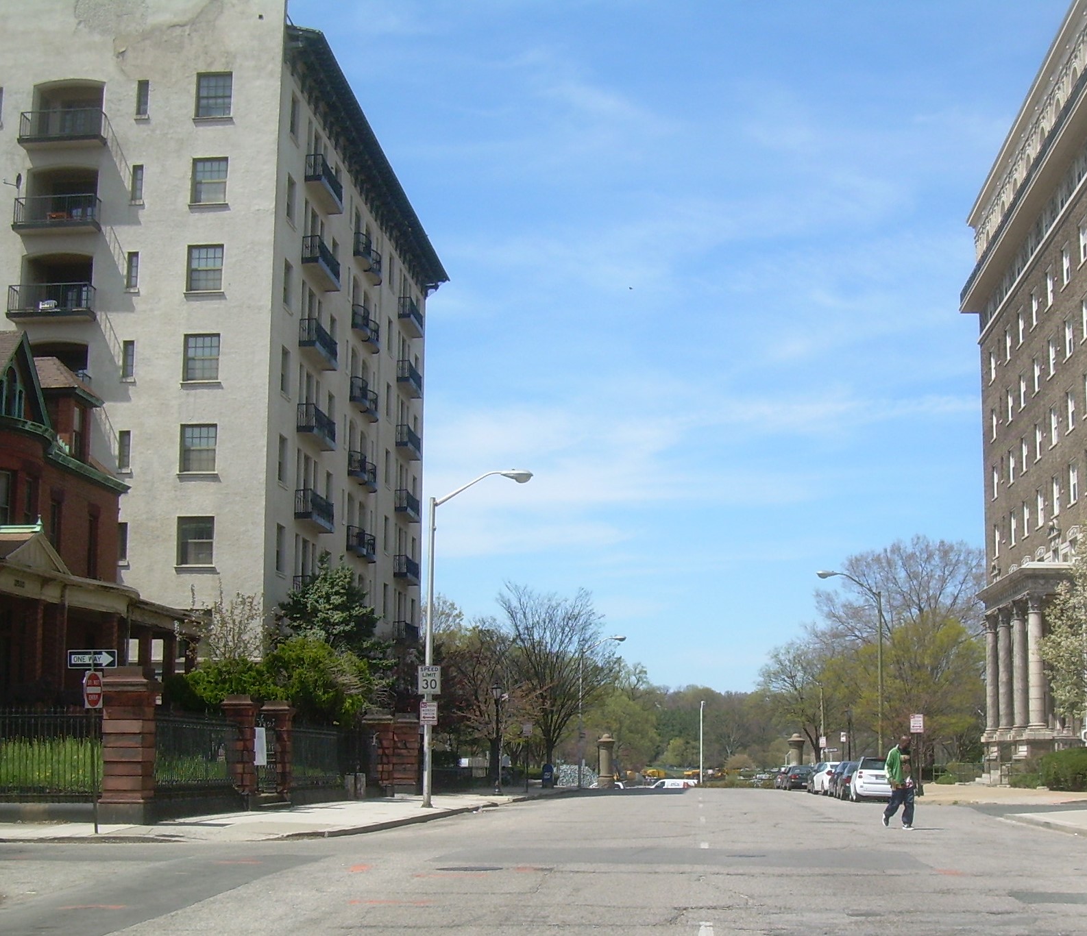
This is Druid Hill Park's gateway from Reservoir Hill and all the downtown-oriented neighborhoods. It's also the "low hanging fruit" of all the proposals, requiring only pavement narrowings and no changes in traffic patterns.
The best thing that could be done here would be to simply prohibit this left turn. There is far more capacity and fewer conflicts for this traffic at the adjacent intersections of Liberty Heights Avenue to the north and Fulton Avenue to the south. This should be tried on a trial basis to assess the impacts before permanent changes are made.
"Try before you buy" is a potent concept that the city should use more often, and is a major benefit of the incremental approach. The only question is whether the city bureaucrats are really prepared for all the ensuing public feedback they would get. But it's far better than some designated committee mulling over hypothetical effects or simply carving up the "pavement pie".
Once the results of this trial are known, the intersection can be redesigned in a far more efficient manner with much more people space and much less traffic space.
The next major benefit would be to redesign the Olmsted greenway connection from Druid Hill Park to Gwynns Falls Parkway, in a similar manner as is now being done on another Olmsted parkway - 33rd Street. Both of these are part of the 35-mile greenway trails network currently being planned by the Rails-to Trails Conservancy.
Finally, the redesign of this intersection must be compatible with the changes planned for the Step #3, discussed below. It's probably best to construct most of the permanent changes for both steps at the same time.
This step is the top benefit of the whole nine-step plan. Auchentoroly Terrace has some of the city's most exquisite rowhouses which need to be treasured as befits the way they overlook the city's premiere park. But the adjacent heavy traffic destroys the relationship.
Another park connection which would be development-driven is at the vacant lot in Reservoir Hill overlooking Druid Lake between Brookfield and Lakeview Avenues. The city has made numerous attempts to find a developer for this site and has always failed, indicating that it's still not ready. However, the neighborhood has been great progress so it should happen eventually, especially after the lake is rebuilt.
Here are nine critical points where a far better interface between the park and the neighborhoods can be created, presented in the order of how they can be implemented for maximum benefit and minimum disruption.
 |
| Nine steps to better Druid Hill Park neighborhood access: (1) Eutaw Place, (2) Gwynns Falls Parkway, (3) Auchentoroly Terrace, (4) Park Circle, (5) Fulton Avenue, (6) Lakeview Avenue, (7) Liberty Heights Avenue, (8) Hampden, (9 ?) Streetcars |
"Complete Neighborhoods" are key - not streets
Conditions at each of the nine critical points are different, and not amenable to a single uniform solution. This is how it usually is in traffic planning. The specific conditions, traffic patterns and neighborhood needs and desires of each location are the most important focus.
There's been a lot of talk recently about the concept of "complete streets". Yes, it's a clever rhyme, but uniformly attempting to make every street "complete" by serving every need is pointless, and usually ends up as an exercise in chopping up the pavement space to try to serve every need of cars, bikes, transit and anything leftover for parking, with lots of flexi-posts, signs and stripes to plot it all out. Instead, "Complete Neighborhoods" should be the catchphrase. But what rhymes with "neighborhoods"?
Now there's even a City Council bill to attempt to legislate "complete streets", with a proposal for a new citywide committee to micromanage the entire effort. These people must think the city transportation department is incompetent to do this themselves. Well... so far, they haven't done well in places like the vicinity of Druid Hill Park.
Focusing on specific points rather than whole streets is also a way to implement a plan in easy increments and learn from each step, rather than in one big gulp that may or may not work. So here are the nine critical locations and nine manageable steps to make the wonderful Druid Hill Park accessible to the communities around it:
1- At Eutaw Place
 |
| Eutaw Place looking north to Druid Park Lake Drive - all that's needed is to narrow this street down to two normal width lanes and do the same to each direction of Druid Park Lake Drive. |
This is Druid Hill Park's gateway from Reservoir Hill and all the downtown-oriented neighborhoods. It's also the "low hanging fruit" of all the proposals, requiring only pavement narrowings and no changes in traffic patterns.
The intersection of Druid Park Lake Drive and Eutaw Place simply has far too much pavement in all directions. There are no possible turns off Druid Park Lake Drive, so the third extra lane in each direction is totally extraneous, and ends beyond the intersection anyway. Similarly, the two lanes on Eutaw Place are far too wide and the "free flow" right turn lane was designed as if it is on a major suburban arterial and should be eliminated. Eutaw Place should simply be narrowed to two "normal"-sized lanes at the intersection.
As the current reconstruction of Druid Lake is completed, Eutaw Place will then be a great place to put a new grand pedestrian entrance to Druid Hill Park.
This plan was first presented in a 2013 article in the Baltimore Brew, with urban design aspects provided by Marc Szarkowski.
2- At Gwynns Falls Parkway
This intersection has great significance as the interface between Druid Hill Park and West Baltimore in the historic Olmsted Plan for the city's greenway system.
In contrast to Eutaw Place, traffic patterns are a major problem here, particularly the heavy left turn from northbound Swan Drive into Gwynns Falls Parkway, which must immediately and unexpectedly stop for the opposing southbound traffic, causing major queueing, confusion and congestion.
The best thing that could be done here would be to simply prohibit this left turn. There is far more capacity and fewer conflicts for this traffic at the adjacent intersections of Liberty Heights Avenue to the north and Fulton Avenue to the south. This should be tried on a trial basis to assess the impacts before permanent changes are made.
"Try before you buy" is a potent concept that the city should use more often, and is a major benefit of the incremental approach. The only question is whether the city bureaucrats are really prepared for all the ensuing public feedback they would get. But it's far better than some designated committee mulling over hypothetical effects or simply carving up the "pavement pie".
Once the results of this trial are known, the intersection can be redesigned in a far more efficient manner with much more people space and much less traffic space.
The next major benefit would be to redesign the Olmsted greenway connection from Druid Hill Park to Gwynns Falls Parkway, in a similar manner as is now being done on another Olmsted parkway - 33rd Street. Both of these are part of the 35-mile greenway trails network currently being planned by the Rails-to Trails Conservancy.
Finally, the redesign of this intersection must be compatible with the changes planned for the Step #3, discussed below. It's probably best to construct most of the permanent changes for both steps at the same time.
3- At Auchentoroly Terrace
 |
| Auchentoroly Terrace - shift both directions of thru traffic over to left side, away from the houses, and turn the median into a linear neighborhood park. Druid Hill Park's exquisite Rawlings Conservatory can be seen to the upper left. |
This step is the top benefit of the whole nine-step plan. Auchentoroly Terrace has some of the city's most exquisite rowhouses which need to be treasured as befits the way they overlook the city's premiere park. But the adjacent heavy traffic destroys the relationship.
The best solution here is to build new southbound connections within the median strip which consolidate this traffic onto what is now the northbound roadway (called Swan Drive). This is exactly what was done with astounding success on Mount Royal Avenue in Bolton Hill. What was once an isolated median strip then became a linear park, intimately linked to the neighborhood.
 |
| Mount Royal Avenue used to have heavy traffic next to these Bolton Hill houses, until it was converted into a local street and all the traffic was pushed onto the roadway on the left (note the big truck). The same thing can be done to Auchentoroly Terrace. |
This proposal was first introduced in a Baltimore Brew article in 2010. That article linked it to a larger plan that extended beyond Liberty Heights Avenue to the north. Christopher Nunn later made a thoughtful comment to the article explaining how an overpass at Liberty Heights Avenue could be avoided. He proposed a traffic dispersion plan that may or may not work, but demonstrated how too much change should not be attempted at once.
The easy part of this plan is the southbound connector links south of Liberty Heights Avenue and north of Fulton Avenue that would divert the heavy through traffic away from the houses on Auchentoroly Terrace, and open up the present median strip for use by the neighborhood.
The more difficult part is how to handle the intervening intersection with Gwynns Falls Parkway. However, that should be determined prior to this in Step #2. Physically, the design should become clean and clear, but for traffic operations, it may be tricky. That intersection is already set up operationally as if it was two separate signalized intersections, one with Swan Drive (northbound) and one with Auchentoroly Terrace (southbound). That odd arrangement is currently a disadvantage, with most turning traffic needing to stop twice, but it may be the key to actually making it work. We'll find out.
 |
New path for heavy southbound traffic between Liberty Heights Avenue (left) and Fulton Avenue (right),
away from adjacent houses and freeing up the median strip to be used as a neighborhood oriented park.
|
The more difficult part is how to handle the intervening intersection with Gwynns Falls Parkway. However, that should be determined prior to this in Step #2. Physically, the design should become clean and clear, but for traffic operations, it may be tricky. That intersection is already set up operationally as if it was two separate signalized intersections, one with Swan Drive (northbound) and one with Auchentoroly Terrace (southbound). That odd arrangement is currently a disadvantage, with most turning traffic needing to stop twice, but it may be the key to actually making it work. We'll find out.
4 - At Park Circle
This five-legged intersection of Reisterstown Road, Park Heights Avenue and Druid Park Drive, at the extreme northwest corner of the park, was once actually a roundabout. Then in the 1950s, it was chopped up and made into the confusing auto-dominated hodge-podge intersection it is today, with the sixth leg into the park itself cut off completely.
About a decade ago, the city proposed that the roundabout be restored, but nothing became of that plan - probably because it was part of a larger plan to install roundabouts at all kinds of other crazy places, most notably Key Highway and Light Street in the Inner Harbor.
But Park Circle was actually designed originally to be a circle, and so it should be returned to being a circle. The primary benefit of roundabouts is that they subordinate the intersecting traffic streets and promote the place itself. Park Circle is indeed a place that needs to be celebrated as the southern culmination of the Park Heights neighborhood, its only gateway to Druid Hill Park, and really the only point at which that huge neighborhood interfaces with the rest of urban Baltimore.
Roundabouts aren't great for pedestrians, but Park Circle could certainly be made far better as a roundabout than it is now as a confusing five-legged intersection. And certainly better than its current all-but non-existent entrance to Druid Hill Park.
Something really special should be installed in the central focal point of the circle - a monument or sculpture. Traffic demands would dictate that this is off-limits to pedestrians, but that just means the object should avoid small inscriptions and could be made somewhat less vandalism-resistant than otherwise.
The original Park Circle also had to accommodate streetcars, which was no doubt another problem. So the new design should consider the needs of a possible future streetcar line (as per Step #9 below).
Rebuilding Park Circle could be done anytime, but since it would be a fairly expensive and time-consuming project, it is listed here as Step #4.
Rebuilding Park Circle could be done anytime, but since it would be a fairly expensive and time-consuming project, it is listed here as Step #4.
5- At Fulton Avenue
The downsizing of the horribly oversized intersection of Fulton Avenue, Swan Drive, McCulloh Street, Druid Hill Avenue and Druid Park Lake Drive was the focus of this recent 2017 blog post, which makes the case that it should be driven by major new adjacent development. The city isn't quite ready for that yet, so hopefully it will be by the time some of the previous steps take place.
This is a critical location because it is right where Reservoir Hill, Mondawmin, and much of the North Avenue corridor intersect.
This is a critical location because it is right where Reservoir Hill, Mondawmin, and much of the North Avenue corridor intersect.
6- At Lakeview Avenue
 |
| Lakeview Avenue in Reservoir Hill, looking toward Druid Park Lake Drive, with Druid Lake on top of the mound in the background. A pedestrian bridge to the lake can be built as part of new development on the vacant lot in the foreground. |
Another park connection which would be development-driven is at the vacant lot in Reservoir Hill overlooking Druid Lake between Brookfield and Lakeview Avenues. The city has made numerous attempts to find a developer for this site and has always failed, indicating that it's still not ready. However, the neighborhood has been great progress so it should happen eventually, especially after the lake is rebuilt.
Other issues are that the site is quite submerged relative to the man-made lake, and traffic noise is quite high, so a high rise development will be necessary to disorient the building from the street level. So it should be a major project.
As such, including a pedestrian bridge to the development plan would be a valuable feature, to provide a direct connection to the lake and its jogging loop for residents and the rest of the Reservoir Hill neighborhood. And as always for pedestrian bridges, intelligent design is essential. No helix or switchback ramps! There's already one of those a block away over Mount Royal Terrace (built with the JFX in the early 1960s), and practically no one uses it.
7- At Liberty Heights and Greenspring Avenues
This location is a critical pedestrian connection between the Mondawmin Mall/Metro Station and the Maryland Zoo. This Baltimore Brew article makes the case for an overpass for Auchentoroly Terrace to create a direct pedestrian connection underneath. Minimizing traffic conflicts would also enable the minimization of pavement, down to a single lane in each direction northward to Reisterstown Road, where there is now the equivalent of eight lanes through the park adjacent to the new Parks and People headquarters.
A two-lane bridge designed by subtly changing the surrounding topography could have the grace and elegance of similar bridges in New York's Central Park.
But such a project could be expensive overkill. An overpass would only accommodate through traffic, not the heavy turning volumes which could get even heavier. What is needed is to crunch the traffic volume numbers for all movements in the intersection at various stages, particularly after Step #3. Something should be done, but perhaps a less ambitious but more cost effective solution can be designed without an overpass.
8- At Hampden and the Jones Falls Valley
 |
| Possible new Hampden Gateway to Druid Hill Park shown in yellow at the end of Ash Street. The connection would proceed underneath the Jones Falls Expressway (I-83). |
The large Hampden neighborhood is totally segregated from Druid Hill Park by the big, bad Jones Falls Expressway (JFX, I-83). There is, however, one point where the JFX is up on a large overpass and the topography of the park is gentle enough to allow a gateway to be created. This location is in the vicinity of Ash Street and Clipper Mill Road, several block south of the west end of 36th Street.
All that would be needed is a small bridge over the Jones Falls stream bed and a grade crossing of the light rail tracks. The Jones Falls Valley has recently become an important regional recreational resource in its own right and this connection would enhance it greatly.
The Jones Falls greenway trail now provides good connections to the park from Woodberry to the north and Wyman Park / Remington to the southeast, but nothing in the vast section between.
Ever since the light rail line was being planned in the 1980s, a park connection has been contemplated to the Woodberry Station, which is well served from Union Avenue in Hampden. However, this is an extremely remote section of the park with very steep topography, so nothing has never gone anywhere with this idea.
A new Druid Hill Park gateway near Ash Street is the best alternative. Druid Hill Park is big enough and significant enough that it needs to serve the entire city as well as possible. Bringing in a larger citywide and regional clientele will then summon resources to improve the park for everyone.
9- For Streetcars
Druid Hill Park was originally developed with streetcar money, back in the glory days when the city's streetcar system was built with private money and was actually profitable enough to tax. (Nowadays of course, tax money flows into the transit system, not out.)
So streetcars in the park is not a far-fetched idea. One concept would be to start a streetcar line at the Mondawmin Metro Station transit hub, run it into the park along Liberty Heights and Greenspring Avenue to serve the zoo, then northward to Park Circle and along Park Heights Avenue to the prime Pimlico Racetrack development area (see three part Pimlico blog series that begins here). Park Heights Avenue in particular is perhaps the most suitable streetcar street in the entire city - big and wide and not too congested, and lined with what should be attractive houses.
South of Mondawmin, the streetcar line could run right through the Coppin University campus and then down North Avenue. (See my streetcar system slide show here.)
The most important rule for developing a streetcar line is that it MUST be driven by new development and urban design. The technical advantages of streetcars over buses are elusive enough that streetcars can practically never be justified only on the basis of mere transportation.
Washington DC's H Street corridor is a prime example of how to use streetcars as a catalyst for redevelopment. Baltimore's far more pretentious Howard Street corridor is a prime example of how NOT to do it. In both cases, the rail line itself has been just one factor in the development process.
So a streetcar line in this corridor must be driven by a very serious redevelopment plan for Mondawmin Mall, with real genuine transit orientation this time (not fake like the Target store and Shoppers Food Warehouse), plus a very serious plan for Pimlico Racetrack, plus a very serious plan for Park Heights Avenue itself (after numerous false starts over past years and decades).
But building the new and improved gateways into magnificent Druid Hill Park as proposed here would be a serious first eight steps.
Great posting and thank you for letting me know that someone actually saw my comment on the Auchentoroly Terrace article. lol.
ReplyDeleteThat 8 year old BaltimoreBrew article generated many comments but yours is the only one that survived! The Brew's comment system is provided by Disqus, and they wipe out all the comments after a time to save some megabytes. The Brew wipes out most of its photos eventually for the same reason.
ReplyDeleteYou wrote your comment about 7 years after I wrote that article, "only" nine months ago, so your patience was rewarded (to both of us!) City planning is a subject with a very long shelf life which is thus more conducive to this blog than to The Brew. Proposals and their issues never seem to die.
I love The Brew and I've made a zillion contributions there (comments and articles), but many articles like that one get buried there, which is why I reprint them here on my blog - https://baltimoreinnerspace.blogspot.com/2010/11/druid-hill-park-traffic-diversion-plan.html
Since this blog is powered by Google, whose servers have more megabytes than anyone's except God's, our posts and comments can seemingly last forever! So thank you!
I came across these renderings for RFP's of Druid Lake Drive. Have you seen them? They look great and include pedestrian bridge from your wish list above https://www.dabardevelopment.com/brooklyntownhouse
ReplyDeleteThank you, I hadn't seen them. Looks gorgeous - I love it! Much nicer than what we usually get in Baltimore.
DeleteFor some reason, I had to go through the company's Home Page to access the web page -
https://www.dabardevelopment.com Then click on "Portfolio" and "Druid Park Lake Drive"
While I agree with dedicated transit lines connecting the park with area, I'd dare say, go with something that something other than traditional streetcars. A fleet of self driving buses, in their own lanes, where possible. Which would have flexibility to reroute, as needed, depending on demand. That way, additional vehicles could be used for Zoo traffic, or events elsewhere in park. So that say, concerts, parades (PRIDE for one, could make good use of space), or Fluid Movement shows wouldn't have artificial limits to attendance, as parking wouldn't be a barrier (I know, for those who had cars, already). These could also run with more regularity, than a streetcar, depending on demand. As the germans say, electronics, before concrete. Cameras at the Regular stations could be used to determine the number of people waiting (which could be supplemented with cellphone location feeds), and allocate additional Autotrams to the location. I'd envision a test system running from Station to Station (Metro to Light Rail), with Zoo and some of the pavilions and pool complex, as stops.
ReplyDeleteAs for the Rear facing park entrance, I'd have the bridge run straight from Ash street, so it crossed the light rail on a straight away. This would be so that it could become essentially a whistle stop , as needed, for the park. Using aforementioned technology to determine if there are people waiting, and signal oncoming trains to stop. The question that arises is, how would folks get into the Zoo, if that was their destination? Set up a Entrance Pavilion for the Penguin ?
Good ideas, David! You're way ahead of me. That's why I made Hampden and Streetcars the last on my list, Numbers 8 and 9, so we'd have lots of time to do them right.
DeleteI recall that the zoo was one of the advocates for a connection to the Woodberry Light Rail Station (way back in the 1990s), so they must have had some ideas on how to get people in from the back side of the park. As of now, the zoo is still far too obscure from all directions, despite those cute and clever elephant sculptures on Swann Drive.
Also, Ash Street itself is not that far from the south end of the Woodberry Station, which is now cut off from the neighborhood. It should be very possible to create a pedestrian connection there.
Hey, Gerald I really appreciate your blog and what this article proposes. However the 2 intersection point of Gwynn Falls proposal does not work. The reason there are heavy left turns is because this is the fastest way into/out of the city from the western Baltimore county area. Drivers are often traveling through Leakin Park to job centers in woodlawn or downtown from the city/county. If they drive to liberty road that would add time to the commutes. I would suggest enacting your plan without the elimination of the left turn at this intersection.
ReplyDeleteYour characterization of "Complete Streets" leaves out a few things. "Complete streets" is an end goal, but getting there includes a range of strategies, such as incremental improvements and pilots like what you describe, as well as full-on capital projects. Much of the implementation of the complete streets law will in fact come through incremental improvement, like what you describe with your 9 points, that arise at maintenance opportunities. On a related note, DOT is about to kick off a major planning effort to redesign Druid Park Lake Drive and Auchentoroly Terrace as neighborhood serving streets. If you live in the area I encourage you to participate. What neighborhood do you live in?
ReplyDeleteSounds the same as what good planning has always supposed to have been, but apparently isn't or wasn't, so it needed a clever new name. I live in Butchers Hill. Too bad, I guess. Good luck! Thanks for writing.
Delete