
THE RED LINE SHOULD TURN GREEN
Running Red Line rail transit through the streets of Fells Point would repeat the same mistakes that were made when the Central Light Rail line was rammed down Howard Street, only worse. Light rail has done little to help Howard Street. It has overwhelmed the small-scaled streetscape to accommodate the block-long 300 foot trains and has eradicated vital on-street parking in the process.
Regional rail transit is effective only when it is fast and fits in. On Howard Street, light rail is painfully slow and could be even slower on the narrower Fells Point streets, where unlike on Howard, it would have to share its lanes with traffic.
Instead of running the Red Line on the streets of Fells Point, regional rail in East Baltimore should be built as an extension of the existing Metro Green Line, east of the current Hopkins Hospital Station. This can be built in a corridor in which rail transit can be established properly from the "ground up" rather than as a weak retrofit, where it can truly serve regional travel needs, and where a brand new culture of transit oriented development can be created.
As illustrated on the diagram above, six potential station locations along a three mile East Green Line Extension have been identified where regional rail transit can become a true foundation for the future.
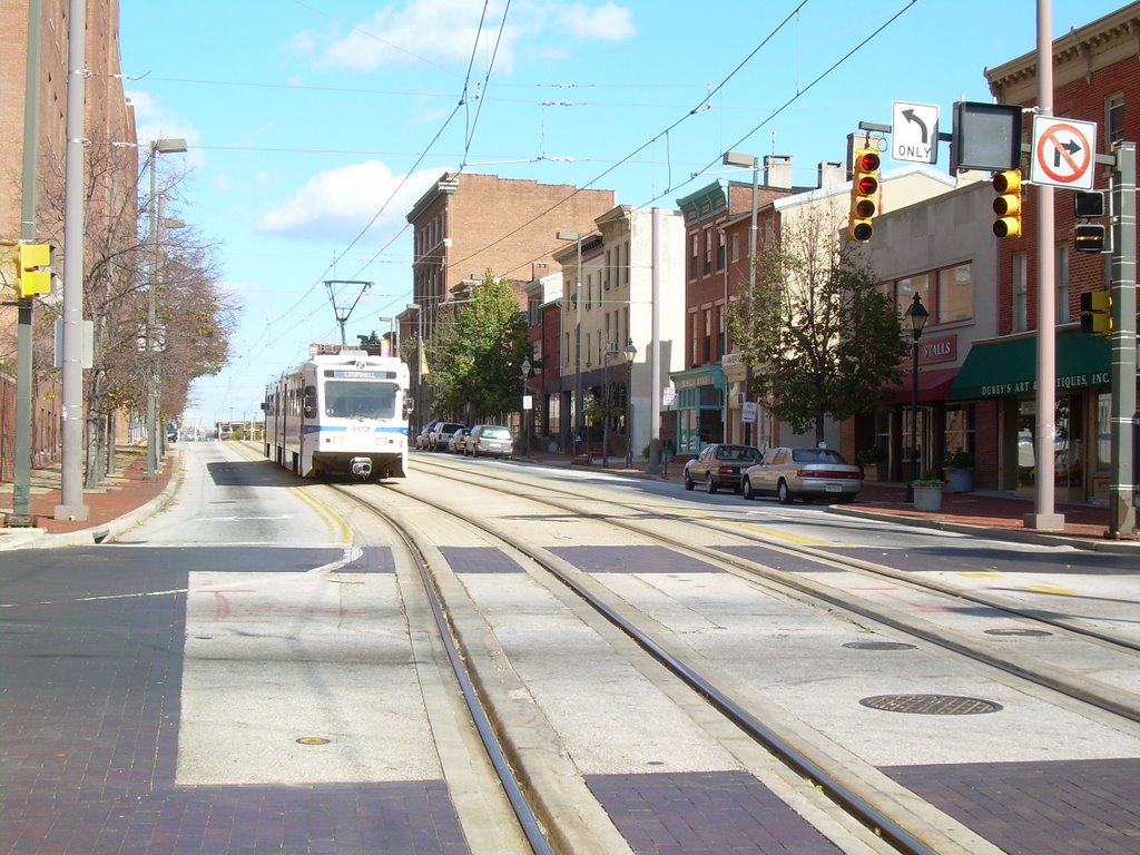
The above photo shows light rail on Howard Street looking north from Madison in the Antique Row district. This illustrates how NOT to provide regional rail transit. From the neighborhood perspective, the biggest and most obvious problem is that parking has been totally banned from the west side of the street (to the left). Merchants in areas like Antique Row and Fells Point rely heavily on street parking for their customers.
Another problem here is that the closest light rail station is two blocks away. Regional rail can only perform properly if stations stops are spaced at least a few blocks apart, and activity will not be attracted to transit if it is not oriented to these stations. Moreover, on Howard Street, much of the parking has been wiped out on all blocks, but in Fells Point, the blocks with stations would be the ones that have their parking eliminated.
On Howard Street, the light rail runs painfully slow. But in Fells Point, it would be even slower, because the streets are narrower and there would be no way to keep the very heavy traffic off of the tracks, and since three car trains would take up an entire block, there would be no place else for the traffic to go.
Light rail is supposed to evoke fond memories of streetcars, but that is where the similarity ends. It is streetcars rather than light rail that would be at home on the streets of Fells Point. Unlike light rail, streetcars require stations that are only slightly longer than bus stops, so the lost parking would be negligible, even if stops were more frequent. Light rail is also intended to serve longer trips, such as Hunt Valley to the airport or Social Security to Canton, so travel speed is of the utmost importance. That is why light rail is out of place on slow downtown streets, whether in Antique Row or Fells Point.
Light Rail transit is supposed to transform the places it goes through, but on Howard Street or Fells Point, the transformation can only be for the worse.

The photo above shows the corridor where regional transit should be located in East Baltimore: As an extension of the existing Green Line Metro along existing rail rights-of-way for Amtrak just north of Eager Street and an unused Conrail branch just east of Haven Street.
Unlike the Red Line culture clash in Fells Point, fresh opportunities would be created at station areas along an east Green Line. They include the following:

BIOTECH PARK - This photo, looking east along Eager Street from Washington Street to Broadway, shows what a radical change is now taking place just north and east of Hopkins Hospital, where many blocks of new houses and employment centers are about to be built. The Metro subway currently ends right under the portion of Broadway shown in the background here. Now is the time to plan for a Metro extension that would proceed under this section of Eager Street and rise to the surface in the Amtrak corridor just a block to the east. A station could be incorporated into the portal where the Green Line would emerge from underground, thus making it much easier to build, secure, and assimilate into the community.

BEREA/MADISON PARK - Further east along Eager Street, the Amtrak corridor is lined with marginal and abandoned buildings and vacant lots that are ripe for redevelopment as central elements in the effort to expand the redevelopment momentum created by the Biotech Park. The City has already begun efforts to acquire property for redevelopment, both here and to the north near the American Brewery.

This view provides an overview looking west from Edison Highway toward the Hopkins Hospital skyline. The Amtrak tracks are under the power poles on the right. The Metro extension would be just left of the Amtrak tracks under the large trees.

EDISON/MONUMENT - This huge tract adjacent to the Amtrak tracks would be a perfect location for a comprehensive transportation hub, serving both a Metro Station and a MARC Commuter Rail Station, as well as bus transfers and parking. This will facilitate easy connections between thousands of daily bus and rail trips between Cecil, Harford and Baltimore Counties, Downtown Baltimore, and all the way to Washington D.C. It would thus be a vital link to the State's strategy for accommodating the thousands of new federal and spin-off jobs for the expansion at Aberdeen, Fort Meade and in the DC metropolitan area. This is crucial to creating a true REGIONAL transit system and diverting traffic overload from I-95 as well as the surface streets of East Baltimore.
Additional development to support the transit line and/or maintenance facilities may also be provided, including a replacement facility to allow redevelopment of the MTA bus yard on Oldham Street, which is the critical link between Greektown and Bayview for the continued expansion of housing and health-related jobs.

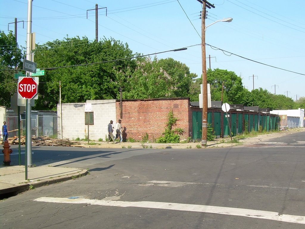
The Southeast Metro Extension would diverge from the Amtrak right of way at Haven and Monument Streets, and then proceed southward along an unused rail spur owned by Norfolk Southern which begins at the two bridges shown here over Haven (to the left) and over Monument Street (to the right.) Amtrak is on separate tracks just behind these two bridges. A spur eastward to Bayview and beyond could be easily built from this point.

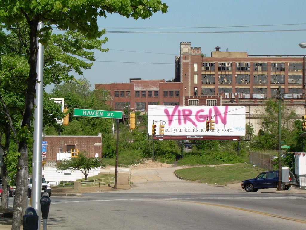
HIGHLANDTOWN/GREEKTOWN - The Green Line extension would swing southward from the Amtrak corridor on an unused rail branch just east of Haven Street. The station location shown here is at Eastern Avenue in Downtown Highlandtown, which is the past and future central hub of southeast Baltimore (NOT along the waterfront where development is virtually all done). The huge vacant Crown Building is shown in the background, and represents the vast redevelopment potential of this area, extending into Greektown and Bayview to the east.

BREWERS HILL - Streuver Brothers is already doing much to redevelop this area, including the Natty Boh Building and vicinity, but that is just the tip of the iceberg. The transit line would occupy the green swath to the right of the photo above taken just south of O'Donnell Street, surrounded on both sides by new development opportunities.


CANTON CROSSING - The transit line would terminate at the Ed Hale waterfront complex, near the intersection of Boston and Conkling Streets. The high rise First Mariner Bank Building shown is just the first phase in creating a new urban center to extend development beyond the waterfront toward the east.