October 8, 2022

"STOP THE ROAD": Ev Paull's epic story of highway battles from the 1940s to 80s with one still raging on

 Evans Paull's great new book, "Stop the Road" is a clear, detailed and gripping account of Baltimore's expressway battles from the 1940s to the 1980s. Built or not, these expressway plans had a profound effect on what the city looks like today.

"Highway to Nowhere" wall adjacent to Franklin Street houses

Highways and the threats of highways shape everything around them. They motivate people. They move people... literally. "Stop the Road" delves into all this and the results can still be seen in Baltimore over four decades after the last highway bulldozer of 1979.

Among all the various highway proposals described in the book are some that would have prevented the Inner Harbor. Others would have prevented Fells Point, Canton or Federal Hill as we now know them. Even Mount Vernon Place and its Washington Monument rubbed up against a proposed expressway plan. But ultimately, all of these vital Baltimore areas survived and later flourished due to victories in hard fought road battles by ordinary people who loved their neighborhoods.

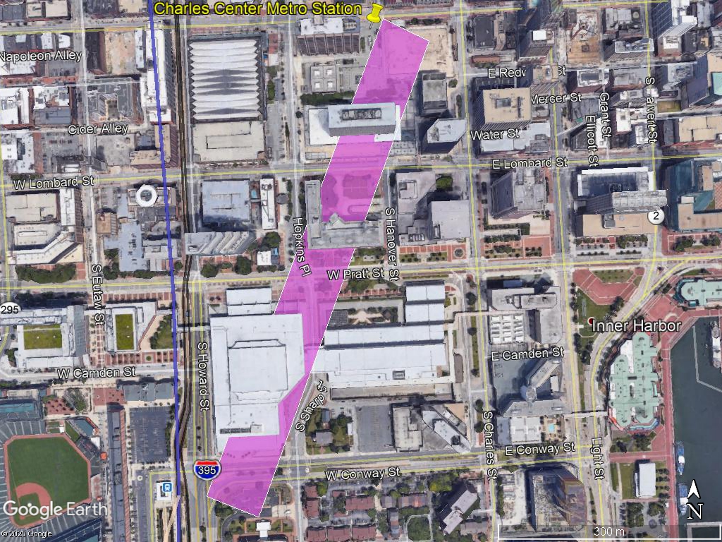
These victories stand in stark contrast to the lone isolated expressway segment in inner West Baltimore where the brave and tireless road warriors lost and the road planners won - Interstate 170, later dubbed the "Highway to Nowhere". Evans Paull explains this with astonishing historic background in vivid blow-by-blow detail.

"Highway to Nowhere" looking east with rail transit right-of-way in the median strip

The "Highway to Nowhere" was built because Mayor McKeldin signed its condemnation ordinance in 1967, which became a self-fulfilling prophesy of deterioration and destruction. Soon after there was virtually nothing left to save. The immediate motivation for this was "slum clearance", even though before the expressway plan, the corridor was a flourishing African-American community on what was a major part of the only small slice of the city's real estate which was open to its residents.

The large amount of up-front federal highway money that was spent for the highway's planning, engineering and demolition created another problem. A "hard and fast" deadline of June 1973 was imposed on getting construction started, constituting a threat that the federal government would demand repayment if the project was cancelled. Since William Donald Schaefer, mayor at the time, was frustrated over the lack of progress on the other segments of his expressway system, he took it out on West Baltimore and thus gave the order to proceed with the "Highway to Nowhere". Mayor Schaefer's reasoning was apparently that if he couldn't get this piece under construction, how could he ever get the rest of the system built?

Schaefer was trapped by his own hype. He promised that Baltimore's expressway system would provide a great economic lift to the city. So it's ironic that the expressway segments which were NOT built became the famous symbols for the so-called Baltimore Renaissance. Meanwhile, the "Highway to Nowhere" has produced absolutely nothing for its surrounding neighborhoods. Not a single new development of any size has occurred in the highway's Franklin-Mulberry corridor since its completion in 1979.

Abandoned housing on Harlem Avenue near "Highway to Nowhere"

Once it was built, the next promise was to build a large platform cap over the highway to provide sites for new development. But Paull cited community activist Esther Redd's reaction, "They're still trying to dupe us." It turns out she was right. The land created by such a platform cap would not in any way approach the value that would be necessary for such a cap to make any sense. It would be pointless to build an expensive cap to create developable land when the adjacent neighborhoods were increasingly generating their own vacant lots due to the spreading blight from the highway project.

After that, the next promise was to build a rail transit line in the median of the highway on land reserved for it in the design. For the first twenty years after the highway was completed, this was just another pipe dream, until 1999 when the Red Line was first proposed as part of a new regional rail transit plan.

If anything, however, the fifteen year Red Line planning effort prolonged the useless highway's life even more, since it encased the transit line. To the current day, there has still never been an official proposal to demolish the highway and return the Franklin-Mulberry corridor to its adjacent communities.

MTA rendering of proposed Harlem Park Red line Station in median of "Highway to Nowhere"

So even now, the "Highway to Nowhere" continues to haunt us

The 2015 cancellation of the Red Line by Governor Hogan is the last planning event of the "Highway to Nowhere" saga to be covered in Paull's book. But the Red Line cancellation had practically nothing to do with the highway. The Red Line was cancelled because about half or more of its estimated $3 billion price tag (most recently $3.8 billion) was devoted to its downtown tunnel that didn't even connect to any of the existing rail transit system. Just as with the expressway system, the Red Line as a whole was a money pit, but only crumbs were allocated to West Baltimore.

It's also interesting that even while Red Line planning was still proceeding circa 2008, the highway's original development platform cap concept was revived in the administration of Mayor Sheila Dixon. A new catchphrase was even coined: the "Highway to Somewhere". That catchphrase literally meant that the two mile highway could be made more useful if it went to "somewhere" rather than "nowhere". But the platform was as impractical in 2008 as it was four decades before when first proposed. Instead, just as during the original road war, the proposed cap seemed to be more of a ploy to try to win community support for a mega-dollar transportation project than something that made intrinsic sense. 

So planning still continues to the present day. Amtrak is now building a totally new West Baltimore MARC Station at the west end of the highway as part of its new Frederick Douglass West Baltimore tunnel project to be completed in 2031. This brand new station will offer the opportunity to provide the best, fastest and most convenient rail service between Baltimore and Washington and serve as the west anchor of the corridor.

This year, the state also just completed the first phase of its latest East-West Corridor Transit Study. This brings Franklin-Mulberry transit planning full circle. One of the identified options in the current study is a heavy rail line that bears an uncanny resemblance to the 1968 plan that would spur off the existing Lexington Market Metro Station, which was completed in 1982.

But there are big differences between what we knew then and what we know now. By 2022, we have confidently demonstrated that the "Highway to Nowhere" is a failure. About a decade ago, the entire highway was closed for about six months to enable the demolition of its west retaining wall at Pulaski Street for an expansion of the MARC Station parking lot and for a future Red Line. Increased congestion did not happen in the corridor. This was easily predictable because all the traffic has always had to exit the brief highway west of Pulaski Street anyway.

We also know that transit is as important as ever to the future of the corridor, but this needs to include a mix of local, regional and inter-regional travel. Most significantly, West Baltimore needs to take advantage of its proximity to the Washington Metropolitan area as an essential future asset, including not just DC but also its suburbs with new MARC linkages to the upcoming Purple Line to New Carrollton and to the Amazon HQ2 in Northern Virginia. This is why it needs an absolutely accessible first class flagship MARC station instead of the cobbled together setup with grossly undersized platforms and no ADA access that's there now.

We also know that the Red Line as planned from 1999 to 2015 had serious flaws, and that a faster and higher capacity heavy rail line as conceived way back in the late 1960s would be a far more flexible solution. It can now be built as a spur off the existing Metro system that already extends 16 miles from Hopkins Hospital to Owings Mills and can be efficiently and affordably extended in an incremental manner by as little as two or more miles at a time, eastward to Bayview, Dundalk, Sparrows Point and White Marsh and westward to Edmondson Village and Woodlawn.

We also know that getting rid of the highway would open up far more opportunities for transit oriented development and other amenities which can be developed in no other way, particularly in a light rail line encased in a highway median strip.

We also know how to make economic growth happen without displacement of current residents, from experience elsewhere, most notably in the Station North neighborhood near Penn Station.

So the saga is not yet completed, and a new chapter of economic growth and prosperity is just beginning. The "Highway to Nowhere" somehow managed to survive the Road Wars as documented in Evans Paull's book, when the highways through all the other communities did not. But it should not survive any longer.

April 30, 2021

Downtown Loop revival could kickstart rail system

Briefly in the late 1990s, the region's hottest transit proposal was to build a light rail loop surrounding downtown. It even garnered a front page top-of-the-fold full-speed-ahead headline in The Sun. This happened amid growing concerns that the system's downtown segment on Howard Street which opened in 1992 was too far west to serve all downtown adequately. Fast forwarding to the present, downtown has indeed pushed eastward toward Harbor East and away from Howard Street, which light rail has failed to revive. So it's time to revisit this concept. Despite inherent problems, it could still work and get the rail transit system moving.

A possible downtown rail plan - A light rail spur from Penn Station southeastward to beyond Shot Tower (in blue) and an Inner Harbor streetcar line (in orange) would constitute a loop. The Orange streetcar line could be extended eastward and westward and augmented by a Purple streetcar line to Carroll and Montgomery Park. A Red Line west of Lexington Market and a Green Line east of Hopkins Hospital are also shown. Existing rail lines are shown as outlines.

The full loop would use the existing Howard Street light rail line on the west, the Jones Falls Expressway / President Street corridor to the east (both in blue on the above map) and Pratt Street to the south (shown in orange on the map).

The northern stub for such a loop was even completed in 1997 to Penn Station. It was always half-hearted, as it dead-ends right into a structural column for the St. Paul Street bridge directly above it, which would have to be adjusted somehow if the loop was ever extended beyond this stub.

The Penn Station stub has proven to be an almost totally useless part of the system. Various operating patterns have been tried over the years to try to make it work, and it has been completely shut down since last year, attributed in response to the Covid pandemic. Aside from some minor confusion, riders have hardly missed it.

Over the years, the region's entire light rail system has been a case of "symbolic transit". The big thirty mile line looks great on paper - from the big Hunt Valley mall and business park on the north to BWI-Marshall Airport and Glen Burnie on the south, with downtown and the Camden Yards stadiums in the middle. There have also been numerous "transit oriented development" projects and proposals, almost all major failures.

Amid all this, the main justification for light rail to Penn Station has been simply to be able to say that light rail serves Penn Station.

Circular reasoning for a light rail loop


The main problem with any kind of transit loop is that people don't want to travel in loops. It is basic geometry that the most direct travel path from any Point A to B is a straight line. This is compounded by the fact that the existing west edge of a downtown loop on Howard Street is the slowest portion of the entire system. While this is bad, and perhaps even inexcusable, it is still only a small part of the whole thirty mile system, and so the problem can readily be overstated.

But a loop would magnify the slowness problem. The east portion would be reasonably quick since it would mostly be next to or underneath the Jones Falls Expressway, but the south and southeast portions would be along Pratt and President Streets and would likely be as slow or slower than Howard Street. Moreover, much of the slowness is simply due to the need to handle passengers getting on and off at numerous stops, and is thus unavoidable.

Still, the most unavoidable element is the loop itself. Anyone riding on at least two sides of the loop would be going out of their way - not in a straight line. The country's most famous transit loop - The Chicago "L" Loop - transcends this by being fairly tight. Many riders can get off on one side of the loop and board for the return trip on the other side of the loop. Detroit's downtown people mover is also fairly tight but is only a single one-way track which exacerbates this problem. You cannot simply reverse your direction for the return trip. There is only one way to go.

In contrast, Miami's Metro-mover is a much larger loop, but it has two tracks to run both ways. What's more, the vehicles are operated so that most of them do not use the entire loop, but instead use the loop to spur off to other portions of the system. The loop does not function primarily as a loop, except to enable riders to transfer from one train to another to use different portions of it.

All these systems are also elevated. Baltimore's surface loop would be slower, but that's merely a challenge to make its other aspects work better.

None of these issues were ever really addressed in the Baltimore process back in the 1990s. Instead, despite the  hype, the inherent limitations of the loop format were finally recognized, and the whole loop idea was soon abandoned as the comprehensive regional rail transit study began in 1999.

The 1999 study then led to the 2002 comprehensive rail plan, including the Red Line which then took on a life of its own until finally dying in 2015, taking the rest of the plan down with it. The 2002 plan had circumvented the whole question of downtown distribution by creating redundancy instead, emulating the DC Metro or even the New York subway system. The proposed Red Line paralleled the existing Metro subway downtown within only two blocks, while a proposed Yellow Line paralleled the existing central light rail line all the way from Timonium outside the Beltway to downtown, mostly tunneling underneath streets like York Road and St. Paul Street. All this was highly extravagant, to say the least.

So now in 2021, the process remains stalled at square one. Downtown looks very different from how it did in 1992. To the west, Howard Street is desolate. To the east, a "new downtown" Harbor East has sprung up. So the need for downtown distribution is more important than ever.

To loop or not to loop?

With the eastward downtown shift, the case for a light rail spur from the north leg of the line, through Penn Station and then along the Jones Falls corridor to Harbor East is now stronger than ever. Of course, a spur is not a loop, and the case for a full loop is not as strong, as discussed above.

But is the case for a spur strong enough? And then what happens to the loop concept?

The case for building the spur probably boils down to whether the central light rail line as a whole is important enough to matter, particularly to the north of downtown. Right now, it probably isn't. The city's most recent significant development project in the corridor is "The Woodberry" apartment complex on Cold Spring Lane, and this is hardly even oriented to the light rail station. Just prior to that, a key parcel just north was given over to an electric substation, so the overall net potential has been decreased, not increased.

The 2002 rail plan basically declared the existing north leg of the central light rail line a flop by proposing another line (the Yellow Line) in the nearby adjacent corridor, and things have only gotten worse since then.

Of course, this should be re-evaluated if other major development projects happen. But will they? The track record in Old Town is bad, consisting only of empty promises over the years. Most people consider MagLev high speed rail a long shot, so a Shot Tower/ Old Town MagLev Station as proposed here would be an even longer shot.

So that brings us full circle (so to speak) back to the loop. The best way to make a loop work, particularly a large loop like this one, is to make it not function like a loop. This is the lesson from the Metro-mover in Miami. Instead, make it a series of loop segments that can stand on their own.

If an east spur is built, the loop's missing link would be the south segment along Pratt Street and the Inner Harbor. This would also be the tightest and slowest segment. It would be particularly slow and congestion-inducing if it included turns to link it to the existing light rail line at Pratt Street and the proposed spur at President Street to create the loop. Trains on the existing straight segment of the light rail line can move simultaneously with the parallel Howard Street traffic, but turning trains would require all other traffic in the intersection to stop, which would be a recipe for gridlock.

So the best way to design a Pratt Street segment would be to design it for east-west streetcars, not light rail trains. The east end of this streetcar line could be the upcoming Perkins Point project (as described here) or anywhere between Harbor East and Canton Crossing. The west end of this streetcar line could be Carroll Park (as described below and here) or the Franklin-Mulberry corridor, where it could join a new version of the Red Line (as described here). Or a combination of these.

Possible streetcar line to Carroll Park and Montgomery Park via the historic B&O Railroad "First Mile" corridor would unify and redevelop the area.


A real rail system that merely looks like a loop


In sum, what we have here is simply a series of candidate rail transit projects, none of which have extravagant price tags and all of which are eminently do-able. They are therefore all opportunities to kick-start the region's moribund rail transit ambitions. In no particular order, they are:

1. Central light rail spur from Penn Station to Harbor East.

2. East streetcar line from the Inner Harbor (e.g. Howard/Pratt Street) to Harbor East, Perkins Point, Fells Point and/or Canton.

3. West streetcar line from the Inner Harbor to Edmondson Village via the "Highway to Nowhere", MLK Boulevard and Pratt Street. The portion of this line on the former Red Line alignment would use the previous Red Line design to ultimately accommodate multi-car light rail trains instead of just streetcars.

4. Southwest streetcar line from Carroll Park to the Inner Harbor via the "First Mile" corridor and Pratt Street.

If the light rail spur (#1) is built with any of these three streetcar lines, then voila! The result would be a downtown loop.

But any and all of these should be driven by actual development plans, not grandiose prayers. Real transit-oriented development has been the most missing element of all the rail that has been built in this city so far, so that must not happen again. Real development plans must come first.

Back when the Red line was being debated, the city administration's most cited purpose for the project was to reduce traffic congestion. That was wrong then and it is even more wrong now. The rail system must spur development. The Red Line had two major failures in this regard. The first was the city's refusal to come up with a real development plan for the "Highway to Nowhere" corridor, except its tired old promise since the late 1960s to someday build a "cap" so that the highway could be preserved underneath any new development on top. The second was when Harbor East developer John Paterakis actually kicked the Red Line station away from that area's greatest future growth corridor, Central Avenue.

Besides feasibility and lower cost, the primary advantage of proposing small incremental rail transit projects such as these, instead of multi-billion dollar mega-projects is that they can be used strategically to promote such development. That is the main thing Baltimore needs to get from rail transit.

February 1, 2021

Three city MagLev stations that would actually work

Thanks to the botched Draft Environmental Impact Study report which was recently released, it's back to the drawing board to find a workable Baltimore Magnetic Levitation train station. The international MagLev team can be excused for its failure, even if it was intended, but our own Maryland Department of Transportation's name is right there on the cover page along with the US DOT, so they need to go back and get busy re-examining options. Based on the station standards in the DEIS, here are three that are far more reasonable than their own options, Cherry Hill or Camden Yards.

Patapsco Hill MagLev Station site - showing a range of possible angles to conform to any underground  MagLev alignment. The central light rail line which would provide regional connections is on the left (west) edge of the yellow box.

It's all about the angles

This failure can't be blamed on the specialized requirements of cutting edge MagLev technology. Yes, a very smooth gentle alignment is necessary to accommodate 300 mph speeds, but that's just a matter of geometry, not technology. Creating such a smooth high speed alignment simply boils down to the angle to which each station is oriented. And the 1300 foot long trains also require stations to be of that same length, or more depending on the construction requirements for digging the tunnel at a given site.

Here is how the Draft EIS report describes this challenge and the resultant need to demolish ALL buildings around their proposed station at Camden Yards:

(Chapter 4, Affected Environment, page 9/13)

"The Camden Yards station is more challenging because the project orientation and alignment cannot match the existing Baltimore street grid. To access the station area, all buildings above the proposed station for a distance of 1,970 linear feet will have to be demolished to create open space for the top-down construction activity. It is not feasible to build a station in this location with the tunnel boring method because of the width required for a station, the presence of underground utilities and the presence of adjacent building and roadway support structures."

So here are three other station locations that can work in this context. Two are situated so that they can be oriented to a wide range of angles, depending on what becomes the optimum alignment for high speed non-stop through trains between Washington, DC and New York City. The third option is a relatively minor tweak of the Camden Yards station proposed in the Draft EIS plan, in order to minimize its damage to downtown, which would otherwise be severe and unacceptable, including demolition of the Bank of America tower, Garmatz Federal Building, historic Otterbein Church and much of the Convention Center and Federal Reserve Bank complex.

1 - Patapsco Hill Station


The graphic above shows a wide range of possible angles and locations for this station option just south of Patapsco Avenue. All of these options can be feasibly excavated and connected to the central light rail line (shown in blue on the left/west edge of the yellow box) without demolition of any significant buildings or permanently losing any Southwest Park facilities. The background for this plan was provided in this previous blog post

The two potential station boxes shown are both in excess of 4300 feet long, well over twice that of the proposed Camden Yards Station and far longer than the required 1300 foot MagLev train platforms. So the actual project footprint would be much smaller than the two that are shown, anywhere in the range between them which ensures full flexibility.

Shot Tower / Old Town Station site - Under Fayette Street at the bottom (south - brown box) has the least tilt toward the northeast, while extending it through the Post Office site (purple box) and/or under Gay Street (yellow box) would increase the angle.

2 - Shot Tower / Old Town Station


Three alternative station boxes for this site are shown in the graphic above. All would originate in the vicinity of the Jones Falls Expressway (I-83) corridor adjacent to downtown, where they would be served by the Shot Tower Metro Station and a possible extension of the light rail line from Penn Station that was part of the proposed regional rail system from the mid 1970s to late 1990s. More background is contained in this blog post.

Ironically, this light rail extension plan was abandoned just as the building boom started in nearby Harbor East, while the light rail line which was built in the 1990s along Howard Street on the west side of downtown was met by a major building bust in that corridor.

The police headquarters at the southwest (lower) end of the brown and purple boxes is slated to be vacated by the Police Department, because of the poor condition of the buildings caused by deferred maintenance. The Central Post Office would most likely also be demolished as part of this plan, if for no other reason but that it would be a valuable site for MagLev construction staging and future transit oriented development, but it could be saved if necessary.

The three proposed station location boxes are 2100 to 2600 feet in length, more than enough for construction needs.

Charles Center Station site - this is a variant on the Camden Yards station site proposed in the Draft EIS but shifted slightly to the west and north so as to rework Charles Center and connect it to its Metro Station.

3 - Charles Center Station


This proposed station mostly overlaps the Camden Yards station which has already been found to be feasible in the Draft EIS, but this revision extends slightly to the north and west, rather than the east and south. It therefore saves the Bank of America Building, the historic Otterbein Church and the Federal Reserve Bank. However, it still requires the demolition of the Garmatz Federal Building and a large portion of the Convention Center. It also requires taking the Fallon Federal Building just north of Lombard Street, a somewhat older building that is very poorly situated as a wall which divides the south end of Charles Center from the Inner Harbor. This causes great problems for pedestrian circulation through the plazas of Charles Center. Demolition of the Fallon Building would be a major net enhancement to its surrounding area.

This station box would also extend northward to the Charles Center Metro Station though the empty open pit where the Mechanic Theater was demolished. Combined with the elimination of the Fallon Building, this would open up great opportunities for new urban attractions in Charles Center. More background is contained in this blog post.

This plan could also be combined with a previous city plan to demolish and replace much of the Convention Center with varied uses, including a new arena to replace the adjacent obsolete facility just to the west.

The station box would be up to about 2200 feet in length, which is more than for the currently proposed plan. Access to the Camden MARC and light rail station would be about the same as the current plan.

In sum, this "tweak" would impact portions of downtown that need to be impacted, most notably in south Charles Center, and save the buildings that ought to be saved.

That goal also should apply to any Baltimore MagLev station plan, which would be a major public face for how this city would present and position itself to the rest of the country and particularly to the Northeast Corridor between DC and New York. Like Charles Center, the light rail corridor and the Shot Tower/Old Town corridor, all greatly in need of the kind of development push which the MagLev project would provide. 

The city cannot afford to blow this opportunity. We must count on the Maryland Department of Transportation to be Baltimore's advocate in the MagLev planning process.

January 20, 2021

Downtown Maglev station needs to move back to Phase 2

The Draft Environmental Impact Statement has just been released for the 300 mph, $10-billion-plus Magnetic Levitation train system from Washington to Baltimore, and wow, have they made a shambles of the plans for the Baltimore Station! The only rational thing that can be done now is to end the project's Phase One at BWI Marshall Airport and save Baltimore for the future, when clearer heads may prevail.

Proposed Downtown Maglev station (in yellow) would wipe out two large modern Pratt Street buildings, much of the Convention Center, the historic Otterbein Church and the Federal Reserve Bank. 

Downtown station alternative


The proposed plan for the station underneath Downtown Baltimore is shown above. It calls for the demolition of the Garmatz Federal Building, 17-story Bank of America building, historic Otterbein Church, the Federal Reserve Bank complex and much of the Convention Center in order to create a huge hole in the ground for the underground station. The hole covers such an extensive area because the planners insist that the station must be built on an angle that is not aligned with the north-south downtown street grid. This angle will enable the line to be pointed to a future extension northeastward toward Philadelphia and New York. Since Maglev is built for such quick acceleration and speed, its curves must be smooth and seldom.

The trains will also be long, which calls for large stations. Just recently, they adjusted their design specs to expand the trains from 12 to 16 cars totaling 1300 feet in length. This would accommodate larger seats and even restrooms. Apparently, the designers are preparing for a future of Maglev trains criss-crossing the entire country and even competing with airlines for lengthy trips. So Maglev trains and stations would be almost three times as long as the Baltimore Metro, over four times as long as light rail and a whopping six and a half times as long as the defunct Red Line.

Alternate Cherry Hill Maglev elevated station and site for 5000 parking spaces

Cherry Hill station alternative


If all that downtown destruction seems crazy, the planners have also developed an alternate plan for a station in Cherry Hill. This one is elevated instead of underground, and requires only the demolition of large low-rise warehouses and commercial space to provide 5000 decked parking spaces. According to the planners, this station would save an estimated $1.18 billion compared to the downtown plan. Saving that much money and demolition is sufficient for the planners to now conclude that putting the station under downtown just is not worth it. The project sponsor, an international corporate consortium, has recommended that the Cherry Hill station should be built instead of the Downtown station.
 
The biggest challenge for the Cherry Hill option is that raising the tracks up out of the ground to an elevated station requires very long grades. To the south of the Cherry Hill station, Patapsco Avenue and Annapolis Road would need to be rebuilt and raised approximately twenty feet so that Maglev can be accommodated in a trench underneath. To the north of the station between Westport and its waterfront, the tracks would be elevated on a 62 foot high bridge above Kloman Street.

Plan and profile drawings for elevated Westport extension north of the proposed Cherry Hill station. The huge I-95/395 elevated interchange is shown on the plan view photo at top-right but is only labeled but not shown on the profile drawing underneath

But regardless of how that might impact the Westport neighborhood and its recently announced new waterfront development plan, the most insurmountable problem lies just north of that point where Maglev would confront Interstate 95. Shown above is the plan and profile sheet for the Maglev line adjacent to Westport. The profile diagram shows the vehicle guideway at an elevation of 22.96 meters (75 feet), above ground that is about 4 meters (13 feet) above sea level. Interstate 95 is on the right end of this diagram, but its elevation profile is conveniently not shown. So how would the elevated Maglev line get past I-95, whose elevation is about 54 feet for the thru lanes and 68 feet for the adjacent northbound off-ramp flyover to I-395? And how could Maglev then dive back down from this height into the earth north of I-95 in order to get down into a tunnel under downtown?

The plan and profile sheets don't show any of this. In contrast to the meticulous attention which the plans devote to the overall alignment of the Downtown station alternative, the Cherry Hill station alternative leads to nothing except futility. This looks painfully like a fatal flaw.

Going back to BWI and forward toward the northeast


The differences between the Downtown and Cherry Hill station plans could not be more stark. Spatially, downtown is and always has been the heart, the centerpiece and the focal point of the Baltimore area. But physically, the contrast of the plans' impacts is just the opposite. The Downtown alternative calls for massive destruction and digging a huge crater, tearing the heart apart.

Fortunately, there exists a common means of identifying feasible station alternatives. That would be to define the entire range of possible track alignments northeastward through the city. But that task has thus far been a void in the planning process.

Instead, the process has had a very counterproductive bias to focus on possible station sites in south Baltimore and south downtown. But the best station sites are most likely on the opposite side of downtown toward the northeast. These sites would require a longer and thus more expensive Maglev line in the short run, but the total project distance to Philly and New York is fixed. 

We thus do not know the entire range of feasible Baltimore station sites. For a project of this magnitude, this is a conspicuous failure. The report even laments the alignment of Baltimore's downtown street grid and the lack of streets on angles, in contrast to Washington, where angled New York Avenue was selected for the station, which resulted in far less digging and destruction. But Baltimore does indeed have such angular streets, most notably Fayette and Gay Streets toward Oldtown and the northeast. (See blog post on Post Office Maglev station). Those streets and areas must be studied, even if that means starting over.

In the meantime, the Maglev project can keep going with BWI Marshall Airport as an interim end of the line from Washington, DC. This station location may seem limited, but it has great potential as a true focal point for Baltimore's south and southwest suburbs. New Maglev oriented development could be planned around the BWI stations to create the same kind of urban center that Crystal City provides to support Reagan National Airport in Arlington. The light rail line from Downtown Baltimore to BWI could be given major upgrades such as express service, track and signal improvements, and new transit oriented development at key stations to strengthen the connections and take maximum advantage of Maglev.

Probably the best thing about the Maglev project is its showcase of the advanced Japanese technology. The project sponsors have a tremendous incentive to present it well, to sell it to the rest of the nation and even the world. Maryland and Baltimore will be where this can happen, so we need to take maximum advantage of it.

So let's give the go-ahead for the Maglev consortium to build a smaller and less expensive project where it can be done right, from Washington to BWI Airport. And then let's immediately begin work on Phase Two to a Baltimore station that will work for us and for everyone else. Comments on the plans can be submitted to MDOT until April 22.

October 15, 2020

How to save Harborplace: Make it a neighborhood

From its opening in 1980, Harborplace was an international success story. So what went wrong? Harborplace's big strength was also its big weakness. It was built by a suburban developer, James Rouse, as a little piece of suburbia in the center of the city where suburbanites and visitors would feel safe experiencing the city. But since then, neighborhoods in the real city have emerged to fulfill this role in a far more authentic way. Now it's time for Harborplace to emulate the neighborhoods.

Pratt Street Pavilion of Harborplace - Its pedestrian bridge over Pratt Street should be extended over South Street to a new high rise/low rise residential complex (shown in gold).


Finding the right tenant and land use mix


Hopefully, retail gurus are already busy trying to identify a tenant mix that can fill Harborplace's mostly empty space - a civic embarrassment where once was a "festival marketplace" that made international news for success and innovation. Hopefully, they're looking at its retail forerunners such as Ghirardelli Square in San Francisco, Faneuil Hall in Boston and the Torpedo Factory in Alexandria, as well as countless subsequent imitators, some of which have since gone defunct, to figure out what will work in the 2020s and what won't.

But as much as retail has changed in the forty years since 1980 when Harborplace was new, Baltimore has changed even more. Back then, there wasn't an important distinction between being innovative and being fake. The Inner Harbor was supposed to be a world apart from the rest of the city. This wasn't really just a calculated way to build it. It was the only way to build it and it was the right site to build it on.

The biggest change in those forty years affecting Harborplace as a place was the emergence of real neighborhoods that served the same role that Harborplace originally served. The most successful of these neighborhoods have been Federal Hill, Fells Point, Canton, Hampden and finally, Harbor East, which has been touted as the "new downtown".

Harborplace then responded by going for national chain retail and restaurants, which might have been OK except the city then also added even more retail space along Pratt Street, Market Place and in the Power Plant, which in the long run has all been impossible to keep filled. Then they planned even more retail space in the Transamerica plaza (formerly USF&G) and the Convention Center, plans which could hardly have been more wrong for the time.

The main advantage of the neighborhoods is that they have been able to experience their growth in a mostly organic way, without relying on adhering to master plans that leave little margin for error. The amount of retail and other commercial space in these neighborhoods, relative to residential space, has been open to constant adjustment and thus has been resistant to precipitous failures. Of course, there have been failures, notably the Hollins Market area, but these are mostly due to external forces.

But downtown and the Inner Harbor have recently had one very bright spot - the residential market has been booming. People like the idea of living downtown, even if downtown has not reacted very favorably to them. This mismatch is partly due to the fact that office and retail space still dominate even though it is underutilized.

Moreover, while planners have been coming up with huge "game changer" plans like a mega-arena Convention Center, a grand Pratt Street boulevard and a pedestrian drawbridge across the Inner Harbor, what they have ended up with are very weak half-hearted plans like tearing down the McKeldin Fountain to plant more grass, tweaking Light Street's excessive ten lane width instead of actually narrowing it and providing bike paths that are really just sidewalks. There is a huge disconnect between their vast ambitions and their results.

Downtown and the Inner Harbor need large comprehensive plans because there are so many forces and interactions at play. But big plans can translate into a big failures.

So regardless of what direction the city goes regarding the overall functioning of downtown and the Inner Harbor, individual projects need the kind of organic flexibility to respond like the neighborhoods do.

Harborplace must be open to accommodating everything from high powered national chains like H&M and the Cheesecake Factory, all the way down to unique mom 'n' pop shops to artist and craft studios and everything in between. It should attract tourists and it should attract residents. The residents should gawk at the tourists and the tourists should gawk at the residents.

But how do we stimulate these interactions? More residents in the closest possible proximity should be the catalyst.

The key to the proposed new residential complex (in gold) is orienting it to a "Main Street" style linear courtyard that is flexible enough to be anything from fully public to fully private with any mix of uses.
Architect's rendering of the building proposed for the site - a generic mixed-use high rise building which indicates they'll go in any direction the market demand takes them (MCB Real Estate).

How to make Harborplace a neighborhood


So here's a new plan: On the one remaining surface parking lot just across the street from the Harborplace Pratt Street Pavilion which is waiting to be developed, instead of building yet another freestanding office, hotel or residential tower, a complex should be designed and built to emulate a high density neighborhood.

This should include a direct connection from the pedestrian bridge above Pratt Street from Harborplace into a simulated "Main Street" environment that traverses the length of the site up toward Lombard Street. While this space should be designed to evoke a traditional urban "Main Street", flanked by a high and low rise buildings, it should not be locked into any particular functions.

Overhead walkways are currently out of favor with urban designers, but that is mainly due to a lack of commitment to making them work. The above-ground environment needs to focus on its own "ecology", and not simply be some kind of extension of what is below on street level. It needs to be a completely new self-contained environment.

The objective of this space should be to allow adjacent Harborplace to function as much like a neighborhood as desired and necessary. Therefore, flexibility is important. It should also add significant value to the new development. No other residential property in the city has a direct linkage to anything as "iconic" as Harborplace, at the heart of the Inner Harbor.

Such simulated "Main Streets" were already the next iteration of suburban retail design after "festival marketplaces" and shopping malls, and are typified by The Avenue at White Marsh and somewhat more timidly by Canton Crossing.

Residential complexes often have outdoor courtyards, but they are usually very private and not patterned after a very public "Main Street". The Scarlett Place condo complex in the Inner Harbor between Pier 6 and President Street has an above-street courtyard, with a prominent and public looking stairway down to the public Jones Falls promenade and Columbus Piazza. The Scarlett Place courtyard looks great, but is very poorly designed. It is not well oriented to the residential complex itself, so while the design aims for flexibility, what it creates is ambiguity, which is the worst problem for attempting to achieve "defensible space".

Another nearby attempt at an above-street public courtyard is at the Verizon office building at Light and Pratt Street, which predates Harborplace from the 1970s, and has been groping for an identity ever since. It had overhead linkages to both the Convention Center and Harborplace and so was poised to be a very public thru-space, originally even having pretentions to being a Ghirardelli Square style retail complex, but never had the flexibility to find its place. It has now become mostly private, mostly by default.

The new "Main Street" at Harborplace can be designed in a far clearer and more flexible manner. It needs prominent entrances to all buildings. It should be designed to fully support any kind of retail, from resident conveniences to restaurants to artist studios to whatever, or none at all. It should be readily adaptable to being fully private or fully public or anything in between. By being part of a mostly residential complex, this should be achievable.

It's overarching role should simply be to serve Harborplace, particularly to support any kind of new functions and uses that anyone may dream up for the forty year old complex, in the clearest and strongest manner possible, as the entire world of retail continues to be redefined. This new complex will create a reservoir of residents to create a human "real world" identity for whatever happens - which is actually what we want any urban  neighborhood to do.

Birdseye aerial view showing above street-level linkage between Harborplace Pratt Street Pavilion, the Gallery at Harborplace retail/hotel complex (upper left) and the proposed "Main Street" residential complex (in gold, upper center).

Providing new direction for the rest of the Inner Harbor


All this can then set a new tone for the entire Inner Harbor, which despite a stream of egotistical plans, no longer appears to have any direction at all. This problem is most clearly illustrated by the petulant destruction of the McKeldin Fountain, only to be replaced by a new isolated space seemingly designed only to be a campground for the homeless. 

There's also the new replacement for the building on the Constellation Dock, which hardly anyone wanted in the first place. Just a few weeks before the signs said it was scheduled to be completed, they were still in the "site prep" phase and construction had not really even begun. They finally stuck a "1" over the "0" so the the scheduled completion would be "September 2021" instead of "September 2020".

This aimlessness is further typified by the aborted reboot of Harborplace itself several years ago for larger footprint tenants that would have greater direct access from outside the building, particularly direct access from Pratt Street. Retailers hate having front doors on opposite ends of their stores. This hardly ever works, and was made even more impossible here because the Pratt Street frontage of Harborplace still looks and smells like the building's garbage dump. This is truly pathetic.

Part of the problem is Pratt and Light Street themselves. They should be reconfigured to fully accommodate local functions while still handling their very heavy traffic loads. The city's previous plans to make it into a two-way boulevard a la Conway Street predictably appear to be dead, which is good riddance from the standpoints of both traffic and pedestrians.

Fixing the larger Light Street Pavilion of Harborplace will be an even more daunting challenge than fixing the Pratt Street pavilion, but success must be found where it can, before we can spread it around. The recent closure of the cheesy "Ripley's Believe It Or Not" Museum illustrates the problem, but hopefully also creates new opportunities for solutions.

The Inner Harbor's basic problem is that it has just become a stew for anything anybody wants - a bit of this, a bit of that. Instead, the city needs to make it a neighborhood. This puts the onus on the urban designers and architects to design something which will organically allow it to become whatever kind of place the Inner Harbor itself wants to be.

Related Article Links:


February 18, 2020

Five ways candidates should embrace city's future

The same old answers aren't going to work for candidates in the city's upcoming election. So here is a guide to show them how to get beyond the current rhetoric about urban symptoms like crime and corruption to make a real physical difference in the future of Baltimore. Voters can then compare this to what the candidates are promising and decide who to support. Here are five ways Baltimore can turn the corner and embrace the future:
A possible new Circulator Bus non-profit authority district

1 - Replace and expand Charm City Circulator Bus System

The Charm City Circulator bus system is the perfect example of how this city is spending too much of our tax dollars in favor downtown and the privileged neighborhoods, to the detriment of the rest of the city. Moreover, the city does not run the system very well. A state official described the city's system as being in a "death spiral" of reduced service and aging buses. Moreover, it has become part of a crazy quilt of redundancy that competes with existing MTA bus service and a slew of private shuttles run by institutions such as colleges and businesses such as Amazon.

The solution is to create a new organization that will consolidate all of these public and private circulators and shuttles into a new integrated localized system which serves everyone. It would be funded by those who really have "skin in the game" - the same institutions who are now spending money to benefit only a small segment of the transit market. This would then enable the state-run MTA system to focus on areas not served by the shuttles and to strengthen its system of transit transfer hubs, instead of dealing with unfair and destructive competition with free buses.

Read more in this 2015 blog post:  https://baltimoreinnerspace.blogspot.com/2015/10/how-to-sort-out-bus-system-circulator.html

Possible new diverse income housing on the Cherry Hill waterfront

2 - Create mixed-income developments in lower income areas that really work

There's a lot of talk about "Two Baltimores", rich and poor, but investment in mixed-income developments really hasn't worked well in virtually any part of the city.

For many decades, there's been a lot of money thrown at providing low income housing, from the high-rise projects of the 1950s through the huge Sandtown project by the Enterprise Foundation in the 1990s, but the overall result has been that the city has been losing rather than gaining low income housing. Two of the problems in this, bad design and lack of diversity, have since been rectified in more recent mixed-income projects such as Heritage Crossing, Albemarle Square and Center West, but this has not been nearly enough to make them catalysts to stem blight in their surrounding areas.

Albemarle Square, which replaced the Flag House Courts high rises just north of Little Italy and east of downtown, has almost all the ingredients of success - a near ideal location, good design and a mix of low and middle income units, but the adjacent Corned Beef Row and Jonestown areas are now even more vacant and blighted than ever. Major institutions such as the Jewish Museum, National Aquarium and Ronald McDonald House have only helped a little. And this is an area located squarely in the so-called "White L" of affluence and privilege.

The basic problem is that property values in surrounding areas are still too low to justify adequate investment and maintenance. Higher income "residents by choice" still avoid these surrounding areas, creating isolated islands of development. Even moderately higher income people will only live there if it's cheaper than their alternatives. This creates an escalation of subsidies, not only for the low income residents who actually need subsidies, but also for those with higher incomes as well. It has also seriously curtailed the ability to support non-residential uses, particularly strong retail, which is essential to creating viable urban communities and attracting "choice" residents. The result is more disinvestment, not investment.

The solution is to identify and invest in low income areas where major value can actually be added. The north side of Carroll Park adjacent to the Mount Clare neighborhood is a prime example. Carroll Park is magnificent and is next to the world class B&O Railroad Museum and the higher income Union Square neighborhood, but Mount Clare is crumbling from neglect. Another example is next to the even more magnificent Druid Hill Park where Reservoir Hill intersects the Greater Mondawmin neighborhood. The Westport and Cherry Hill waterfronts are other clear examples. None of these are in the so-called "White L".

Gentrification? That's not a significant issue in a city as non-diverse as Baltimore which has lost over a third of its population.

Read more in many articles throughout this blog, such as:
 https://baltimoreinnerspace.blogspot.com/2017/07/green-network-part-1-four-priority_10.html

Possible neighborhood down in the ditch where the "Highway to Nowhere" is now,
leaving room for a revival of the Red Line plan (Marc Szarkowski).

3 - Get rid of the "Highway to Nowhere" once and for all

Why can't the city admit that this useless ill-fated stub of an Interstate Highway is a cancer that must be fully removed from West Baltimore? The charades started in the 1970s before construction even began with visions of "capping it over" to create development lots that would be far more expensive than their dubious value. Then the ill-fated light rail Red Line stuck in its median strip was supposed to add the value, but of course, it never did. Payson Street was extended across the highway through a pair of obnoxious high speed intersections, but that didn't help much, and now there's talking of doing the same with Fremont Avenue.

Now the focus has turned to doing something with the huge abandoned Metro West complex formerly occupied by the Social Security Administration. Even this project has not raised calls to get rid of the highway. The plan still appears to be to keep the highway, but knock down the bridges over MLK Boulevard to simply move all the traffic to the surface intersections. But the problem is not the connections across the highway - it's the highway itself.

Redeveloping Metro West is an important project, but only if it is an opportunity to integrate it with all of West Baltimore, notably Heritage Crossing, Lafayette Square, Harlem Park and Poppleton. The unconflicted connections left by the highway bridges may be the best way to add value to really make the project work. And perhaps moving the much of the State Center office space to Metro West is the way to get it going.

Read more in many articles throughout this blog, such as:
 https://baltimoreinnerspace.blogspot.com/2012/08/the-low-line.html

Historic architecture on Lafayette Square surrounded by squalor that needs to be treasured

4 - Get serious about historic preservation

Baltimore's glorious but often tumultuous history is the main thing that sets it apart from the suburbs and gives us our soul and identity. This is especially so in the African American communities where this history has never been fully told or has even been largely forgotten. The center of this history is Upton, where some residents longingly remember the destroyed Royal Theater, Freedom House and other vestiges of the past, while others are busy plotting to knock down even more of this heritage such as the row of houses where Cab Calloway grew up.

Upton has a proud past and should have everything going for it in the future - a great location, a subway station and distinctive architecture. All it needs is an intelligent historic preservation plan to add to its value. Instead, we get a city that simply wants to knock down the irreplaceable buildings, to add to the portfolio of vacant lots, failed parks and sporadically located modern ticky tacky rowhouses that could be from anywhere, USA.

Without preservation, Upton will no longer be Upton. It will just be part of the continuing depopulation of the city that began half a century ago. Next stop: Lafayette Square.

Possible MagLev Station on the downtown Post Office site across the street from the Shot Tower
 at the end of the Jones Falls Expressway

5 - Tune in to the Magnetic Levitation high speed rail project

A consortium of investors in the US and Japan want to build a 300 mph MagLev system from Washington, DC to New York, with a first phase that would terminate in Baltimore. They've gotten the federal government involved and have submitted major portions of the environmental impact review process. If this project happens, Baltimore would suddenly be a mere 15 minutes from downtown Washington and at the cutting-edge of 21st century transportation.

Baltimore doesn't really need to do much to push this project, but we do need to watch it closely and get involved. The consortium really doesn't seem to care much about Baltimore, except for it being the place where the first phase would end and be evaluated on the way to phase two. They've selected BWI-Marshall Airport as a first station, a choice that would maintain a high profile for the project without much additional risk. This might help reveal the impact of MagLev on air travel, but DC already has Reagan National Airport as the choice of air travelers for whom convenience is the priority.

In contrast, Baltimore is where the impact of MagLev could be profound. Underneath Camden Yards was the project's early station choice. Now Cherry Hill is being favored, because they think they could build the station there less expensively above ground. The downtown option has shifted to the site of the Garmatz Federal Building on Pratt Street. But the alternatives are highly fluid because very little of the project would be above ground, with the major constraints being constructability and the need for a straight alignment that would enable vehicles to maintain maximum speed. Two other options could be in the vicinity of Charles Center and the Shot Tower, but these have not been studied.

The city has not been asked to pay for anything on this project. So in the aftermath of the city's hangover from the failed Red Line light rail project, why has their been so little interest in a far larger project that would dramatically vault Baltimore to the front of the international transportation stage?

Read more in these blog posts:

Baltimore has fared badly from overhyping potential "game changer" projects from the Grand Prix to the Horseshoe Casino to Port Covington and the Red Line, but the city's need for big ideas is as strong as ever. Our future depends on it.

December 23, 2019

MagLev station should cross street into Charles Center

The latest word for the 300 mph MagLev plan under Baltimore is for the downtown station to replace the Garmatz Federal Courthouse, just north across Pratt Street from the previous site at the Convention Center. That's progress, but it needs to be nudged north just one more block to the site of the Fallon Federal Building at the south end of Charles Center, whose demolition would be far more beneficial for the entire city.
Fallon Building, as seen across Lombard Street from Garmatz Building, built on top of an imposing impenetrable pedestal, cutting it off from the rest of the city and all of Charles Center behind it. This should be the location of the MagLev Station. (Baltimore Heritage, Eli Pousson)

To the MagLev planners and engineers, this is no doubt all about "constructability". They need a site where a giant hole in the ground could be dug in a place that allows access to the huge deep tunnel accommodating the high speed trains. The location originally chosen under the Convention Center must have been very problematic to have gotten them to move it northward to the other side of Pratt Street, where the functional and modern Garmatz Courthouse would have to be demolished.

But moving the MagLev station hole northward just one more block across Lombard Street would allow them to knock down the older and very dysfunctional Fallon building instead and create a great station location that would open up all of downtown. Ever since that building was constructed in the mid-1960s as the south anchor of the massive Charles Center project, it has been a curse on downtown, effectively creating a wall that forever cut a large portion of downtown off from all growth to the south, most notably the Inner Harbor.

What's more, there's already a large hole in the ground next to this site, due to the failure of the Mechanic Theater redevelopment project which has been largely a result of the massive wall that the Fallon building created when they were both built at about the same time. The Mechanic Theater hole in the ground can be combined with a Fallon Building hole and the vacuous plaza between them to create a truly formidable and encompassing MagLev Station site.

Here's the big hole in the ground already dug where the Mechanic Theater once stood, just north of the Fallon Federal Building and adjacent to the Charles Center Metro Station entrance, shown just to the right.

Making this area work is crucial to the future of downtown Baltimore. Without a fully functional Charles Center, downtown Baltimore really has no center. Ever since it was built in the 1960s, the huge mass of Charles Center has reduced the viability of the Howard/Lexington retail center to the west and even the Chinatown area to the north. The Charles Center access problem was originally supposed to be solved by aerial walkways which were built across virtually every major street in the area, including Lombard, Pratt, Charles and Light, as well as through the buildings, plazas and the McKeldin Fountain to the Inner Harbor. These walkways have gradually been dismantled over the years in the face of their failure to unify the areas.

Recommended Charles Center MagLev Station site in green, just north of the currently proposed Garmatz Building site and the previously proposed Convention Center site.

Creating a central rail transit hub is also essential


This failure is also inextricably linked to the failure of Baltimore's regional rail transit system to have a central unifying hub. The semi-permanent hole left by the demolition of the Mechanic Theater is contiguous with the Charles Center Metro subway station and also occupies much of the intervening gap westward to the Howard Street light rail line.

It is crucial to connect all of this as well as possible to the proposed MagLev station. The MagLev planners talk about the need for a parking garage to serve the station, but that's a very minor consideration. Sure, convenient parking is needed for certain VIP passengers, but there is no way that auto access can accommodate more than a very small share of them, and the efficiency of this access and the high speed MagLev time savings would inevitably be fully negated by street congestion anyway. MagLev should be capable of saving a half hour or more in getting to Washington, and eventually more toward New York, but it would lose all of this if it relied on driving on the local streets to get to the station.

This access can only be provided if it fully relies on the entire regional rail transit system. This can only be provided north of Lombard Street.

There is also a "default" station location proposed for Cherry Hill several miles to the south, but this is a non-starter in achieving this. It's too far from downtown, too close to BWI Airport (but not close enough to be useful) and basically near nowhere that most MagLev riders would want to go.

Ultimately, Baltimore needs the MagLev station to be downtown. It may very well be possible that the MagLev planners, designers and engineers can conceive of a solution that achieves the necessary downtown linkages without knocking down the Fallon Building, but this must not be an afterthought. It's disconcerting that they're already talking about details like parking, which makes it appear that they're putting the cart before the horse (there's a good metaphor in there somewhere!)

Many people have also questioned the level of importance that Baltimore is having in the whole MagLev planning equation, fearing that the city is being treated as a mere stepping stone in connecting Washington to New York. In the linked article, that includes Jim Shea, a very prominent citizen now dealing with MagLev in his role with the Central Maryland Regional Transit Plan Commission. Only locals can truly ensure that Baltimore's needs are being fulfilled in the MagLev planning process. And clearly, if the city's station is not well located, Baltimore will forever be doomed to be an unimportant "whistle stop".

To make the current downtown MagLev station plan work, the best possible linkage is needed with the Charles Center Metro Station, the Mechanic Theater demolition pit, the rest of Charles Center, and the central light rail line. Moreover, knocking down the Fallon Building will remove the wall that has prevented Charles Center from being integrated with the Inner Harbor and serving its historic and rightful role as the center of downtown.

If that can't be achieved, then it will be necessary to go back to the drawing board to consider other locations like the Shot Tower Post Office site a few blocks to the northeast.

The older and obsolete Fallon Federal Building, not the adjacent Garmatz Building, is what is standing in the way of a great linkage to all of these essential access points.

The Baltimore Magnetic Levitation planning process has now reportedly "paused", but it's really only just begun. Baltimore needs to use this pause to determine if MagLev is going in a direction that will actually serve the city.

October 29, 2019

"Station West" should strive to outdo Penn Station

While the planners at the Baltimore Metropolitan Council have declared failure in the effort to build any new rail transit in their 25 year plan, there's still a project that can keep the door open. The West Baltimore MARC Station must be totally replaced when the planned new Amtrak tunnel is built. For this new station, $90M has been programmed in the region's long range plan. This creates a great opportunity to use the Amtrak Northeast U.S. Corridor as the impetus for new transit in Baltimore, even while we've given up on expanding our own region's rail transit system. Building a great train station in West Baltimore at the end of the Franklin-Mulberry "Highway to Nowhere" is the key.
Welcome to Station West - This needs to become a real neighborhood, instead of just a bus loop and commuter parking lots as far eastward down the "Highway to Nowhere" as the eye can see. The temporary station platform is up the wood stairs to the left. The "Ice House" should be a future neighborhood development along Franklin Street, to the upper left.

The rationale goes like this. Starting with the 2002 regional rail plan, transit planners believed that a comprehensive rail system throughout the region was necessary to achieve a "critical mass". They rejected the concept of incrementalism as much as possible. They saw the failure of "transit oriented development" and the stagnant rail ridership throughout the system as explanations for why Baltimore needed a D.C. Metro kind of major comprehensive system. With the $3 billion Red Line, it was all or nothing, and even if all of it had been built, many more billions of dollars would still be needed to complete the system before success could be achieved. Even when Governor Hogan killed the $3 billion Red Line, they refused to even consider anything less.

But a different kind of "critical mass" has been emerging over the past several decades. The suburbs are now a sideshow. The traditional linkage between the city and suburbs is being gradually replaced by a new linkage between Baltimore and the other cities of the Northeast Corridor - Washington, Philadelphia, New York and in between. And instead of daily 9 to 5 job commuting, the new linkage emphasizes mostly independent employment, along with occasional face-to-face activity in the different cities. Much of this is fueled by widening disparities in the cost of living among these cities, so that long distance encounters make more economic as well as cultural sense.

This concept has long been recognized by planners for the Penn Station area. The surrounding "Station North" neighborhood has been marketed to people who make frequent, if not daily, trips from Baltimore to Washington, but the success has only been modest. Station North didn't really take off until its emphasis was shifted more recently to culture, arts and education, fueled by expansion of the nearby Maryland Institute College of Art and University of Baltimore.

This follows a long proven principal: Any successful urban neighborhood needs a diverse mix of activities and a strong quality of life, regardless of its other reasons for being. So fledgling "Station West" which includes the West Baltimore Station should strive to emulate "Station North" as a  neighborhood, which includes Penn Station. Of course, the neighborhoods have virtually nothing in common except train stations, but that makes them even more complimentary.

New West Balt Station should be iconic neighborhood anchor


So start with the train stations. The new West Baltimore Station should be designed to be an icon, just as Penn Station is. It won't have the historic beaux-arts architecture of over a century ago, but it will have the advantage of being a clean slate where contemporary style can be free to express itself. What must be avoided is building just a cheap train platform plus bare-bones facilities. The attractive new Camden Station which the MTA has just completed at Camden Yards has the right concept, but the West Baltimore Station should go further because it must play the role of a neighborhood anchor.

Here's an idea: A few years ago, the zeal to extend the iconography of Penn Station was perhaps overdone with the installation of the new Man-Woman sculpture in front of the station. Many people complained bitterly about how this contemporary sculpture was totally in conflict with the historic beaux-arts look of the station itself. This controversy demonstrated the power of art and iconography. So let's use this same power to promote the West Baltimore Station. When the new station is built, the Man-Woman sculpture should be moved to Station West to allow its iconic value to achieve better integration with its surroundings.

Critics decry the metallic Man/Woman Sculpture for how out of place it is in front of historic Penn Station in Station North. Its iconic value would be better served by moving it to the front of a new modern train station at Station West.

The sculpture would continue to be associated with train travel, but now it will be able to do so in a more harmonious way. And it would be "good riddance" for many advocates of Station North.

Beyond that, what the new Station West neighborhood needs is to create logic out of what is now the  illogic and destructive force of the obsolete "Highway to Nowhere". This should not necessarily be done by destroying the illogical or destructive past, but simply by making it work. History is not neat and tidy. That's why a "Walk of History" could be part of what replaces the highway, as discussed in a previous blog article. Various other art objects that didn't work in other parts of the city could be made to work here.

Most importantly, Station West must be made into a true neighborhood, with real residents and real life rather than just parking lots. But every train station area has its own strengths and weaknesses which must be dealt with. Station West is closer to Washington, DC than is Station North, so that may be a key advantage to some people. It provides abundant free parking, unlike Station North, but this may only be a small relative advantage, since the nearby Halethorpe or BWI Airport stations offer much better parking and auto access, especially in the long run.

Rail service will be expanded


The whole way that train service is marketed will change in the future. The distinctions between MARC and Amtrak - commuter and regional rail - will be blurred. The Baltimore Metropolitan Council long range plan considers the MARC rail service area to be expanded all the way from Northern Virginia to the south (where it would serve the new Amazon headquarters) to Philadelphia to the north.

Station West must find its role in all this, just as Station North has. There's also "Station East" to consider, even though that emerging neighborhood east of Hopkins Hospital doesn't even have a station now. Then there's a possible Magnetic Levitation train system, and - who knows - maybe even hyperloop. Transportation is always evolving and progressing.

And there's no reason why the Red Line plan couldn't be resurrected in some alternative guise to serve Station West, which in turn, could make Station West much more connected to downtown than Station North is. This need not be dependent on some multi-billion dollar comprehensive rail plan such as the 2002 plan.

Incrementalism will certainly play a role. It could start as simply a shuttle bus line that takes advantage of the lack of traffic conflicts inside the "Highway to Nowhere" ditch. One of the justifications for not knocking down both of the "Highway to Nowhere" bridges over MLK Boulevard would be to accommodate buses between the West MARC Station and downtown. This service would be far better than the Charm City Circulator from Penn Station to downtown, which is really just a redundant replication of MTA bus service. Beyond that, the west shuttle could be upgraded to a streetcar line, then part of a streetcar system, and then part of the light rail system, possibly connected to the existing central light rail line on Howard Street. It could even grow into a facsimile of the Red Line extending all the way to suburban Woodlawn and the CMS and Social Security complexes, and even to the east side as well.

In any case, the eventual long range rail transit system of the future won't necessarily be built as it was envisioned in 2002, but all possible options need to be considered.

It all begins by building a new West Baltimore train station that can truly serve as an anchor for a new Station West neighborhood. And while Station West should strive to outdo the initial premise behind Station North, all neighborhoods ultimately develop their own personalities based on their own residents. One could call it the "Creative Class" phenomenon invented by Richard Florida - except that people,  neighborhoods and cities have always worked to define each other.