CONNECTING THE TRANSIT SYSTEM:
LEXINGTON MARKET IS THE KEY
The most obvious flaw in Baltimore's transit system is that the two rail lines don't connect to each other.
What other city has its rail transit system set up that way? Amazingly, the Maryland Transit Administration (
MTA) doesn't even pretend that its heavy and light rail lines connect to each other. But what most people don't realize is that the same mentality that gave us our disconnected rail system is also responsible for the way the bus system is organized.
The purpose of maps and graphics is to show the relationship between things. The official
MTA system map shows a huge web of bus and rail lines weaving throughout the Baltimore region, but the maps don't even attempt to convince you that you can make an easy transfer (or any kind of transfer for that matter) between the two rail lines.
Way down in the lower left-hand corner of the back of the printed version of the map, there is a very small copy of the system map of the Washington Metro system, that conveys more useful information than that for the entire Baltimore system which occupies the remaining 99% of the maps. That's no exaggeration: we're talking 36 square inches (1/4 square foot) for the clear concise DC Metro Map, out of a two-sided, 3 by 2.5 foot, 30 square foot Baltimore map.
Check out the Baltimore transit system map at:
www.mtamaryland.com/maps/regional_system/index.cfm
As confusing as it is, this latest edition of the Baltimore transit map is actually a tremendous improvement over previous versions, using far more color and context in a brave attempt to clarify the system. But the map provides far too much detail as a compensation for the underlying lack of rational system structure.
The Washington Metropolitan Area Transit Authority's small six colored map has become a regional icon, emblazoned just about anywhere within hailing distance of the system, including in its neighbor 35 miles to the north, Baltimore, where nobody ever sees anything equivalent about our own transit system. The DC Metro icon map is as ingrained into the mainstream mass psyche almost as much as the DC Capitol dome.
Please recall that Washington
DC's transit system was being planned in the 1960s and '70s, just like Baltimore's, and that both were still fledgling systems as recently as the early '80s. And believe it or not, DC has only three separate rail transit lines through downtown, only one more than Baltimore's two.
There the similarity ends. Downtown DC has three Metro stations where riders can transfer freely between rail lines, while Baltimore has zero. And every other urban rail transit system in the world strives to follow the DC pattern, while none has ever said, "We want our transit system to be like Baltimore's !!!!" Cue
laff track. Ha ha.
The putative place where one would go to attempt to transfer between Baltimore's two rail transit lines is Lexington Market. This station was given big-time attention when it was planned back in the 1970s, right between the four huge major department stores that are now long gone and split up into a bunch of little stores, offices, and vacancies. Lexington Street was closed to traffic and made into a pedestrian mall anchored by the "World Famous Lexington Market" (shown below) and by Charles Center, which at the time was still downtown's epicenter.

The physical distance between Baltimore's two rail transit lines is not the problem. The light rail tracks on Howard Street are shown in the foreground of the photo above, while the blue pylon to the right of Lexington Market in the background indicates where the escalator takes you down to the heavy rail line, only a block away.
Nor is the quality of the urban design, at least by the standards of the New
Urbanists who admittedly can be a bickering bunch. Lexington Mall was
de-malled and reopened to cars a few years ago, in accordance with the vicissitudes of urban dogma and fashion. Howard Street was also
de-malled. Tons of money has been poured into the area and folks are still generally optimistic about the future. Most of the irreplaceable architecture has been spared.
OK, maybe just maybe, you could try to blame the people who hang out on the streets of the area. That would be wrong. It's also unfashionable and politically incorrect to blame the poor downtrodden masses, who are the ones who actually use the transit system in far greater numbers than the folks in tailored suits that show up in the
MTA advertisements, but I suppose you could do that if you wanted to, and then point to showplaces like Portland Oregon and say that they have a much better transit system, although many more people use Baltimore's.
You could also point out that the activity center of downtown Baltimore is a moving target -continuously drifting farther south and east toward the harbor, faster than the transit system can shift to accommodate it. Of course, they also say that transit is supposed to be a catalyst for new development, which is difficult to reconcile with the fact that the booming areas of Baltimore are generally places like Harbor East that are the farthest from good transit.
Then there is the ever-present argument that the Baltimore transit system still doesn't go "anywhere", unlike the DC Metro system upon which much of the image of the entire metropolitan area has been built.
That brings us back to the seemingly endless web of convoluted bus routes which still serve the lion's share of Baltimore's transit needs. Baltimore transit still means buses. There's no getting around it. To most people, that is the end of the conversation. Yuck, buses, yuck. The image of buses conjures up an unfathomable melange of random motion, here and there, hither and yon. This web is illustrated in excruciating detail on the
MTA system map - much more detail than any normal or even mildly abnormal person could ever absorb. Again, we contrast this to the simple DC Metro icon map which tells everyone much more than Baltimore's huge graphical web.
OK, here is the painful part: The west side of downtown Baltimore, centered on Lexington Market and generally extending four blocks from
Saratoga to Baltimore Street, is the real, life-sized physical manifestation of the confusingly complex
MTA transit system map.

On the west side of downtown, there is a bus stop on just about every corner, and a confusing web of bus routes that stops there. This makes every street corner look like a massive loitering zone. The regulars know where to go to catch their bus or to transfer, but to the uninitiated it just looks like a inscrutable intimidating mess.

On Baltimore Street east of Howard Street, literally the entire block is a bus stop. Bus riders must pick a place to sit or stand without knowing where along that block their bus will eventually stop to pick up passengers. Bus patrons must be constantly vigilant to see the destination sign on each oncoming bus as soon as possible off in the distance, so that as soon as the proper bus is sighted, one will have sufficient time to figure out where along the block it will stop and quickly rush to that spot. What a life.
No wonder people avoid riding the buses. The web of bus stops and routes is so confusing and intimidating that the only people who ride are those that have no choice. The riders all seem to have a PhD in
MTA-
ology, for which their are no classrooms, only an academy of the streets. Meanwhile, everyone else heads straight for their cars.
The
MTA knew they had a problem and tried to address it in the recent system reorganization. They tried to consolidate as many routes as possible on Fayette and Baltimore Streets to reduce confusion, facilitate transfers and provide more frequent service. But the benefits were not clear enough to win over the regular riders and local merchants, many of whom protested until one of the routes was moved back to
Saratoga Street. It hard to prove how having more routes on a given street would make things clearer anyway.
Previously, the
MTA had tried to sort out this confusion by establishing transit hubs. One hub was set up on Baltimore Street west of Greene, but this was too far away from most of the downtown riders to be very beneficial to them. The
MTA tried to set up another hub on Light Street in the Inner Harbor but that was shot down by anti-transit forces, and would also have been too far from most riders as well. The primary benefit of these hubs to the
MTA was to provide staging areas for buses beginning and ending their routes, but in the recent reorganization, they addressed this issue in the opposite manner, by combining routes so that they wouldn't begin or end near downtown. This tends to make service less reliable, however. By the time a bus travels clear across the region from White Marsh through downtown to
UMBC, it has more opportunities to get behind schedule.
This points to another serious problem. Much of the
MTA route confusion can be traced to an extreme aversion to transfers. Downtown transfers are so painful that many people will put up with almost any other problem to avoid them. They will ride on the same bus for what seems like hours, and they pressure the
MTA to operate too many redundant routes with way too many bus stops.
The most glaring redundancy in the transit system is between the bus routes and the rail lines. Rail transit is supposed to be the backbone of the system. The rail system map should be a vivid icon for the entire region. I could cite examples here of how it isn't, but just gaze at the
MTA system map at
www.mtamaryland.com/maps/regional_system/index.cfm and allow your mind to be blown.
THE SOLUTION
Ah, you knew I wouldn't lead you this far if I didn't have the optimal solution to transform the
MTA into a clear rational efficient transit system.
The key is to establish a truly comprehensive transit hub in the midst of the confusion around Lexington Market - a safe and secure place where order could be maintained instead of the chaos of the streets. A place where one could go and be confident that you could get on a bus or rail line that would take you almost anywhere the
MTA goes, with real
MTA employees on duty at all times to make sure everything worked and to answer questions. A place where you could transfer between routes in full confidence.
The
MTA's new "Quick Bus" technology would find its perfect application in a major Lexington Market transit hub. A large prominent electronic message board would inform riders of exactly when each bus would arrive, based on its Global Positioning System. This technology is already being implemented in scattered bus stops around the region, but it offers the opportunity to make selected bus stops and hubs truly special. This can be part of a plan to create a structured hierarchy of bus stops, with major bus stops having more service, more amenities, and more prominence.
The key step is to make the Lexington Market transit hub as attractive as possible, and get as much of the
MTA congregation as possible off the streets.
The perfect location for a transit hub that could accomplish all this is in the state-owned property on the east side of
Eutaw Street between
Saratoga and Mulberry Streets.

The south end of this block is the escalator entrance to the Lexington Market subway station, shown above looking north from
Saratoga Street. The subway escalators are on the left. The transit hub would begin just beyond the wrought iron fence (above to the right). This was originally one of those "people places" that urban designers thought would create a lively attractive environment for the transit station, but it turned into a vacuous no-man's land and so the
MTA made it into an equipment and supply storage area.
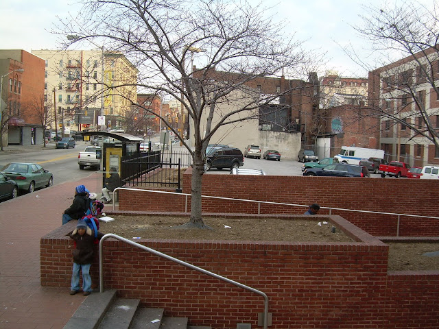
The transit hub would extend from the wrought iron fence through a parking lot northward to Mulberry Street. Several old buildings that have previously been ripped from their context by this parking lot and are now crumbling would need to be demolished.
This would make a perfect place for bus routes to begin and end. Transfers between buses would be easy and riders would be encouraged to transfer to and from the subway. Riders could get on the buses that are getting ready for their routes and wait inside the buses instead of out on the cold, hot, wet, dangerous, chaotic street corners.

Finally, a real, clear, unambiguous physical connection could be created at this point between the heavy rail subway and light rail lines, and between both and the buses. The photo above shows the northbound Lexington Market light rail stop on Howard Street. Just across the street, under the elegant black art deco
Hutzler Brothers logo (on the left side of the photo) is an ideal place to put an entrance to the subway.
This looks like an old entrance to the grand old vacant
Hutzler's Department Store, but it is actually Clay Street, which runs right underneath the building. The elevation differential between Howard and
Eutaw Street is such that a subway entrance on Howard Street at this point would be only slightly above the subway mezzanine level. It would be an easy walk, and it could be made into the kind of controlled environment - inside the subway system - where people do not balk at the distance they are walking. It would also be an easy, clear and controlled walk from the light rail on Howard Street, through the subway mezzanine, and then up the escalator (in the previous photo) to the bus transit hub.
One more minor point would be to relocate the southbound light rail platform directly at this point on Howard Street, which is where it was designed and intended to be in the first place, instead of the current location one block south.
The result: A clearly integrated central hub for light rail, heavy rail and buses, which can serve as the heart for the transit system serving the entire region. The
MTA should immediately begin to conduct their planning based on the premise that Lexington Market is the center of the Baltimore regional transit system universe.
The
MTA should also NOT wait until they actually build this transit hub to create a regional transit "icon map" like Washington's that reflects this. They should begin to ingrain such a map into our regional psyche as soon as possible.
No one would ever consider using a map of the United States that includes every street in every town, city and state. Such a map would be a hopeless mess. On a map of a large area, only the most important highways should usefully be shown. In the same way, the transit map of the Baltimore region should show only the major transit routes, as well as the transfer points to get to the smaller routes. That would make Lexington Market the rightful centerpiece of the map as well as of the transit system.
The current
MTA system map has muddled us. A fresh new icon map would clear our minds. It would even help us think better about the role and relationship of future plans like the proposed Red Line. Above all, the Red Line must be thought of in terms of how it would effect the system as a whole. The best possible Red Line connections to the rest of the system should be a prerequisite.
Whether the Red Line would serve ANY given place should be subordinate to how well the Red Line would contribute to serving EVERY place. Just as that is how we should conduct our transit planning for Lexington Market, it is also how we should conduct our planning for the entire transit system.


